Download
1 / 43
430 likes | 542 Vues

E N D
2. Collaborators Iain Gilchrist
Bruce Hood
Kirsten Cater
Niall Alcock
Kylie Nott
Naimah Ikram
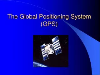
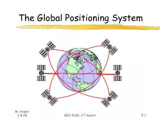
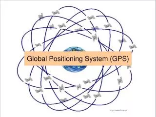
3. Global Positioning System Measurement of distance between receiver and constellation of satellites orbiting the Earth
At any location there should be at least four of them �visible� in the sky
Powerful tool but conditions are not always ideal
4. What�s in it for me? Opportunity to measure human navigational behaviour in a real-world setting
Record position in space over time
Objective and automatic measurements
Practical potentials (e.g. blind mobility aid)
5. Navigational processes Two main processes contribute to monitoring of position and orientation
Landmark-based
Monitoring changing position of distal visual cues
Path integration
Idiothetic cues (e.g. vestibular, kinaesthetic)
6. Navigational processes Two main processes contribute to monitoring of position and orientation
Landmark-based
Monitoring changing position of distal visual cues
Path integration
Idiothetic cues (e.g. vestibular, kinaesthetic)
7. Landmarks A fundamental source of information
Serve to identify specific locations in our environment and enable calculation of position and heading
First and most important aspect of our surroundings to be noticed and remembered as children develop large-scale environmental cognition (Piaget & Inhelder, 1967; Siegel & White, 1975)
8. Reorientation Situations in which children seem unable to make use of landmarks
Based on rat work by Cheng (1986)
9. Human reorientation Hermer & Spelke (1994; 1996) reported similar findings with young children (around 2 years of age).
Searched equally at the correct and geometrically equivalent corners even when the short wall adjacent to the target location was blue
Children, like rats, reorient themselves using geometry ? impervious to landmark information and is therefore an innate and encapsulated module
10. Human reorientation Hermer-Vasquez et al. (2001) used a regression approach to show that successful integration of landmarks and geometry for reorientation occurred with emergence of spatial relational grammar (5 � 7 years)
Hermer-Vasquez et al. (1999) showed that adults failed to use landmarks to reorient when concurrently shadowing verbal material (successful with non-verbal rhythmic shadowing)
11. Equivocal findings LANGUAGE
Non-human animals including goldfish (Vargas et al., 2004), chicks (Vallortigara et al.,1990) and tamarins (Deipolyi et al., 2001) can integrate the two sources of information in the absence of language
Verbal shadowing does not interfere with integration in adults when the condition order counterbalanced (Ratliff & Newcombe, 2005)
ENVIRONMENT
Children of successfully use landmarks in chamber twice the size of that used by Hermer & Spelke (Learmonth et al., 2001; 2002)
Infants can also correctly combine geometry and landmarks in a rhombic environment (Hupbach & Nadel, 2005
12. Environmental influence Hermer & Spelke space smaller than that in which children are used to navigating - likely crowded by people and goal locations
Less navigational significance being attached to smaller or more portable objects (including the coloured fabric covering a short wall)
13. Ecological validity Not established whether any of these theories scale up to the natural world - ultimate goal has been to relate the behaviour of humans to that of non-human animals in their natural environment (Wang & Spelke, 2002).
Reorientation in the real world
size of the environment can be assumed to approximate that in which homo-sapiens have evolved to negotiate
landmarks more likely to be perceived as large, natural, and immutable
role of geometry will likely be diminished, as the environment is less an enclosed or bounded space and more defined by the relationship between certain landmarks
14. Experiment Focuses on utilisation of landmarks to reorient
Three age groups (3/ 5/ 7 years) tested in a large open space (Durdham Downs)
Smaller search space was created by a quadrilateral arrangement of four proximal hiding locations
No geometric cues present to guide reorientation in either the arrangement of locations or in the open environment successful reorientation must be achieved by the use of landmarks.
16. Experiment Four search trials in each arrangement, with every position used as the hiding location.
Size of array counterbalanced - first four trials were with identical buckets, and the second four trials were with different colours
Search recorded with GPS technology and Mobile Bristol software
18. Mobile Bristol
19. Results - accuracy t-tests against a chance performance level of 25% showed that all participants performed significantly above chance in each condition
No effects of sex on any of the measures
21. Results - latencies SMALL
main effect of landmark colour (F(1, 29) = 5.12, p < .05)
no between-subjects effect of age (F < 1)
no age x colour interaction (F < 1)
LARGE
no effect of colour (F(1, 29) = 3.68, p > .05)
no effect of age (F < 1)
no age x colour interaction (F(2, 29) = 2.61, p > .05)
22. Discussion Naturalistic landmarks are utilised by children as young as 3 years to reorient in a real world setting
Utilisation is modulated by subtle environmental contexts - greater overall accuracy when the proximal locations were spaced in a large array (despite counterbalancing)
Suggests that distal landmarks need to be successfully integrated with the proximal locations in order to be successfully utilised
23. Discussion When search locations were further away they may have been processed as distal cues
Maybe locations need to be coded in allocentric coordinates, at both proximal and distal spatial scales, in order to be integrated - might be more difficult for younger children, who are more likely to code locations in egocentric co-ordinates (Piaget & Inhelder, 1967; Siegel & White, 1975).
24. Discussion Supports Learmonth et al. (2001) although based on the scale of the surrounding environment, rather than the search locations within it
Counter to those reported by Hermer & Spelke
Inadequacy in current accounts of human reorientation - Wang & Spelke (2002) model does not account for the nature of landmarks (proximal or distal) or encompass an allocentric representation of the environment that is separate from a distinct geometric boundary (Burgess, 2006).
25. Navigational processes Two main processes contribute to monitoring of position and orientation
Landmark-based
Monitoring changing position of distal visual cues
Path integration
Idiothetic cues (e.g. vestibular, kinaesthetic)
26. Ethological observations Widely studied in insects, birds and mammals
Desert ants return to the nest using a novel and direct vector
If transported in darkness they will perform appropriate homing vector to where nest should be
Subject to forgetting � lost after sufficient delay
27. Human path integration Humans also demonstrate the ability to integrate across vectors
Walking to previously seen location (e.g. Philbeck et al., 1997)
Path/ triangle completion (e.g. Loomis et al., 1993)
Errors associated with path length and complexity (Klatzky et al., 1990)
28. Dissociable components Homing vector gives a measure of distance and direction
Suggestion that they are coded separately in locomotion (Berthoz et al. 1999)
Neuropsychological evidence from RTL patients (Worsley et al., 2001)
29. Individual differences Bredin et al. (2005) tested athletes and non-athletes on a distance estimation paradigm � athletes more accurate at fast velocities
Athletic training improves spatial imagery � faster image transformation (Ozel et al., 2002)
Athletes can more accurately navigate novel and complex environments at greater speeds (Gerin-Lajoie et al., 2007)
30. Current experiment Bredin et al. (2005) state that practice in athletes develops and improves calibration of idiothetic information
Does the spatial scale of that experience affect accuracy?
Test athletes who perform at different spatial scales (rather than expert vs. novice) � rugby players (large-scale) and martial artists (small-scale)
Tested in larger space than usually used in laboratory studies (remove some artefacts)
31. Participants N=24 athletically trained males (19 � 43 years; M: 22.4)
12 martial artists from Judo and Jujitsu Societies at UoB
12 rugby players from UoB Men�s Rugby Club
All trained for more than 7 hours a week
All competed at University level
32. Task
33. Task
34. Procedure Participants wear a GPS receiver on a belt around their waist
Blindfolded and played white noise through headphones
Passively led through leg 1, turned 90o, then led along leg 2.
Tapped on shoulder when required to return to point of origin
35. Mobile Bristol
36. Results
37. Distance error No effect of Group
F (1, 21) = 1.70, p = .206
Significant Leg 1 x Leg 2 interaction
F (4, 84) = 4.67, p < .005
No other main effects or interactions
38. Angle error Main effect of Group
F (2, 42) = 16.7, p = 0.001
Main effect of Leg 1
F (2, 42) = 6.36, p = 0.001
No other main effects or interactions
39. Overall path length
40. Discussion Difference between groups for angle/direction only � rugby players more accurate
Greater experience of self-movement � better calibration of idiothetic cues? (i.e. Bredin et al., 2005)
More experience of movement at a larger scale � continual reference to multiple elements of the game?
Greater need to make inferences about spatial position without visual input?
41. Discussion Increasing length of Leg 1 incurred more angular error � consistent with the outbound path being stored in memory (e.g. Fujita et al., 1993)
Consistent with Worsley et al. (2001) � RTL patients impaired at angular estimation only
Further evidence for dissociation of distance and direction information
Effects appear to extend to a larger scale (although no analysis of under/overshoot)
42. Conclusions A powerful means to record and track different components of navigational behaviour
Affords a greater degree of accuracy than has hitherto been possible
Next challenge is to develop the system further and to identify paradigms to be used
Being independently developed by scientists in ostensibly different fields � a good forum for interbreeding
43. Contact Dr. Alastair D. Smith
School of Psychology
University of Nottingham
University Park
Nottingham NG7 2RD
UK
Tel: +44 (0)115 951 5365
Fax: +44(0)115 951 5324
Email: alastair.smith@nottingham.ac.uk
WWW: http://www.psychology.nottingham.ac.uk/staff/lpzas2/