Download
1 / 59
590 likes | 594 Vues
Chapter 2 Basics of Global Climate. 2.1 Components and phenomena in the climate system 2.2 Basics of radiative forcing 2.3 Globally averaged energy budget 2.4 Gradients of rad. Forcing and energy transport by atm. 2.5 Atmospheric circulation 2.6 Ocean circulation

E N D
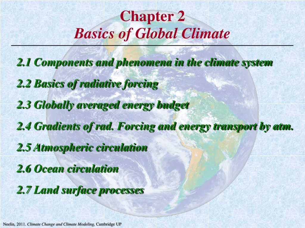
Chapter 2Basics of Global Climate 2.1 Components and phenomena in the climate system 2.2 Basics of radiative forcing 2.3 Globally averaged energy budget 2.4 Gradients of rad. Forcing and energy transport by atm. 2.5 Atmospheric circulation 2.6 Ocean circulation 2.7 Land surface processes Neelin, 2011. Climate Change and Climate Modeling, Cambridge UP
2.1 Components and phenomena in the climate system • "Components" of the climate system: • atmosphere • ocean • land surface • cryosphere (land ice (including ice shelves and glaciers), snow and sea ice) • biosphere • lithosphere (solid earth) • chemical composition (biogeochemistry; biology Û chemistry of climate system). Neelin, 2011. Climate Change and Climate Modeling, Cambridge UP
Climate processes • solar radiation tends to get through the atmosphere; absorbed at land surface and upper 10 m of ocean. • ocean heated from above Þ stable to vertical motions. • warm surface layer, colder deep waters • mixing near ocean surface by turbulent motions created, e.g., by wind Þupper mixed layer ~ 50 m depth. • mixing carries surface warming down as far as thermocline, layer of rapid transition of temperature to the colder abyssal waters below Neelin, 2011. Climate Change and Climate Modeling, Cambridge UP
Figure 2.1 Schematic of components of the climate system Neelin, 2011. Climate Change and Climate Modeling, Cambridge UP
Table 2.1 Neelin, 2011. Climate Change and Climate Modeling, Cambridge UP
Neelin, 2011. Climate Change and Climate Modeling, Cambridge UP
Figure 2.2 Satellite image basedon visible light Courtesy of NASA Neelin, 2011. Climate Change and Climate Modeling, Cambridge UP
Figure 2.2 Satellite image based on visible light with 5°x5° grid overlay Courtesy of NASA Neelin, 2011. Climate Change and Climate Modeling, Cambridge UP
The parameterization problem • For each grid box in a climate model, only the average across the grid box of wind, temperature, etc. is represented. • In the observations, many fine variations occur inside, • e.g., squall lines, cumulonimbus clouds, etc. • The average of these small scale effects has important impacts on large-scale climate. • e.g., clouds primarily occur at small scales, yet the average amount of sunlight reflected by clouds affects the average solar heating of a whole grid box. • Average effects of the small scales on the grid scale must be included in the climate model. • These averages change with the parameters of large-scale fields that affect the clouds, such as moisture and temp. Neelin, 2011. Climate Change and Climate Modeling, Cambridge UP
Method of representing average effects of clouds (or other small scale effects) over a grid box interactively with the other variables known as parameterization. • Successes and difficulties of parameterization important to accuracy of climate models. • grid used in Figure 2.2 to illustrate a climate model is not as fine as current models (half in lat. and lon.). • finer grid implies greater computational costs (or shorter simulation) • As computers become faster Þ finer grids. • But there are always smaller scales. • Scale interaction is one of the main effects that makes climate modeling challenging. Neelin, 2011. Climate Change and Climate Modeling, Cambridge UP
Related animations Rainfall from the TRMM-based merged data (3B42RT) Weekly accumulation Rain rate from a 3-hourly period within the week shown above Visible image Western Pacific1652Z Rainfall animation from the TRMM-based merged data (3B42RT)
Figure 2.3 A cumulonimbus cloud in the tropics • area, thickness and height of different parts of the cloud affect how it will reflect solar radiation and absorb or emit infrared radiation (hard to parameterize). • (less hard) transports heat from surface through deep layer in atm. Image courtesy of T. A. Toney Neelin, 2011. Climate Change and Climate Modeling, Cambridge UP
Figure 2.4 Satellite image of sea surface temperature off the east coast of the United States • Gulf stream, ocean eddies. • Eddy have spatial scale ~50 km Þ computationally costly. • Eddies tend to twist into very small scale features, become mixed Þ transport heat poleward ("eddy transports") Courtesy of Ocean Remote Sensing Group, Johns Hopkins U., Applied Phys. Lab. Neelin, 2011. Climate Change and Climate Modeling, Cambridge UP
2.2 Basics of radiative forcing • Solar radiation comes in, mostly reaching the surface • Infrared radiation (IR) is the only way this heat input can be balanced by heat loss to space • Since IR emissions depend on the Earth's temperature, the planet tends to adjust to a temperature where IR energy loss balances solar input: • i.e., outgoing flux of long wavelength infrared radiation*, integrated over the Earth, balances flux of incoming short wavelength solar radiation. *"outgoing longwave radiation" (OLR). • intensity of radiation as a flux in units of Watts per square meter (W/m2). • Blackbody radiation: approximation for how radiation depends on temperature (that does not depend on the substance doing the emitting; black = perfect absorber/emitter). Neelin, 2011. Climate Change and Climate Modeling, Cambridge UP
Figure 2.5 Blackbody radiation curves & absorptionof radiation at each wavelength Fraction of radiation absorbed at each wavelength as it passes through whole depth of atmosphere Fraction absorbed above 11 km After Goody and Yung, 1989, Atmospheric Radiation, Theoretical Basis by permission of Oxford University Press (www.oup.com). Neelin, 2011. Climate Change and Climate Modeling, Cambridge UP
Total energy flux integrated across all wavelengths of light (for a blackbody emitter) depends on absolute temperature T by the Stefan-Boltzmann law R = sT4 s = 5.67x10⁻⁸ Wm-2K-4, T in Kelvin (celsius + 273.16) • Actual surfaces or gases do not absorb or emit as a perfect blackbody Þ define an emissivity e for each substance R = esT4 • absorptivity = emissivity. • later bulk emissivity ea for an atmospheric layer. • Full climate models do detailed computation as a function of wavelength, for every level in the atmosphere, … Neelin, 2011. Climate Change and Climate Modeling, Cambridge UP
Figure 2.6 Schematic of Sun's rays arriving at disk and spherical Earth • Solar energy flux (integrated across all wavelengths) at Earths orbit • So» 1366 Wm-2 • Insolation averaged over one day, and over all latitudes = global average solar flux So/4 »341.5 Wm-2 (round to 342 Wm-2 below) Neelin, 2011. Climate Change and Climate Modeling, Cambridge UP
Supplemental Figure Daily total solar irradiance averaged over Earth’s surface (So/4) Variations from mean. Multi-satellite estimates following Frohlich and Lean, 1998; Frohlich 2003. (NB: corrections between satellites applied) Note: 11 yr solar cycle (little climate impact due to ocean heat storage & large natural variability)
Figure 2.7 Seasonal and latitude dependence of insolation Orbital parameters vary on paleoclimate time scales, e.g., ice ages. (Axial tilt precesses around orbit 23 kyr; tilt changes 41 kyr; eccentricity 100, 400 kyr; kyr=1000 yr) Neelin, 2011. Climate Change and Climate Modeling, Cambridge UP
2.3 Globally averaged energy budget Pathways of energy transfer in a global average Figure 2.8 After Kiehl and Trenberth, 1997, Bull. Amer. Meteor. Soc. Neelin, 2011. Climate Change and Climate Modeling, Cambridge UP
Albedo: fraction of incident solar radiation that is reflected. • Global average "planetary albedo" 0.31 (=107/342). • Deep clouds: albedo roughly 0.9, ocean albedo 0.08. • Some absorption of solar radiation, e.g., in ozone layer (UV). • Aerosols = suspended particles. • Most incoming sunlight that is not reflected passes through the atmosphere, absorbed at surface. Neelin, 2011. Climate Change and Climate Modeling, Cambridge UP
Heat transfer from the surface upward: sensible heat, latent heat and infrared emission. • Sensible heat: contact between molecules, subsequent upward transfer by parcels of hotter air (e.g. hot plumes known as thermals; dry convection). • Evaporation more effective means of cooling the surface; • stores energy as latent heat. • Latent heat subsequently releasedwhen water vapor condenses into clouds. • Wherever there is precipitation, latent heat remains in atmosphere. • Cloud formation is most often associated with overturning motions, known as moist convectionÞ transfers heat through a deep layer. • Overall effect convective heating. • Over land, vegetation plays such an important role in evaporation that process is called evapotranspiration. • plants access ground water, actively regulate water loss. Neelin, 2011. Climate Change and Climate Modeling, Cambridge UP
Greenhouse effect: • The upward IR from the surface is mostly trapped in the atmosphere, rather than escaping directly to space, so it tends to heat the atmosphere. • The atmosphere warms to a temperature where it emits sufficient radiation to balance the heat budget, but it emits both upward and downward, so part of the energy is returned back down to the surface where it is absorbed. • This results in additional warming of the surface, compared to a case with no atmospheric absorption of IR. • Both gases and cloudscontribute to absorption of IR and thus to the greenhouse effect. • Atmosphere emits IR downward Þ absorbed at surface. Neelin, 2011. Climate Change and Climate Modeling, Cambridge UP
At the top of the atmosphere, in the global average and for a steady climate: • IR emitted balances incoming solar. • Global warming involves a slight imbalance: • a change in the greenhouse effectÞ slightly less IR emitted from the top (chap. 6). • small imbalance Þ slow warming. • Three roles for clouds and convection: • heating of the atmosphere (through a deep layer) • reflection of solar radiation (contributing to albedo) • trapping of infrared radiation (contributing to the greenhouse effect) Neelin, 2011. Climate Change and Climate Modeling, Cambridge UP
2.4 Gradients of rad. forcing and energy transport by atm. • Differences in input of solar energy between latitudes Þ temperature gradients. • These gradients would be huge if it were not for heat transport in ocean & atmosphere and heat storage in ocean. • e.g., North Pole in winter time would be extremely cold. • Net solar energy input (Dec. climatology; Fig 2.9) • net = incoming minus part reflected to space. • essentially zero north of the Artic circle to about 385 Wm-2 near 30°S . • Outgoing longwave radiation (Fig 2.9) varies much less as a function of latitude because: • atmospheric and oceanic transports are very effective at reducing temperature gradients. • the ocean stores some heat from the previous summer. Neelin, 2011. Climate Change and Climate Modeling, Cambridge UP
Figure 2.9 Net solar energy input and output of longwave radiationfor December climatology as a function of latitude Neelin, 2011. Climate Change and Climate Modeling, Cambridge UP
Figure 2.10 Annual average net solar energy input and outputof infrared radiation to space from Earth • In the annual average climatology: rate of heat storage is small. • differences between solar input and compensating IR is due to north-south heat transport. • Net loss at poles approximately balances net energy gain in the tropics. Neelin, 2011. Climate Change and Climate Modeling, Cambridge UP
2.5 Atmospheric circulation Temperature as a function of height or pressure Figure 2.11 Neelin, 2011. Climate Change and Climate Modeling, Cambridge UP
Figure 2.12 Latitude structure of the circulation Neelin, 2011. Climate Change and Climate Modeling, Cambridge UP
Latitude structure of the circulation (cont.) • Hadley cell: thermally driven, overturning circulation, rising in the tropics and sinking at slightly higher latitudes (the subtropics). • transports heat poleward (to roughly 30°N). • rising branch assoc. with convective heating and heavy rainfall. • subtropical descent regions: warm at upper levels Þ hard to convect, little rain. Neelin, 2011. Climate Change and Climate Modeling, Cambridge UP
Latitude structure of the circulation (cont.) • In midlatitudes, the average effect of the transient weather disturbances transports heat poleward. • Trade winds in the tropics blow westward (i.e., from east, so known as easterlies). • they converge into the Intertropical Convergence Zone (ITCZ), i.e., the tropical convective zone. Neelin, 2011. Climate Change and Climate Modeling, Cambridge UP
Latitude structure of the circulation (cont.) • At midlatitudes surface winds are westerly (from the west). • Momentum transport in Hadley cell and midlatitude transients important to wind patterns. Neelin, 2011. Climate Change and Climate Modeling, Cambridge UP
Figure 2.13 July precipitation climatology January precipitation climatology Neelin, 2011. Climate Change and Climate Modeling, Cambridge UP
Figure 2.13 • Intertropical convergence zones (ITZCs) or tropical convection zones: heavy precipitation features deep in the tropics, (convergence refers to the low level winds that converge into these regions). • Monsoons: tropical convection zones move northward in northern summer, southward in southern summer, especially over continents. • e.g., Asian-Austral monsoon, Pan-American monsoon, African monsoon. • traditionally monsoon was defined by local reversals of wind; now generalized. Neelin, 2011. Climate Change and Climate Modeling, Cambridge UP
Figure 2.13 • Not perfectly symmetric about the Equator. • Variations in longitude (departures from "zonal symmetry"). e.g., eastern Pacific has little rain, western Pacific has intense rainfall. • More convection and associated rising motion in the western Pacific Þ overturning circulations along the equatorial band known as the Walker circulation (see Figure 2.14). • Storm tracks around 30-45°N. Neelin, 2011. Climate Change and Climate Modeling, Cambridge UP
Figure 2.14 Equatorial Walker circulation Adapted from Madden and Julian, 1972, J. Atmos. Sci. and Webster, 1983, Large-Scale Dynamical Processes in the Atmosphere Neelin, 2011. Climate Change and Climate Modeling, Cambridge UP
Figure 2.15 DJF climatology for upper (200 mb) level winds • Note subtropical jets; strong near storm tracks. DJF climatology for lower (925 mb) level winds • Note strong tropical Pacific trade winds. Neelin, 2011. Climate Change and Climate Modeling, Cambridge UP
Figure 2.16 2.6 Ocean circulation Sea surface temperature climatology - January Sea surface temperature climatology - July Neelin, 2011. Climate Change and Climate Modeling, Cambridge UP
Figure 2.16 • SST is warmest in tropics; approaches freezing in higher latitudes ( -2 C); strongest SST gradient occurs at midlatitudes. • SST is not perfectly symmetric about the Equator. • Variations in longitude. e.g., eastern Pacific is relatively cold. • Equatorial cold tongue: along the equator in the Pacific. • maintained by upwelling of cold water from below. Neelin, 2011. Climate Change and Climate Modeling, Cambridge UP
Figure 2.16 • Rainfall over oceans has a close, though not perfect, relationship to SST pattern (compare to Figure 2.13). • in the tropics it tends to rain over SST that is warmer than SST in neighboring regions. Neelin, 2011. Climate Change and Climate Modeling, Cambridge UP
Figure 2.17 Ocean surface currents Neelin, 2011. Climate Change and Climate Modeling, Cambridge UP
Ocean surface currents (cont.) • Along the Equator, currents are in direction of the wind (easterly winds drive westward currents [note terminology!] • Off the Equator, currents need not be in the direction of the wind. Currents set by change of the zonal wind with latitude and Coriolis force (chap. 3). (“zonal" = east-west direction) Neelin, 2011. Climate Change and Climate Modeling, Cambridge UP
Just slightly off the Equator, small component of the current moves poleward; important because it diverges Þ produces upwelling (chap. 3). • Circulation systems known as gyres. In the subtropical gyres, currents flow slowly equatorward in most of basin. Compensating return flow toward poles occurs in narrow, fast western boundary currents (Gulf stream, the Kuroshio, Brazil currents). Neelin, 2011. Climate Change and Climate Modeling, Cambridge UP
Figure 2.18 Ocean vertical structure • Ocean surface is warmed from aboveÞ lighter water over denser water (“stable stratification”). • incoming solar radiation warms upper 10 m. Turbulence near the surface mixes some of this warming downward. • mixing driven by wind-generated turbulence and instabilities of surface currents. Neelin, 2011. Climate Change and Climate Modeling, Cambridge UP
Figure 2.18 Ocean vertical structure (cont.) • At thermocline, any mixing of the denser fluid below into lighter fluid above requires workÞ limits the mixing. • Deep waters tend to remain cold • on long time scales, import of cold waters from a few sinking regions near the poles maintains cold temperatures. Neelin, 2011. Climate Change and Climate Modeling, Cambridge UP
Figure 2.18 Ocean vertical structure (cont.) • Ocean surface is directly warmed by solar radiation Þ loses heat to atmosphere. • air temperature a few meters above the surface tends to be slightly colder than the surface temperature. Neelin, 2011. Climate Change and Climate Modeling, Cambridge UP
Figure 2.19 The thermohaline circulation • Salinity (concentration of salt) affects ocean density in addition to temperature. • Waters dense enough to sink: cold and salty • Thermohaline circulation: deep overturning circulation is termed the (thermal for the temperature, haline from the greek word for salt, hals). Neelin, 2011. Climate Change and Climate Modeling, Cambridge UP
Figure 2.19 The thermohaline circulation (cont.) • Deep water formation in a few small regions that produce densest water • e.g., off Greenland, Labrador Sea, regions around Antarctica. • Small regions control temperature of deep ocean Þ potential sensitivity. • likely player in past climate variations. Neelin, 2011. Climate Change and Climate Modeling, Cambridge UP
2.7 Land surface processes Land surface impacts on physical climate; main effects: • Land does not transport or store heat significantly. • produces land-ocean contrast. • Albedo depends on vegetation, snow, ice, & sometimes on surface characteristics (e.g., Sahara Desert has a bright sandy surface). Annual average albedo (next slide) is highest where there is year-round snow/ice cover; intermediate values typically from winter snow/summer vegetation; rainforests low albedo. • Evapotranspiration and surface hydrology. • "soil moisture" in subsurface layers of soil • catchment basins, lakes, rivers... • evapotranspiration: vegetation actively regulates moisture loss. Neelin, 2011. Climate Change and Climate Modeling, Cambridge UP
Figure 2.20 Annual average Albedo Neelin, 2011. Climate Change and Climate Modeling, Cambridge UP