Download
1 / 43
430 likes | 599 Vues
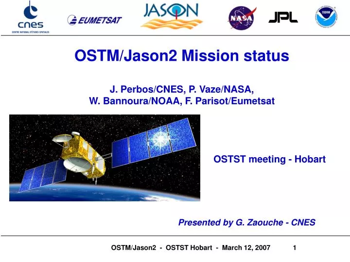
OSTM/Jason2 Mission status J. Perbos/CNES, P. Vaze/NASA, W. Bannoura/NOAA, F. Parisot/Eumetsat OSTST meeting - Hobart. Presented by G. Zaouche - CNES. Summary. Mission features and Responsibility sharing Science and Ops requirements, OSTM/Jason-2 Products System improvements

E N D
OSTM/Jason2 Mission status J. Perbos/CNES, P. Vaze/NASA, W. Bannoura/NOAA, F. Parisot/Eumetsat OSTST meeting - Hobart Presented by G. Zaouche - CNES
Summary • Mission features and Responsibility sharing • Science and Ops requirements, • OSTM/Jason-2 Products • System improvements • Mission status • Station acquisition and keeping strategy • Satellite • Launcher • Ground System
Mission summary Science Measurements Global sea surface height to an accuracy of < 4 cm every 10 days, for determining ocean circulation, climate change and sea level rise Mission Objectives • Provide continuity of high precision ocean topography measurements beyond TOPEX/Poseidon and Jason-1 • Provide a bridge to an operational mission to enable the continuation of multi-decadal ocean topography measurements Instruments • Core Mission: • Poseidon-3 Altimeter • DORIS (Precise Orbit Determination System) • Advanced Microwave Radiometer (AMR) • GPS Payload (GPSP) • Laser Retro-reflector Array (LRA) • Passengers: • T2L2 • JRE (Carmen2 + LPT) Mission Overview • Launch Date: mid June 2008 • Launch Vehicle: Delta II 7320 • Proteus Spacecraft Bus provided by CNES • Mission life of 3 years (goal of 5 years) • 1335 km Orbit, 66º Inclination
GPSP Antenna AMR Reflector NOAA AMR Electronics Poseidon 3 Altimeter DORIS LRA NASA/JPL System elements NASA Elements NOAA Elements EUMETSATElements CNES Elements Jason 2 EUMETSAT – Usingen, Germany NOAA - Wallops/ Fairbanks - USA Operational product processing & Distribution Dedicated Delta II Launch Vehicle S/C Operations (Suitland, MD) EUMETSAT Science data processing, archive & Distribution Operational product processing and Science Data archive & Distribution S/C Operations (Toulouse, France) CNES Passengers Ops and mission centers CNES- JAXA NASA Instrument Ops
Mission Partnership • CNES responsibilities: • Project Management • Satellite, Proteus bus • Payload • Nadir Altimeter POS3 • DORIS • T2L2 - CARMEN2 - LPT • Ground System & Operations • Satellite Control Command Center (CCC) • OFL product processing and distribution • All archiving • Ground network • Satellite Operations before handover • Navigation, Guidance, Expertise for all mission • System integration & test • Mission Operation support for CNES instruments • System Coordination for all mission phases • User interface • NASA responsibilities: • Project Management • Launch vehicle • Payload • Advanced Microwave Radiometer (AMR) • GPS Receiver (GPSP) • Laser Retro-reflector Array (LRA) • JPL Payload integration and test • Mission Operation support for JPL instruments • NOAA responsibilities: • Project Management • Ground System & Operations • Satellite Operations Control Center (SOCC) • CDA Stations (2) • NRT product processing • All product distribution • All archiving • Ground network • Satellite operationsafter handover • User interface • EUMETSAT responsibilities: • Project Management • Ground System & Operations • Earth Terminal (1) • NRT product processing, archiving and distribution • Ground network • User interface
Summary • Mission features and Responsibility sharing • Science and Ops requirements, • OSTM/Jason-2 Products • System improvements • Mission status • Station acquisition and keeping strategy • Satellite • Launcher • Ground System
Summary of science and Ops requirements • Jason-2 shall pursue the scientific objectives of the T/P and Jason-1 missions and support the running operational services • Jason-2 shall meet the better than 3.5 cm rms accuracy, at 1 Hz, on the fully validated sea surface height measurements and shall provide intermediate products with the required delay and accuracy • In addition to wave height and wind speed, NRT products need to include SSH information, with the required accuracy, for monitoring and forecast ocean fast events • Expectation of improving performances through off-line ground-processing updates • Expectation of collecting a maximum of valid data near the coasts, over inland waters and sea-ice, in order to support emerging research in coastal dynamics, hydrology, sea-ice interactions…
Products • All O/I/GDR products will have the same format and very close scientific content. • OGDR = IGDR but the following : • Orbit is computed using Doris Navigator files on OGDR • Meteorological fields are predicted • Pole Tide, Altimeter and radiometer calibration values (historical files) • Dynamic Atmospheric correction (derived from Mog2D) is not available • GIM ionospheric correction (derived from JPL maps) is not available • Platform derived off-nadir angle is not available • IGDR = GDR but the following : • Orbit is computed using MOE ephemeris • Pole Tide, Altimeter and radiometer calibration values (historical files) • Dynamic Atmospheric correction (derived from Mog2D) is less accurate • Taken into account Jason-1 heritage, products will be split into several files : • One file close to current Jason-1 NRT-SSHA, limited to 1Hz sampling. • One file close to current Jason-1 I/GDR, containing 1hz and 20hz values. • One file close to current Jason-1 SGDR, containing 1hz, 20hz and waveforms values. This file will not be generated in NRT. • User Handbooks, reading tools, products samples will be defined and delivered to OSTST group in a few months
OGDR products (Near Real Time) • Description : • NRT geophysical product, data latency of 3 hours. • DORIS/DIODE onboard orbit : 10 cm rms for the radial component • Ground retracking is performed and all environmental and geophysical corrections computed. • Non fully validated product which contains data for both bands (Ku and C). • Two files : • SSHA_OGDR : close to current Jason-1 NRT-SSHA, limited to 1Hz sampling. • OGDR : close to current Jason-1 I/GDR, containing 1hz and 20hz values. • Keys inputs : • Satellite telemetry • Auxiliary data • Production requirement : • For the OGDR, 75% of the data taken shall be made available to the users within 3 hours from acquisition and 95% of the data within 5 hours. • No dynamical auxiliary data are mandatory input for OGDR processing. In case of lack of dynamical auxiliary data, the corresponding OGDR field will be computed with the most recent data available (none field being set to default).
Editing Time Series & Map (Wind) Time Series (SSH) Asc/Des Maps (Iono) Histograms (Iono) NRT Products Quality Assessment System • Quality Assessment System Developed by JPL under NOAA Contract has been installed & tested at NOAA • Presently running on Jason-1 IGDRs, until Jason-2 OGDR is fully defined • QA Package has been made available to EUMETSAT via JPL licensing
OSTM Product Suite * Compressed BUFR format; all other products in native netCDF format
Some system improvements “Collecting a maximum of valid data near the coasts, over inland waters” Achieved through implementing new altimeter functional modes: • “Median Tracker algorithm” in addition to the current Poseidon 2 “Split Gate Tracker algorithm” (adapted to ocean surfaces) • should improve significantly echo tracking capability over non ocean surfaces • Use of satellite altitude data provided in real time by DORIS/Diode : 2 new experimental modes : • Signal acquisition using Diode altitude data + usual on-board tracker : • should improve the delay to get echoes after a land-water transition (3 times better) • Range directly computed from : Diode altitude data + Digital Elevation Model data • DEM data stored on-board, representative of oceans, lakes and rivers, and flat land areas • should improve data collection near the coasts and over inland waters Final altimeter nominal mode will be selected after data evaluation during the assessment phase
Some system improvements • New coastal & inland water product (demonstrative one) : • ITT has been issued by CNES to develop a new product suitable for applications in coastal and inland areas. • All current ground processing will be reviewed and analyzed. • We foresee : • Dedicated retracking and radiometer algorithms • Dedicated geophysical corrections (tides, ssb, …) • Dedicated environmental corrections (wet tropo, iono, …) • Prototype shall be ready for Jason-2 launch, operated during CalVal phase and products made available to OSTST community for review. • Using OSTST feedbacks, this demonstrative product might become an official product during Jason-2 operation phase.
Summary • Mission features and Responsibility sharing • Science and Ops requirements, • OSTM/Jason-2 Products • System improvements • Mission status • Station acquisition and keeping strategy • Satellite • Launcher • Ground System
Jason-1 is Jason-2 maintained is maintained in a control in a control box of box of ± 1 km ± 1 km Jason-2 Orbit • Tandem flight with Jason-1 planned for both altimeters cross-calibration purposes • Jason-2 final orbit characteristics : • - semi axis = 1336 km; inclination = 66° (same ground tracks as Jason-1) • - Jason-2 : 1 minute ahead Jason-1 Each satellite remains in its control box by controlling the equator crossing. The station keeping is made independently Improvement wrt Jason-1 : for Jason-2 station keeping, maneuvers will be made with only one thrust above earth on any orbit (no more on the last orbit of the 10-day cycle) ± 1 km 1 km ± target : 1 min
30 days max. Second rendez-vous maneuver (DV ≤ 5 m/s) 2 days min. 4 days 2 days Injection First rendez-vous maneuver (DV ≤ 5 m/s) Test maneuver to check propulsion system (DV< 15 cm/s) Trim maneuver if needed One or two inclination maneuvers Station acquisition strategy • Injection orbit (same as Jason-1) • 10 kmbelowthe nominal Jason-2 orbit : to avoid polluting the operational orbit by pieces of launcher and to create a drift to reach the right time phase between Jason-2 and Jason-1. • Maximal duration for station acquisition : 1 month • Number of rendezvous maneuvers and duration of the station acquisition depends on the launch date (day number in the Jason cycle).
3 days LEOP 2 months Assessment Phase 4 weeks Orbit Acquisition Orbit Acquisition key point 9 to 10 months Verification Phase First Verification Workshop 5 months NRT Verif Phase Near RT products delivery by NOAA and EUM OFL Verif Phase Final Verification workshop NRT Operational Phase OFL Operational Phase Operational Phase 2 months Sat Operational Phase CNES Flight operations Hand over to NOAA Mission Phases Resp : CNES with support of EUMETSAT, NASA, NOAA Nominal satellite and instruments modes In-Flight Assessment Meeting Resp : CNES with support of EUMETSAT, NASA, NOAA Start of cycle 1 Resp : CNES , NASA with support of PIs Start of OFL pdts delivery + data reprocessing Resp : CNES , NASA with support of PIs Resp : EUMETSAT, NOAA (generation and distribution) Resp : CNES(generation and distribution), NOAA (distribution) Start of Satellite & Ground nominal operations Sat Op Handover Review Resp : CNES for System coordination Resp :CNES (Sat Operations) Resp : NOAA (Sat Operations)
Jason-2 satellite • 8-instrument Payload • AMR (NASA/JPL) • GPSP (NASA/JPL) • LRA (NASA/JPL) • DORIS receiver (CNES) • POSEIDON 3 altimeter (CNES) • 3 passengers : Carmen 2 (CNES), T2L2 (CNES), LPT (JAXA) • 505kg/ 472W satellite
DORIS • Provides accurate time-tagged Doppler measurements to meet Jason2 POD requirements • MOE/IGDR required accuracy : 2.5 cm on radial component • POE/GDR required accuracy : 1.5 cm (1cm goal) with Laser measurement • Delivers on-board, in real time, an estimation of satellite position with an accuracy better than 10 cm RMS on the radial component • Provides accurate TAI time-tagging of satellite PPS and payload measurements with an accuracy better than 7 microseconds • Provides to both altimeter chains and to T2L2 equipment the 10 MHZ USO signal • DGxx BDR corresponds to a new design of DORIS receivers • USO NG design (different from JASON1 USO design) but with a 5 MHz resonator (instead of 10 MHz) to improve short-term stability • Improvement of resonator selection and process method to reduce USO sensitivity to radiation in SAA area (DORIS/JASON1 lessons learned) • Flight Model 4 delivered and assembled on the satellite • Flight Model 3 will be delivered mid April and will replace FM4 DORIS 2 frequency antenna Doris DGxx BDR (including USO)
Altimeter (Poseidon3) • Provides accurate range measurement between the satellite and the mean sea surface • measurement in Ku-band • C-band range data used to correct for ionosphere path delay • Additional parameters : • Significant Wave Height (SWH) in Ku-band • Backscatter coefficient 0 related to the wind speed • Antenna mispointing • Poseidon 3 design derived from both Poseidon 2 and SIRAL altimeters (CRYOSAT mission) • 2 frequency antenna : copy of Jason-1 antenna • Processing Units : built and testing completed • Radiofrequency Units : built and testing completed • Flight Software is validated • Altimeter assembly and performance tests in progress • Delivery for assembling on satellite : May 07 Poseidon3 two frequency antenna Poseidon3 FM on the payload module panel
Advanced Microwave Radiometer (AMR) Electronics Support Assembly • The instrument is comprised of a 23.8 GHz water vapor sensing channel, an 18.7 GHz channel to estimate ocean surface contributions, and a 34.0 GHz channel to estimate cloud liquid content • Measures single polarization, radiometric brightness temperatures in a nadir beam co-aligned with that of the CNES supplied Poseidon-3 altimeter, i.e. it provides “wet” tropospheric path delay correction for nadir altimeter range measurement. Critical to meeting OSTM science requirements. • Same functional requirements as the JMR but different implementation which lead to a new generation design : less mass and power • New antenna design with larger reflector (1m) and inherited JMR feed, significantly reduces calibration uncertainties and improves coastal resolution • Instrument has completed testing and has been delivered to CNES/Alcatel (Feb ’07) and is integrated on the S/C • Closure of one open point: Rework of Noise Source units and swap with existing flight HW is planned for April ‘07 Complete AMR Instrument
GPSP Instrument Skin connectors Spacecraft chassis Ant. #1 Ant. #2 Power A RS-422 Payload GPS receiver (primary) Telemetry Interface A Processor Module A coax 1553 Processor Module B Payload GPS receiver (redundant) Telemetry Interface B Power B DHU Internal Bus Global PositioningSystem Payload (GPSP) • High performance GPS receiver designed to provide precise orbit determination as a validation to the primary DORIS system and to enhance the accuracy during nominal operations. • HW is build to print of the Jason-1 GPS receiver • As on Jason-1, the instrument is block-redundant with 2 identical single-string receivers and antennas • Each redundant side of the GPSP subsystem consists of a dual-frequency L1/L2 patch antenna/choke-ring assembly, an electronics unit, and a coaxial RF cable • Complete instrument was successfully delivered for S/C integration and fully integrated on S/C in Dec ‘07 GPSP Electronics Unit (1 of 2) Choke-Ring Antenna ( 1 of 2)
Laser RetroreflectorAssembly (LRA) • Consists of several quartz corner cubes arrayed as a truncated cone with one in the center and the others distributed azimuthally around the cone. • The LRA supports determination of the Poseidon-3 altimeter bias through direct comparison of altimeter measurements with laser measured "altitude" corrected to sea level from local tide gauges • Totally passive reflector designed to reflect laser pulses back to their point of origin on earth. The assembly contains no electronics or software. • The LRA allows the OSTM/Jason-2 spacecraft to be tracked with centimeter accuracy by approximately 40 satellite laser ranging stations • The LRA is an exact copy of the Jason LRA and has been delivered to CNES/Alcatel for S/C integration (March ’07) NASA SLR Stations at GSFC
Passengers : T2L2 • Main mission objectives : • Compare distant clocks with an accuracy of a few picoseconds • Contribute to better characterize the Doris USO noise • Environment testing completed • Delivered to CNES, performance tests in progress • Delivery for assembling on satellite : mid April 07 Electronics Optical Unit
Passengers :Carmen2, LPT Carmen2 • mission objectives : to study the influence of space radiation on advanced components ; to measure the deposit dose into the DORIS USO ( South Atlantic Anomaly) • Environment testing completed • Delivery for assembling on satellite : mid March 07 LPT • mission objective : to measure the radiation environment at the Jason2 orbit • Environment testing nearly completed • Delivery for assembling on satellite : April 07 Carmen2 LPT Sensors LPT Electronics
Satellite Status • Proteus Bus equipment fully qualified • Proteus Platform has been integrated and delivered • Platform integrated with Launch Vehicle Interface (LVA). • Platform Safe to Mate (missionisation) completed.
Satellite Status • Payload Instrument Module assembly completed • All functional validation tests performed. • Flight Software Validation completed • Spacecraft Data Base available • Payload Assembly and Integration Tests (AIT) has started Dec 06
Satellite Status December 2006 : DORIS AIT
Satellite Status December 2006 : GPSP AIT
Satellite Status End January 2006 AMR AIT
Satellite Status February 2007 Altimeter antenna integration test
Launch Vehicle • Boeing Delta II-7320 manifested as single payload launch • Payload integration and launch from VAFB (Vandenberg Air Force Base), CA • Implementation timetable based upon ATP (Authority To Proceed) at L-27 months (Mar 06) • NASA Flight Planning Board has identified a launch date of 15 Jun 08 • Single payload configuration will require a system that reduces vibration loads to the spacecraft • Softride isolation system selected for implementation by Boeing • Completed PDR in Feb ’07 with full delivery expected by end of 2007. • Restarted Loads and Structures Working Group to ensure successful implementation • Overall LV development is on schedule with no significant issues.
Command and Data Acquisition Stations Fairbanks, Alaska, USA Wallops, Virginia, USA Resp : NOAA - Phases : all TM/TC SBAND Earth Terminal Hartebeesthoek, South Africa Resp : CNES - Phase : LEOP and Assessment, contingency in routine phase HBK WPS USG FBK EUMETSAT Earth Station : • built and accepted in 2006 • integrated into Jason2 Ground System • currently involved into System Tests NOAA stations : • already existing • adaptation to Jason2 : in progress • to be integrated into Jason2 Ground System in summer 2007 TM/TC Earth Station Usingen, Germany Resp : EUMETSAT - Phase : all Jason2 Ground System : Earth stations
HBK WPS USG FBK Jason2 Ground System :Satellite command/control EUMETSAT processing center (EUMPC) Localisation : Darmstadt, Germany Resp : EUMETSAT Phase : all Role : routing non real-time exchanges between CNES and NOAA EUMETSAT processing centre NOAA SOCC Jason-2 Command Control Center (J2CCC) Localisation : Toulouse, France Resp : CNES Phase : active control center for LEOP and assessment (-> handover), contingency in routine phase CNES J2CCC Satellite Operation Control Center (SOCC) Localisation : Suitland, USA Resp : NOAA Phase : active control center for routine phase (handover ->) Satellite simulator (PRESTO) Localisation : Toulouse, France Resp : CNES Phase : all PRESTO
Jason2 Ground System :CNES command/control center CNES Control Center : • for LEOP & Assessment phases • adaptation and integration to Jason2 Ground System: completed • currently involved in the compatibility tests • will participate to Operational System qualification from Summer 2007
Jason2 Ground System :NOAA command/control center NOAA Control Center : • for satellite operational phase • adaptation to Jason2 Ground System : in progress • first compatibility tests : April 2007 • to be integrated into Jason2 Ground System in summer 2007 • will participate to Operational System qualification from Fall 2007
HBK WPS USG FBK CNES Mission Centre SSALTO (Toulouse) Jason2 Ground System : Products Processing centers CNES Mission Centre : SSALTO(Segment Sol Multi-mission Altimétrie et Orbitographie) Localisation : Toulouse, France Resp : CNES EUMETSAT processing centre NOAA SOCC EUMETSAT Processing Center (EUMPC) Localisation : Darmstadt (Germany) Resp : EUMETSAT NOAA Mission Centre CNES J2CCC NOAA Mission Center Localisation : Suitland (USA) Resp : NOAA JPL instrument experts (Pasadena) JPL Payload command/control center Localisation : Pasadena, USA Resp : JPL Users
EUMETSAT Near Real TimeProduct Center EUMETSAT Near Real Time Product Center : • development in progress • integration to Jason2 Ground System: summer 2007 • will participate to Operational System qualification end 2007 • for operational phases
NOAA Near Real TimeProduct Center NOAA Near Real Time Product Center : • development in progress • integration to Jason2 Ground System: summer 2007 • will participate to Operational System qualification end 2007 • for operational phases
CNES Off lineProduct Center CNES Off line Product Center (SSALTO) : • adaptation to Jason2 ground system in progress • new development in progress • integration to Jason2 Ground System: summer 2007 • will participate to Operational System qualification end 2007 • for verification and operational phases
Users Products and Data access EUMETCAST http://www.eumetsat.int/Home/Main/Access_to_Data/Delivery_Mechanisms NOAA CLASS http://www.class.noaa.gov/nsaa/products/welcome CNES AVISO http://www.jason.oceanobs.com
Project Summary • Successfully completed all mission reviews • Satellite Critical design Review October ’06 • System Interface Review December ’06 • Instruments level reviews • Build and test of all instruments is nearly complete • Current measured payload and satellite performance meets all requirements • Several key risk items for System Safety and LV have been addressed with clear mitigation paths established. • Payload instruments integration has started Dec ‘06 • Satellite Assembly, Integration and Test: from June ‘07 to January 2008 • Ground System qualification tests and End to End (Satellite-Ground) tests : from April ’07 to May ’08 • Launch: mid June 2008 • 2 months schedule margin for satellite and system development