Download

1 / 15
150 likes | 258 Vues
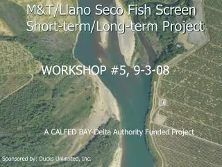
Ideas for Short Term Improvements in NWS Watch/Warning/Advisory Bulletins Jonathan Porter Meteorologist/ Programmer AccuWeather, Inc – State College, PA Direct Phone: (814) 235 - 8681 porter@accuweather.com. The Great News!. /O.NEW.KMPX.WI.Y.0009.070514T1400Z-070514T2100Z/ .

E N D
Ideas for Short Term Improvements in NWS Watch/Warning/Advisory Bulletins Jonathan PorterMeteorologist/ Programmer AccuWeather, Inc – State College, PA Direct Phone: (814) 235 - 8681porter@accuweather.com
The Great News! /O.NEW.KMPX.WI.Y.0009.070514T1400Z-070514T2100Z/ • Implementation of VTEC (Valid Time Event Code) has resulted in quicker, more accurate processing of potentially life saving information • Big improvement now that it is here! • Overall, few problems with VTEC encodings in operational products. • We are awaiting much-needed operational VTEC in Flood Products • VTEC needed in Tsunami & Air Quality Products!
Continuous VTEC Issues • Lack of standard national set of templates for RiverPro resulting in each office is creating their own templates. • Improvement has been seen in the offices using experimental VTEC. • Local & National Partners have different needs. • Correct VTEC encoding is extremely critical for the private sector. • How can the partners help educate? • WFO Backup Procedures • WOU/WCN Contradiction Issues (Timing)
Looking Toward the Future • NWS seems to be moving toward XML encapsulation of WWA bulletins using the Next Generation Warning Software • Now that VTEC has been implemented in most products, we would recommend software be developed for pre-dissemination, post product generation bulletin quality control • Lack of basic bulletin QC will limit the effectiveness of any efforts to generate CAP messages from current raw text products.
Operational Challenges • Partners decode each bulletin and use several key pieces of information to process and route the bulletin to the correct place(s): • WMO Header • AWIPS Identifier • Mass News Disseminator • Universal Geographic Code(s) • Product Purge Date/Time • Valid Time Event Code Software seems to allow forecasters to edit any part of the final text before it goes out with no quality control. In some cases, the public never gets any of the critical information!
Identification of Operational Issues • Based on interaction with forecasters, there seems to be little in place to let a forecaster know about an error that may result in incorrect/incomplete decoding of a product. • In some offices, the NWR encoding software seems to be used for this purpose. • Other offices don’t know about problems until they hear from a partner. • WWA software in order of increasing reliability: RiverPro, WarnGen, GHG (high reliability)
Examples IAC057-115-ILC071-131-<UGC+720>- 1107 AM CDT TUE APR 03 2007 THE NATIONAL WEATHER SERVICE IN QUAD CITIES HAS ISSUED A * FLOOD WARNING FOR MISSISSIPPI RIVER AT KEITHSBURG * UNTIL FURTHER NOTICE. * NO FLOODING IS OCCURRING AND MINOR FLOODING IS FORECAST. $$
Examples 170717- /X.NEW.KALY.FL.W.0038.070417T0014Z-070417T1525Z/ /CTVM3.1.ER.070417T0014Z.070417T0700Z.070417T0925Z.UU/ 317 PM EDT MON APR 16 2007 THE NATIONAL WEATHER SERVICE IN ALBANY HAS ISSUED A * FLOOD WARNING FOR THE EAST BRANCH OF THE HOUSATONIC AT COLTSVILLE. * FROM THIS EVENING UNTIL TUESDAY MORNING. * AT 2 PM MONDAY THE STAGE WAS...4.1 FEET. (…) &&
Examples WWUS84 KMOB 192127RFWMOB SPECIAL WEATHER STATEMENTNATIONAL WEATHER SERVICE MOBILE AL 425 PM CDT WED JUL 19 2006 ALZ051-052-192215- WASHINGTON-CHOCTAW- 425 PM CDT WED JUL 19 2006 ..STRONG THUNDERSTORM IS BEING DETECTED OVER SOUTHERN WASHINGTON AND NORTHERN CHOCTAW COUNTIES…
Examples AXPZ20 KNHC 290344 TWDEP TROPICAL WEATHER DISCUSSION NWS TPC/NATIONAL HURRICANE CENTER MIAMI FL 0405 UTC THUD MAR 29 2007 TROPICAL WEATHER DISCUSSION FOR THE EASTERN PACIFIC OCEAN FROM THE EQUATOR TO 32N...EAST OF 140W. THE FOLLOWING INFORMATION IS BASED ON SATELLITE IMAGERY...WEATHER OBSERVATIONS...RADAR...AND METEOROLOGICAL ANALYSIS.
Examples Examples WWUS54 KMOB 141836 SVSMOB SEVERE WEATHER STATEMENT NATIONAL WEATHER SERVICE MOBILE AL 135 PM CDT SAT APR 14 2007 ALC025-141915- /O.EXP.KMOB.SV.W.0033.000000T0000Z-070414T1830/ CLARKE AL- 135 PM CDT SAT APR 14 2007
Examples PAC017-170649- /X.EXT.KPHI.FL.W.0021.000000T0000Z-070417T1000Z/ /LNGP1.3.ER.070415T1526Z.070416T0545Z.070417T0400Z.NO/ 449 PM EDT MON APR 16 2007 PAC017-170649- /X.EXT.KPHI.FL.W.0021.000000T0000Z-070417T1000Z/ /LNGP1.3.ER.070415T1526Z.070416T0545Z.070417T0400Z.NO/ 449 PM EDT MON APR 16 2007 ...FLOOD WARNING EXTENDED UNTIL TUESDAY MORNING FOR THE NESHAMINY CREEK AT LANGHORNE * UNTIL TUESDAY MORNING ...OR UNTIL THE WARNING IS CANCELLED. * AT 1:00 PM MONDAY THE STAGE WAS 11.2 FEET (…) $$
Solutions • For the foreseeable future, critical WWA messages will still be disseminated in raw text bulletins. • In order for VTEC to reach its full potential, critical information used for bulletin routing/processing MUST be correct every time. • Each piece of WWA software needs to be modified to prevent forecasters from changing encoded data used for routing/processing. • (And/Or) • Final Product QC software prevents improperly formatted products from being disseminated over NOAAPORT or WeatherWire until they are corrected.
Solutions • Preventing these types of critical issues should be much higher priority than producing CAP formatted bulletins. • All users currently use raw text bulletins. • For the next few years, any CAP messages will need to be generated from raw text bulletins.
Ideas for Short Term Improvements in NWS Watch/Warning/Advisory Bulletins Jonathan PorterMeteorologist/ Programmer AccuWeather, Inc – State College, PAJune 20, 2007porter@accuweather.com