Download
1 / 39
390 likes | 539 Vues
Fire Season Prediction for Canada, 2013. Kerry Anderson Canadian Forest Service. Introduction. The Canadian Forest Service is now presenting monthly and seasonal forecast maps through the Canadian Wildland Fire Information System (CWFIS).

E N D
Fire Season Prediction for Canada, 2013 Kerry Anderson Canadian Forest Service
Introduction The Canadian Forest Service is now presenting monthly and seasonal forecast maps through the Canadian Wildland Fire Information System (CWFIS). These are based on Environment Canada’s monthly and seasonal forecasts, information contained in the CWFIS, and advice provided by provincial agencies. This presentation will summarize the current conditions in Canada and a forecast for the 2013 fire season.
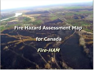
Canadian Wildland Fire Information System The Canadian Wildland Fire Information System calculates the fire weather and fire behaviour conditions across the country. Maps are displayed over the Internet. http://cwfis.cfs.nrcan.gc.ca/
Methodology • Calculate spring start-up conditions based on fall drought code (DC) values and over-winter precipitation amounts, • Calculate average daily weather for weather stations across country, • Incorporate Environment Canada’s seasonal predictions, • Determine the fire severity based on the ratio of forecasted over average monthly severity rating (MSR).
Methodology 1. Fall conditions to Spring startup 2. Calculate average daily weather 4. Calculate fire weather anomaly 3. Apply seasonal predictions
Ensemble Forecasts The Canadian Meteorological Centre (CMC) of Environment Canada has been providing temperature and precipitation probabilistic forecasts based on an ensemble of ten integrations of two climate models developed by Canadian Center for Climate modeling and analysis (CCCma) CANCM3 (which uses the atmospheric model CANAM3 (also known as model AGCM3)) CANCM4 (which uses the atmospheric model CANAM4 (also known as model AGCM4)) Forecasts are provided for the next twelve months.
Ensemble Forecasts Predicted temperatures and precipitation amounts are entered into the Canadian FWI system. Temperature Precipitation
Ensemble Forecasts The ensemble approach provides a measure of confidence indicated by the spread of the ensemble members. June
2012 Prediction The 2012 fire season was a relatively normal year with an average number of fires and an above-average area burned. 1,921,374 ha (avg 1,647,438 ha) 7,288 fires (avg: 7,389)
2012 Prediction Most of the activity occurred in Labrador in June and in northern BC/Alberta and eastern Manitoba/western Ontario in July.
CMC 2012 Prediction April May June July August September
2012 Fire Activity April May June July August September
2012 Prediction In summary, the forecast faired well for much of northern Canada where most of the fire activity occurred but appeared to miss the cooler conditions experienced in the southern Prairies. The map legend, based on fire weather statistics from Edmonton, was not representative for all of Canada. A new scheme has been developed for the 2013 season.
Spring Start-up Conditions The Canadian Forest Fire Weather Index (FWI) System allows for the carry-over of fall conditions to the spring. This is handled by the Drought Code (DC) (similar to the 1000 hour moisture code). All other moisture codes in the FWI system are reset.
Fall Conditions Oct 15, 2012 Fall DC values show extreme (dry) conditions throughout much of Western Canada and the Territories. Snow fell through much of the prairies in late October
Spring Start-up Conditions North American Drought Monitor indicates a relatively normal pattern across all of Canada.
Overwinter Snowfall Much of Canada is still under snow cover so we will be experiencing a late start to the fire season. http://www.natice.noaa.gov/pub/ims/ims_gif/DATA/cursnow_usa.gif
Overwinter Snowfall Snow amounts range from 60% in eastern Canada to as much as 200% of normal western Canada. Northern Manitoba and Saskatchewan are well-below normal (<40%). http://www.natice.noaa.gov/pub/ims/ims_gif/DATA/cursnow_usa.gif
Spring Start-up Conditions Late spring prevents us from seeing the starting DC values, It is expected that Eastern Canada will have total recharge of deep fuel moistures, while Alberta and the interior of BC will be higher.
ENSO Pattern El Niño–Southern Oscillation is a band of warm ocean water that can develop off the western coast of South America. Extremes in this oscillations cause extreme weather (such as floods and droughts) in many regions of the world. El Nino and La Nina events tend to develop during the period Apr-Jun and they • Tend to reach their maximum strength during Dec-Feb • Typically persist for 9-12 months, though occasionally persisting for up to 2 years • Typically recur every 2 to 7 years
El Niño Effects Summer Temperature Precipitation El Niño leads to below-average precipitation in central Alberta and Saskatchewan, southern Ontario and Nova Scotia
ENSO Pattern Most models indicate neutral ENSO conditions this summer. The Canadian CMC CANSIP model is predicting higher conditions. http://iri.columbia.edu/climate/ENSO/currentinfo/SST_table.html
ENSO Pattern Most models indicate neutral ENSO conditions this summer. The Canadian CMC CANSIP model is predicting higher conditions. http://iri.columbia.edu/climate/ENSO/currentinfo/SST_table.html
ENSO Pattern Consensus in the neutral conditions is dropping in the long-term (but beyond the scope of this summer’s prediction). http://iri.columbia.edu/climate/ENSO/currentinfo/SST_table.html
Seasonal Forecasts Spring temperature anomalies are high for southern BC and Alberta as well as the Atlantic coast. Precipitation anomalies are low for the Pacific coast and for central Canada. April-May-June
Seasonal Forecasts Early summer sees above-normal temperatures for western Canada, western Ontario and the Atlantic. Below-normal precipitation is predicted for central Canada and for the Pacific coast. May-June-July
Seasonal Forecasts Nearly all of Canada (except for western Quebec) is predicted to have above-average temperatures. Below-average precipitation is expected in northern Ontario and Manitoba and in southwestern BC. July-August-September
April 2013 Prediction (predicted values normalized against average weather) Confidence (standard deviation normalized against average weather) Low fire severity is seen through most of Canada (except for BC and the southern Prairies). High confidence in all but southern BC/Alberta and western Ontario.
May 2013 Prediction (predicted values normalized against average weather) Confidence (standard deviation normalized against average weather) Above-average conditions develop in BC and the southern Prairies, though confidence appears higher in the east.
June 2013 Prediction (predicted values normalized against average weather) Confidence (standard deviation normalized against average weather) Most of western Canada and western Ontario show above average conditions. Confidence in the forecast drops in central Canada.
July 2013 Prediction (predicted values normalized against average weather) Confidence (standard deviation normalized against average weather) July sees a continuation of above-average in western Canada. Only moderate confidence is shown in these in these forecasts.
August 2013 Prediction (predicted values normalized against average weather) Confidence (standard deviation normalized against average weather) Above-average conditions begin to wane in BC while confidence in these extended forecasts begins to fall (especially in Alberta).
September 2013 Prediction (predicted values normalized against average weather) Confidence (standard deviation normalized against average weather) As fall takes hold, the severity rating drops for all but the southern Prairies, which continue to exhibit above-average conditions.
2012 Prediction In summary, it appears that Canada will see a late start to the fire season. As summer develops, fire weather conditions in western Canada will likely rise to above-average. Well-below normal snowfall in northern Saskatchewan and Manitoba may promote extreme fire activity. September may bring an early end to the fire season except in southern BC.