Download
1 / 39
390 likes | 518 Vues
Representation of the Earth: Maps (History, Use and Importance). Ramos, Erika Mae D. III-6 BEEd. What is a Map?.

E N D
Representation of the Earth: Maps (History, Use and Importance) Ramos, Erika Mae D. III-6 BEEd
What is a Map? A map is a graphic representation or scale model of spatial concepts. It is a means for conveying geographic information. Maps are a universal medium for communication, easily understood and appreciated by most people, regardless of language or culture. Incorporated in a map is the understanding that it is a "snapshot" of an idea, a single picture, a selection of concepts from a constantly changing database of geographic information (Merriam 1996).
3rd Century BC 15th Century BC Cartography Early Map Medieval Maps T-O Maps Renaissance Maps (15th and 16th Century) Modern Maps (17th, 18th, 19th Century)
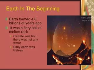
3rd Century BC Maps based on scientific principles had been made since the time of Eratosthenes (3rd century BC
In the 15th century Ptolemy'sGeographia began to be printed with engraved maps; the earliest printed edition with engraved maps was produced in Bologna in 1477, followed quickly by a Roman edition in 1478 (Campbell, 1987).
Early Maps Cartography is the art and science of making maps. The oldest known maps are preserved on Babylonian clay tablets from about 2300 B.C. Cartography was considerably advanced in ancient Greece.
Medieval Maps • During the Medieval period, European maps were dominated by religious views. • The T-O map was common. In this map format, Jerusalem was depicted at the center and east was oriented toward the map top. • Meanwhile, cartography developed along more practical and realistic lines in Arabic lands, including the Mediterranean region. All maps were, of course, drawn and illuminated by hand, which made the distribution of maps extremely limited.
T-O Map • The T-O map derives its name from the map which appears to have the letter "T" contained within an "O" or circle.
Renaissance Maps Printing with engraved copper plates appeared in the 16th century and continued to be the standard until photographic techniques were developed. Major advances in cartography took place during the Age of Exploration in the 15th and 16th centuries.
Modern Maps • Maps became increasingly accurate and factual during the 17th, 18th and 19th centuries with the application of scientific methods. • Modern cartography is based on a combination of ground observations and remote sensing.
Maps Maps are macroscopes which are used primarily to represent spatial phenomena across the Earth's surface, although maps are not limited to the Earth, to a surface, nor to reality.
A map can display only a few selected features, which are portrayed usually in highly symbolic styles according to some kind of classification scheme. • All maps are made according to certain basic assumptions, for example sea-level datum, which are not always true or verifiable. • Finally any map is the product of human endeavour, and as such may be subject to unwitting errors, misrepresentation, bias, or outright fraud
Many maps are designed and produced to serve very specific uses while other maps contain so much information that they are used by a variety of users for a great variety of tasks
Analysis - There are many ways humans carry out analyses. When the subject of study involves change over space then a graphic representation of that space is in order. • Maps are keyed to the earth through a system of georeference and tell us where things are.
Confirmation - After surmising about certain relationships, or carrying out various analyses, we often turn to a map to verify our hypotheses. Or, on our recent journey we saw some interesting things and want to find out what we saw. We read about a political flare-up in a distant country.
Communication and Propoganda - Many maps are produced to convey general information about an area or thematic information about any number of subjects. • Many maps are designed and produced to convey a particular image or communicate a particular idea. • Maps are hung in front of the classroom to give a basis
Decoration, Collection and Investment - Maps are sold and displayed simply because they are maps and many people like the appearance of a map. It is not uncommon to see a map in an advertisement, although it might be used as background.
Exploration and Hypothesis Stimulation - Humans employ many tools to explore our world. • No one can see the entire world at one time, but through the use of maps we can picture our entire world.
Map Compilation - Once the map data are collected, we turn to the task of compiling the data to create a new map. • Map production is an iterative process and in that process a number of maps may be made as we converge on a appropriate design. • In many cases we consult other maps to check geographic names, to confirm boundary changes, or to look at land use and topography to better place dots on a map portraying the distribution of dairy cattle in a region.
Navigation and Control - Whether we move on land, at sea, or in the air we rely heavily on maps to plan our routes and to maintain our course. There are many government agencies, as well as private operations, around the world that regularly produce maps in support of navigation.
Planning - The obvious forms of planning that use maps are urban planning and regional planning. Military operations rely heavily on maps whether for the movement of vehicles and troops, the assessment of enemy positions, or any number of other possibilities. • Thus we see maps being made to Map Reading - Almost everyone will turn to a map at some time just to find out where a place is, relative to other places.
Storage of Information - The topographic maps that are produced by most countries are good examples of this type of map use. These maps are produced to provide a standardized inventory of features that are deemed to be important, such are boundaries, hydrography, topography, and place names.
Synthesis - Many maps serve well to synthesize a number of things in a region or area. In Illinois, Schroeder assembled a map of the date of settlement of all of the lands of the State. The State was not settled randomly, or systematically, as is evidenced by the broad patterns of brilliant colors that make up the map.
Jurisdiction, Ownership, Assessment - Maps are used a legal documents showing the ownership of land and boundaries. • Cadastral mapping is that area dealing with the legal systems showing who has rights to property. Land that is subdivided is platted and those plats are recorded on maps.
Understanding Spatial Relationships - Many maps are made in the process of trying to understand how phenomena are distributed spatially. • The development of the concept of Plate Tectonics was based on a great amount of mapping and map analysis around the world. Police and public officials map data to see if there are patterns in the behavior of crime.
Forecasting and Warning - The weathercaster on television is but one component of the use of maps to predict the future of events that play out over the Earth's surface and that have the potential for significant damage to systems important to humans. • Maps are an important part of the prediction processes and are equally important in forewarning potential victims.
Relevance/Perspective • When students know how to read maps, they will be able to see the world in a new light. Maps provide much more than just a location. Map reading can give students a sense of perspective when they see that they are part of a larger world, which could instill a desire to learn more about the places on a map than just their names.
Geography • By studying a map, students can learn much about a country, including information about its land forms, bodies of water, natural resources and climate. A major part of geography concerns the technical aspects of map construction. Students will learn about the symbols and tools of maps, such as the compass rose, key and titles that help distinguish one map from another.
History • Students get a strong sense of the history of a place by studying its maps. Maps have to be redrawn periodically to reflect changes that result from wars, politics and internal conflict. By studying old and new maps, students can see these transformations.
Cross Curricular Education • Students can reinforce writing skills by comparing features of various countries that they have learned from studying maps. • Because there are many types of maps, students can learn to organize and classify data, which is a useful skill for any academic subject.
Maps – a graphic scale or representation model of spatial concepts. History of Maps – maps are increasingly become accurate and factual as time goes by. Cartography is the study of maps.
Maps could be use from the perspective of the generic task, such as analysis, confirmation, communication and propaganda, decoration, collection and investment, exploration and hypothesis stimulation, Navigation and Control, Planning, Storage of Information, Synthesis, Jurisdiction, Ownership, Assessment, Understanding Spatial Relationships, and Forecasting and Warning
Maps have importance in many fields such as, Relevance and Perspective, Problem Solving, Geography, History, and Cross Curricular Education.
Representation of the Earth: Maps (History, Use and Importance) Ramos, Erika Mae D. III-6 BEEd