Download
1 / 23
230 likes | 396 Vues
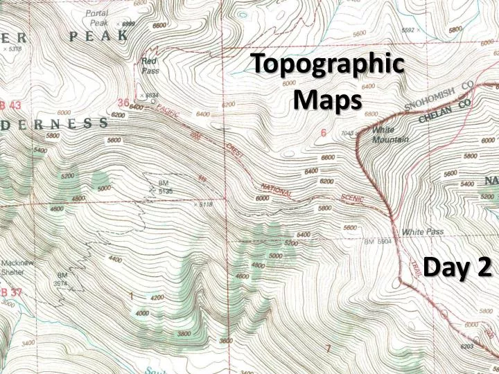
Topographic Maps. Day 2. Topographic Maps. Objective – “I will be able to compare and contrast latitude with longitude.” Essential Question – “Besides the directions of the lines, what is the one big difference between latitude and longitude?” Standard – SC 8-3.9.

E N D
Topographic Maps Day 2
Topographic Maps Objective – “I will be able to compare and contrast latitude with longitude.” Essential Question – “Besides the directions of the lines, what is the one big difference between latitude and longitude?” Standard – SC 8-3.9
Topographic Maps • Models the change in elevation of the Earth’s surface • Shows details of hills, depressions, river valleys, canyons, and volcanoes
(Pre-assessment question 4)
Contour Lines connect points of equal elevation Contour interval = 50 feet The contour interval is the set difference in elevation between adjacent contour lines (Pre-assessment questions 7 & 8)
Index Contours Thicker contour lines marked with the elevation Index Contour Lines Elevation marked on index contour line What is the contour interval of this map? Use the index contour lines to get your answer.
Flow direction Flow direction Where contour lines cross a river or stream, they form a “V” that opens downstream
Lines far apart = gradual slope Close together = steep slope
Rules for contour lines • Contour Lines close around hills and basins. Basins = holes (look for hachures – lines on the contour lines) • Contour Lines Never Cross. How could one spot have 2 elevations? • When contour lines cross streams, they form a “V” that opens in downstream direction.
‘Elevation’ Terms • Topography - the configuration of the surface of the land. • Elevation - vertical distance between a given point and the datum plane. • Datum plane - zero elevation, usually sea level • Bench mark (BM) - a point of known elevation, usually marked by an ‘X’ on the map. • Relief - difference in elevation between points of higher and lower elevation. • Gradient - change in elevation over distance.
‘Elevation’ Terms (continued…) • Contour line - lines connecting points of equal elevation • Contour interval – set difference in elevation between adjacent contour lines • Index contours - Thicker lines with elevations printed • Hachure marks - used to identify depressions (such as a volcano crater)
MAP TERMS • Map Scale – relationship between the map and actual distances on the ground • Shown as ratios 1:80,000 1 unit on the map = 80,000 units on land. • Map Legend – explains map colors, symbols • Topographic Symbols on p. 600 • Map Series – covers the same dimensions of latitude and longitude (Pre-assessment questions 5 & 6)
Fractional – 1/24000 Verbal – “One unit on the map is equal to 24000 units on the ground.” (The ‘unit’ stays the same.) Map Scales Ratio – 1:24000 Graphic (Bar)