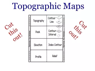
Download
1 / 46
460 likes | 840 Vues
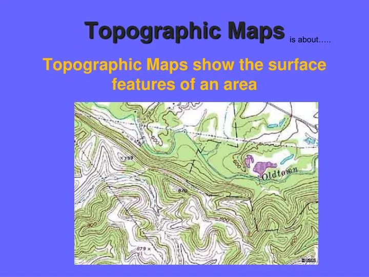
is about…. Topographic Maps show the surface features of an area. Topographic Maps. Contour Lines. Contour Lines are imaginary lines that join points of equal elevation above or below sea level. Contour Line Link. Contour Lines. Equal elevation. http://www.4orienteering.com.

E N D
is about….. Topographic Maps show the surface features of an area Topographic Maps
Contour Lines • Contour Lines are imaginary lines that join points of equal elevation above or below sea level Contour Line Link
Contour Lines Equal elevation http://www.4orienteering.com
Rules of Contour Lines • Never cross each other • Connect with themselves • Get closer together as land gets steeper • Get further apart as land gets flatter
Contour Interval The change in elevation from contour line to contour line is called the contour interval The distance that separates contour intervals
Contour Profile • The shape you would see if were sliced along a line http://serc.carleton.edu/mathyouneed/slope/topoprofile.html
Gradient • The gradient of a mountainside is a measure of its steepness
500 m (950 m – 450 m) [Accept all reasonable estimates.] Relief • The relief of a contour map is the difference between its highest and lowest points Contour Interval = 50m 500 m (950 m – 450 m)
Important thing to remember …. Topographic maps can be used to identify land and erosional features
Let’s keep going! 100m
Now we’re at 200m. 200m 100m
Shall we march on? 200m 100m
We’ve made it to 300m! 300m 200m 100m
On to the peak! 300m 200m 100m
We’re on the peak, but what’s our elevation? 300m 200m 100m
Any ideas? Let’sadd contour lines for every 50 meters and see if that helps. 300m 200m 100m
We know that we are above 350m, but less than 400m. 350m 300m 250m 200m 150m 100m 50m
Let’s head down the hill, it’s getting late! 350m 300m 250m 200m 150m 100m 50m
Now what’s our elevation? If you said somewhere between 200m and 250m you are right! 350m 300m 250m 200m 150m 100m 50m
Let’s try this again! 350m 300m 250m 200m 150m 100m 50m
What’s our elevation now? If you said 50m or just under, you’re right! 350m 300m 250m 200m 150m 100m 50m
Let’s now look at the same hill, but the way we might see it from an airplane!
If you said more than 150 meters, but less than 200 meters you’re right!
Think you know our elevation now? More than 300meters But less than 350meters
If we were standing on the peak, what would be our elevation? • More than 350 meters, less than 400 meters
Let’s see what you know. E C D B 1200m F 1000m A 800m 400m 600m
1. Could the elevation at the peak (B) be 1410 meters? No : The elevation must be under 1400 meters, but over 1300 meters. E C D B 1200m F 1000m A 800m 400m 600m
2. What is the elevation at (E)? About 400 meters E C D B 1200m F 1000m A 800m 400m 600m
3. If you walked a straight line from (D) to (C) would you walk over a ridge or down a valley? Down a valley: If the contour lines point up the slope it’s a valley, if they point down the slope it’s a ridge. E C D B 1200m F 1000m A 800m 400m 600m
4.Just looking at the map, would it be easier to head down from the peak going East, or going North? East: When contour lines are close together that means there is a steep slope, the further apart the lines, the more gentle the slope and therefore an easier walk! Go east! N E C D B W E 1200m F 1000m A 800m 400m 600m S
What land feature is represented in the picture below? Depression
What land feature is represented in the picture below? Valley
What land feature is represented in the picture below? Ridge
Contour Practice • What is the contour interval of the map at left? • What is the elevation of point A? • What is the elevation of point B? • What is the elevation change between A and B? 80 m 320 m 880 m 560 m
Close to Home • Local maps • http://www.topozone.com/states/Texas.asp?county=Bexar • http://www.trails.com/topo.aspx?lat=30.50639&lon=-98.81861&s=50&name=Enchanted%20Rock • Topo Map - http://www.youtube.com/watch?v=EqyfJMgFL-U