Download
1 / 33
330 likes | 460 Vues
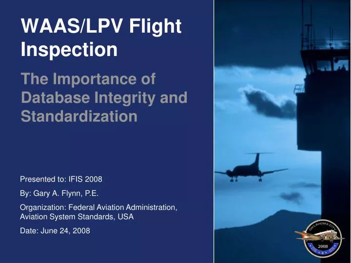
WAAS/LPV Flight Inspection. The Importance of Database Integrity and Standardization. Topics. Introduction – Timeline & Equipage Background – Technical Audit Challenge 1: Vertical Guidance and TCH Challenge 2: Database Integrity & Standardization. Introduction. Timeline

E N D
WAAS/LPV Flight Inspection The Importance of Database Integrity and Standardization
Topics • Introduction – Timeline & Equipage • Background – Technical Audit • Challenge 1: Vertical Guidance and TCH • Challenge 2: Database Integrity & Standardization
Introduction • Timeline • 1999: AVN begins WAAS R&D work using experimental equipment • 2004: AVN has established procedures for inspecting WAAS/LPV approaches • 2004: AVN’s WAAS/LPV inspection program is short-lived, Threshold Crossing Height (TCH) values are unreasonable • 2005: AVN begins in-depth technical audit of WAAS/LPV inspection program
Introduction • Equipage • Six Lear 60 Aircraft • Collins Multi-Mode Receiver (MMR) with WAAS • Differential GPS (auxiliary truth system) • Upgraded Flight Management System (Universal) • Flight Inspection Software Changes
Introduction MMR Installation in Lear 60 MMR
Introduction Lear 60 Flight Inspection Workstation
Introduction Engineering Lab – Test Station
Background • Experience Gained Analyzing F.I. Data for NASA MSBLS • Verified both the sample-by-sampleresults and analytical results • Extremely complex effort (positiontransformations, extrapolations, etc.) • Approached by WAAS/LPV F.I. Technicians • Unrealistic Threshold Crossing Heights (TCH) • Preliminary discussions raised concerns
Background • Preliminary Review Raised Issues • TCH not included in pass/fail criteria • Method for calculating TCH not well documented • TCH results inconsistent & unreasonable • Decision • Convinced AVN management to haltWAAS/LPV inspection until issues resolved • Highest priority given to resolving issues • Concentrated on vertical profile, not somuch on lateral
1: Vertical Guidance & TCH • Why Check WAAS Guidance? • Unlikely WAAS signal would be a problem • WAAS guidance Threshold Crossing Height (TCH) is an excellent indicator of accuracy and integrity of the procedure and supporting data • TCH – Simple Definition • Vertical distance from runway surface to WAAS/LPV guidance path at threshold
1: Vertical Guidance & TCH • ILS • Relatively immune to survey errors • WAAS/LPV • Complex solution • Runway survey data* • Airborne database: Final Approach Segment (FAS) data block definition* • WAAS ground station surveys* * Has associated reference datum
1: Vertical Guidance & TCH • Methodology • Create WAAS/LPV vertical guidance and check in a manner similar to ILS glideslope • Just as for ILS, assume all error is due to WAAS/LPV solution, none due to truth system • Use Final Approach Segment (FAS) data block specification to define desired path (see FAS Build screen shot)
1: Vertical Guidance & TCH FASBuild ScreenShot
1: Vertical Guidance & TCH ILS Vertical Error and Path
1: Vertical Guidance & TCH • WAAS Guidance Error vs. Position Error • WAAS guidance error is same magnitude as position error but opposite in polarity • Sample below assumes that WAAS is reporting altitude 10 feet below actual
1: Vertical Guidance & TCH WAAS/LPV Vertical Error and Path
1: Vertical Guidance & TCH WAAS Vertical Guidance Data Points
1: Vertical Guidance & TCH • Compensating for ATK Error • For a 3° glideslope, a 20-foot ATK error will produce 1 foot of vertical error • Two methods for compensation are described in IFIS paper ATK Error affects TCH
1: Vertical Guidance & TCH • Best Fit Straight Line • Linear regression of vertical guidance path from FAF to Threshold • Produces GPA and TCH • Using multiple data points reduces anomalous results • GPA will typically match FAS
1: Vertical Guidance & TCH WAAS Vertical Guidance Data Points
1: Vertical Guidance & TCH The End …of Part 1
2: DB Integrity & Standardization • Influence of Data • ILS - local geometry only • WAAS/LPV - Affected by: • Runway survey data • FAS data block definition • GPS/WAAS signal (WAAS Reference Station surveys) • Must ensure data is accurate • Must ensure all relate to same geodetic datum
2: DB Integrity & Standardization • Engineering Tools • FAS Pack: Checks FAS data block files before flight (also used to package multiple data blocks into single file) • WAAS Extract: Analyzes AFIS log files & validates AFIS results
2: DB Integrity & Standardization Data Flow -WAAS LPV Flight Inspection
2: DB Integrity & Standardization • Errors Discovered • FAS data block design or data entry • Survey data • Transfer of survey data into database • Latent errors associated with runway database • Runway database filter algorithm • Differences in geodetic datum
2: DB Integrity & Standardization 363 Ft Vertical Error at Threshold (FAS Pack Tool)
2: DB Integrity & Standardization • “Four-Foot Offset” • Persistent TCH bias during technical audit • Averaged about 4 feet • Changed somewhat with geographic location • Many tests performed to identify source: • Multiple truth systems • Post-flight analysis • Static aircraft and laboratory tests • Use of multiple WAAS receivers
2: DB Integrity & Standardization • “Four-Foot Offset” (Continued) • Stumbled upon answer (phone conversation with NGS) • North American Datum 1983 (NAD83) vs. World Geodetic Survey 1984 (WGS-84) • Initially equivalent • WGS-84 datum has been shifted about 2 meters • RTCA DO-229C specifies WGS-84 for FAS data • Continue to use NAD83 ellipsoidal height when creating FAS data blocks
2: DB Integrity & Standardization • Other Survey References • Many WAAS/LPV approaches based upon legacy, orthometric (MSL) coordinate systems • North America Vertical Datum 1988 (NAVD88) • National Geodetic Vertical Datum 1929 (NGVD29) • Tools provided by NGS and NGA convert orthometric height (MSL) to ellipsoidal height (HaE) MSL: Mean Sea Level (Orthometric Height) HaE: Height above Ellipsoid (Ellipsoidal Height)
2: DB Integrity & Standardization Mixed DatumAltitudeTransformations
Conclusions • Conclusions • Imperative to establish exactly what is being checked (and pass/fail criteria) • BFSL TCH provides a good figure of merit for the WAAS/LPV approach • Database accuracy and standardization are larger contributors to WAAS/LPV approach problems than the actual signal in space • Due to the susceptibility of WAAS/LPV to survey errors and the multiplicity of opportunities for errors to enter the development process, it is imperative that an end-to-end check be performed
Questions? The End