Download
1 / 26
260 likes | 379 Vues
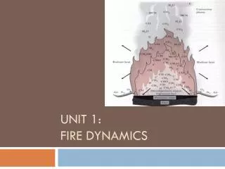
Coeur d’Alene Tribe Fire Regime Condition Class (FRCC) Determination. What is FRCC. Interagency, standardized tool.

E N D
Coeur d’Alene TribeFire Regime Condition Class(FRCC)Determination
What is FRCC • Interagency, standardized tool. • “Measures the degree of departure from reference conditions, possibly resulting in changes to key ecosystem components, such as vegetation characteristics (species composition, structural stage, stand age, canopy closure, and mosaic pattern); fuel composition; fire frequency, severity, and pattern; and other associated disturbances, such as insect and disease mortality, grazing, and drought.”Interagency Fire Regime Condition Class Guidebook. Version 1.2 May 2005. • Guide Management Objectives • Set Priorities
WHY FRCC? • Conforms to requirements associated with National Fire Plan • Required element for Fire Management Plans • Use of Standardized FRCC Evaluation law with Healthy Forest Restoration Act of 2003
Methodology From Interagency Fire Regime Condition Class Guidebook • FRCC Toolkit • ArcGIS Application • Assesses Departure of vegetation-fuel classes • Produces spatial layers that correspond to FRCC Standard Landscape Worksheet Method. • Outputs can be assessed and QC’d against field data collected as part of Standard Landscape Worksheet Method.
Landscape Reporting Levels • Landscape perspective before stand level analysis • Three different levels of landscape sizes • 4th level HUCs to 5th Level HUCs to 6th Level HUCs • Use 6th Level HUCs.
The information depicted on this map is the result of digital analysis performed on a database consisting of information from a variety of governmental and other credible sources. The accuracy of the information presented is limited to the collective accuracy of the database on the date of the analysis. The information is believed accurate and reasonable efforts have been made to ensure the accuracy of the map. However, the Coeur d’Alene Tribe expressly disclaims responsibility for damages or liability that may arise from use of this map. This product is the property of the Coeur d’Alene Tribe and its use is thereby restricted. Map Produced By Coeur d'Alene Tribe GIS on 2/28/05 File Name:\\Gis-dm1\D\Data\Maps\FuelMeetingMaps\\Hucs.mxd For information on this map or other maps please contact us at gisinfo@cdatribe-nsn.gov
Biophysical Settings • BpS layer evaluated against reference conditions. • “Composition of landscape vegetation and disturbance that can sustain native ecological systems and reduce future hazards to native diversity.” Interagency Fire Regime Condition Class Guidebook. Version 1.2 May 2005. • Vegetation Dynamics Development Tool • Extensively Peer Reviewed. • Forest Vegetation Layer and Forest Stands • Groupings of similar stands as per Vegetation Occurrence. • In progress (Draft Products).
The information depicted on this map is the result of digital analysis performed on a database consisting of information from a variety of governmental and other credible sources. The accuracy of the information presented is limited to the collective accuracy of the database on the date of the analysis. The information is believed accurate and reasonable efforts have been made to ensure the accuracy of the map. However, the Coeur d’Alene Tribe expressly disclaims responsibility for damages or liability that may arise from use of this map. This product is the property of the Coeur d’Alene Tribe and its use is thereby restricted. Map Produced By Coeur d'Alene Tribe GIS on 2/28/05 File Name:\\Gis-dm1\D\Data\Maps\FuelMeetingMaps\\BpS.mxd For information on this map or other maps please contact us at gisinfo@cdatribe-nsn.gov
Vegetation-fuel Classes • Successional States • Combination of cover type (early-seral, mid-seral, and late-seral) and structural type (open or closed) • Compares existing vegetation-fuel classes in BpS with reference condition.
Master Grid • Contains all output data. • Organization and sorting of Data
Stratum Vegetation-fuel Class Percent Difference • Contrast between existing vegetation-fuel class and reference condition. • + value = over-represented • - value = under-represented • Most detailed information about status of vegetation-fuel class.
The information depicted on this map is the result of digital analysis performed on a database consisting of information from a variety of governmental and other credible sources. The accuracy of the information presented is limited to the collective accuracy of the database on the date of the analysis. The information is believed accurate and reasonable efforts have been made to ensure the accuracy of the map. However, the Coeur d’Alene Tribe expressly disclaims responsibility for damages or liability that may arise from use of this map. This product is the property of the Coeur d’Alene Tribe and its use is thereby restricted. Map Produced By Coeur d'Alene Tribe GIS on 2/28/05 File Name:\\Gis-dm1\D\Data\Maps\FuelMeetingMaps\StratumFuelClassDepart.mxd For information on this map or other maps please contact us at gisinfo@cdatribe-nsn.gov
Stratum Vegetation-fuel Class Relative Amount • Amount a vegetation-fuel class is under- or over- represented • More general categories reduce complexity
The information depicted on this map is the result of digital analysis performed on a database consisting of information from a variety of governmental and other credible sources. The accuracy of the information presented is limited to the collective accuracy of the database on the date of the analysis. The information is believed accurate and reasonable efforts have been made to ensure the accuracy of the map. However, the Coeur d’Alene Tribe expressly disclaims responsibility for damages or liability that may arise from use of this map. This product is the property of the Coeur d’Alene Tribe and its use is thereby restricted. Map Produced By Coeur d'Alene Tribe GIS on 2/28/05 File Name:\\Gis-dm1\D\Data\Maps\FuelMeetingMaps\\Hucs.mxd For information on this map or other maps please contact us at gisinfo@cdatribe-nsn.gov
Vegetation-Fuel FRCCStand Level • Contrast between vegetation-fuel class and reference condition of that class • Relative Amount into broader scales • FRCC reporting for individual stands
The information depicted on this map is the result of digital analysis performed on a database consisting of information from a variety of governmental and other credible sources. The accuracy of the information presented is limited to the collective accuracy of the database on the date of the analysis. The information is believed accurate and reasonable efforts have been made to ensure the accuracy of the map. However, the Coeur d’Alene Tribe expressly disclaims responsibility for damages or liability that may arise from use of this map. This product is the property of the Coeur d’Alene Tribe and its use is thereby restricted. Map Produced By Coeur d'Alene Tribe GIS on 2/28/05 File Name:\\Gis-dm1\D\Data\Maps\FuelMeetingMaps\\Hucs.mxd For information on this map or other maps please contact us at gisinfo@cdatribe-nsn.gov
Stratum Vegetation-Fuel Class Departure • Departure of existing condition of vegetation-fuel classes from reference conditions across all vegetation-fuel classes within a BpS. • Continuous variable with values ranging from 0 (no departure) to 100 (completely departed).
The information depicted on this map is the result of digital analysis performed on a database consisting of information from a variety of governmental and other credible sources. The accuracy of the information presented is limited to the collective accuracy of the database on the date of the analysis. The information is believed accurate and reasonable efforts have been made to ensure the accuracy of the map. However, the Coeur d’Alene Tribe expressly disclaims responsibility for damages or liability that may arise from use of this map. This product is the property of the Coeur d’Alene Tribe and its use is thereby restricted. Map Produced By Coeur d'Alene Tribe GIS on 2/28/05 File Name:\\Gis-dm1\D\Data\Maps\FuelMeetingMaps\Hucs.mxd For information on this map or other maps please contact us at gisinfo@cdatribe-nsn.gov
Stratum Vegetation-Fuel FRCC • More Specific Vegetation-Fuel Class Departure • 1, 2, 3 = Low, Moderate High • Some information lost • Simplifies Use
The information depicted on this map is the result of digital analysis performed on a database consisting of information from a variety of governmental and other credible sources. The accuracy of the information presented is limited to the collective accuracy of the database on the date of the analysis. The information is believed accurate and reasonable efforts have been made to ensure the accuracy of the map. However, the Coeur d’Alene Tribe expressly disclaims responsibility for damages or liability that may arise from use of this map. This product is the property of the Coeur d’Alene Tribe and its use is thereby restricted. Map Produced By Coeur d'Alene Tribe GIS on 2/28/05 File Name:\\Gis-dm1\D\Data\Maps\FuelMeetingMaps\Hucs.mxd For information on this map or other maps please contact us at gisinfo@cdatribe-nsn.gov
Landscape Departure Index • Depiction of Vegetation-Fuel class departure from reference conditions of all BpS’s across landscape • Area-weighted average • Big picture view of the strata vegetation-fuel FRCCs combined.
The information depicted on this map is the result of digital analysis performed on a database consisting of information from a variety of governmental and other credible sources. The accuracy of the information presented is limited to the collective accuracy of the database on the date of the analysis. The information is believed accurate and reasonable efforts have been made to ensure the accuracy of the map. However, the Coeur d’Alene Tribe expressly disclaims responsibility for damages or liability that may arise from use of this map. This product is the property of the Coeur d’Alene Tribe and its use is thereby restricted. Map Produced By Coeur d'Alene Tribe GIS on 2/28/05 File Name:\\Gis-dm1\D\Data\Maps\FuelMeetingMaps\Hucs.mxd For information on this map or other maps please contact us at gisinfo@cdatribe-nsn.gov
Reports • Reporting Function of tool • Assists in identifying what would need to be accomplished if objective was to match reference conditions • Computes expected acreage of vegetation-fuel class from reference conditions • Subtracts existing acreage of each vegetation-fuel class • + Value = Vegetation-Fuel class under-represented • - Value = Vegetation-Fuel class over-represented