Download
1 / 54
540 likes | 643 Vues
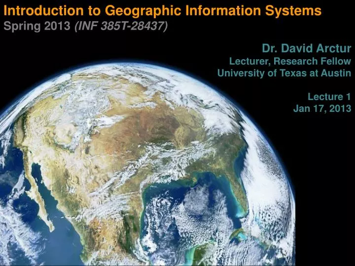
Introduction to Geographic Information Systems Spring 2013 (INF 385T-28437) Dr. David Arctur Lecturer, Research Fellow University of Texas at Austin Lecture 1 Jan 17 , 2013. Who am I? …or at least, where have I been?. University of Texas at Austin

E N D
Introduction to Geographic Information Systems Spring 2013 (INF 385T-28437) Dr. David Arctur Lecturer, Research Fellow University of Texas at Austin Lecture 1 Jan 17, 2013
Who am I? …or at least, where have I been? INF385T(28437) – Spring 2013 – Lecture 1 • University of Texas at Austin • Research Fellow, Jackson School of Geosciences • Lecturer, iSchool • Open Geospatial Consortium (OGC) • Director, Interoperability Programs 2008-2012 • Member/Delegate 1997-2008 • Laser-Scan, Esri, OGC Interoperability Institute • University of Florida, Gainesville • PhD Urban Planning 1996 • Thesis re: GIS with adaptive, object-oriented database https://gsites.google.com/site/dkarctur
Who can say what’s to be done? Natural Resources Biodiversity Population/Urbanization Climate Change Pollution Globalized Economy Technology Science In relationship with our environment Our social fabric is evolving… Whose Issues Are These: Population dynamics Social equity issues Sustainable development Globalization of resource mgmt, production & trade Toxic waste disposal Fresh water availability Energy supplies and demands INF385T(28437) – Spring 2013 – Lecture 1
Overall Course Objectives INF385T(28437) – Spring 2013 – Lecture 1 • Basic understanding of GIS capabilities & tools • ArcGIS 10.1 (software provided) • Open Source GIS (individual exploration) • How many ways it can be used today • Thus the need for data exchange standards • Basic understanding of interoperability – what it is, why it matters, and how to get it
Index to Marine and Lacustrine Geological Samples (IMLGS) database. Sample locations displayed in Arctic projection, July 16, 2012 INF385T(28437) – Spring 2013 – Lecture 1
Index to Marine and Lacustrine Geological Samples (IMLGS) database. Sample locations displayed in Mercator projection, July 16, 2012 INF385T(28437) – Spring 2013 – Lecture 1
Outline for today INF385T(28437) – Spring 2013 – Lecture 1 GIS overview GIS data and layers GIS applications and examples Software overview Course software & exercise files setup
Lecture 1 GIS Overview INF385T(28437) – Spring 2013 – Lecture 1
What is GIS? INF385T(28437) – Spring 2013 – Lecture 1 Geographic Information Systems (GIS) are computerized systems designed for the storage, retrieval and analysis of geographically referenced data GIS uses advanced analytical tools to explore at a scientific level the spatial relationships, patterns, and processes of cultural, biological, demographic, economic, geographic, and physical phenomena
S.America map by Diego Gutierrez, 1562 INF385T(28437) – Spring 2013 – Lecture 1
Today INF385T(28437) – Spring 2013 – Lecture 1 Aral Sea, Uzbekistan
2012 National Election Results INF385T(28437) – Spring 2013 – Lecture 1 http://www.esri.com/news/maps/2012/election-maps/2012-national-results.html
Web-based GIS: World Water Onlinehttp://worldwateronline.org INF385T(28437) – Spring 2013 – Lecture 1
Group on Earth Observations (GEO): Global Earth Observation System of Systems (GEOSS)http://earthobservations.org INF385T(28437) – Spring 2013 – Lecture 1
Tools for GIS INF385T(28437) – Spring 2013 – Lecture 1 • Hardware • Computer • Digitizer • Scanner • Printer/Plotter • Software • Desktop GIS • Internet GIS • CAD Software • Database Software • Multimedia (photos, videos, 3D models)
Unique capabilities of GIS INF385T(28437) – Spring 2013 – Lecture 1 GIS stores related geographic features in separate collections of files called map layers Map layers can be reused easily and assembled into any number of map compositions and overlaid for analysis
GIS answers the following INF385T(28437) – Spring 2013 – Lecture 1 Location:What is at...? Where is it? Condition: Status of features? Trends: What has changed since...? Patterns:What spatial patterns exist? Modeling:What if…?
Scale of GIS data Global to local INF385T(28437) – Spring 2013 – Lecture 1
Vector data INF385T(28437) – Spring 2013 – Lecture 1 • Map features • Points, lines, polygons • Feature attributes • Every feature has attributes (e.g. name, area, population)
Raster Data INF385T(28437) – Spring 2013 – Lecture 1 Stored electronic image or picture taken as an aerial photograph or satellite image Composed of a rectangular array of square cells, called pixels, with a number in each cell representing the solid color fill of that cell
Lecture 1 GIS Data and layers INF385T(28437) – Spring 2013 – Lecture 1
GIS example INF385T(28437) – Spring 2013 – Lecture 1 • Identify polluting companies and their proximity to populations in poverty, water features, or schools. • Start with • Databases • Map layers
Databases INF385T(28437) – Spring 2013 – Lecture 1 Not easy to interpret
Data shown as GIS layers INF385T(28437) – Spring 2013 – Lecture 1
Additional layers INF385T(28437) – Spring 2013 – Lecture 1 Political features (municipalities)
Additional layers INF385T(28437) – Spring 2013 – Lecture 1 Physical features (lakes, rivers, etc.)
Additional layers INF385T(28437) – Spring 2013 – Lecture 1 Administrative data (schools)
Maps and tables are interactive INF385T(28437) – Spring 2013 – Lecture 1 Identify features
Maps and tables are interactive INF385T(28437) – Spring 2013 – Lecture 1 Select features
Advanced GIS functions INF385T(28437) – Spring 2013 – Lecture 1 Proximity selections
Advanced GIS functions INF385T(28437) – Spring 2013 – Lecture 1 • Buffers • Select top polluting companies and show the number of schools within 2 miles of these companies.
Lecture 1 GIS applications and examples INF385T(28437) – Spring 2013 – Lecture 1
GIS applications INF385T(28437) – Spring 2013 – Lecture 1
Neuroscience: brain atlases INF385T(28437) – Spring 2013 – Lecture 1
Lecture 1 SOFTWARE overview INF385T(28437) – Spring 2013 – Lecture 1
ArcMap (Desktop GIS) Main menu Standard toolbar Map document window Table of contents Identify results window Tools toolbar INF385T(28437) – Spring 2013 – Lecture 1
Map documents INF385T(28437) – Spring 2013 – Lecture 1 (.mxd) extension “Points” to layers Saves layer colors, symbology, etc.
Tutorial 1-1.mxd INF385T(28437) – Spring 2013 – Lecture 1 • Two layers • USCities (red points, restricted to major cities) • USStates (yellow polygons)
Adding map layers INF385T(28437) – Spring 2013 – Lecture 1 Separate files added to a map document
Geodatabases Country layer World.gdb Graticule layer INF385T(28437) – Spring 2013 – Lecture 1 The geodatabase is a "container" used to hold a collection of datasets (GIS features, tables, raster images, etc).
ArcCatalog INF385T(28437) – Spring 2013 – Lecture 1 Arranges and manages geographic information in workspace folders and geodatabases.
ArcToolbox INF385T(28437) – Spring 2013 – Lecture 1 Advanced tools with form-based input by users
Lecture 1 GIS tutorial 1Overview INF385T(28437) – Spring 2013 – Lecture 1
Part I Using and making maps INF385T(28437) – Spring 2013 – Lecture 1 • Chapter 1: Introduction • Learn the basics of working with existing GIS data and maps • Chapter 2: Map design • Learn how to create choropleth and point maps • Chapter 3: GIS outputs • Learn how to build and export maps using GIS data
Part II Working with spatial data INF385T(28437) – Spring 2013 – Lecture 1 • Chapter 4: File geodatabases • Learn how to create geodatabases and import data into them • Chapter 5: Spatial data • Explores the basic data types used within GIS and then shows how to use the Internet to gather GIS data • Chapter 6: Digitizing • Learn how to digitize vector data and transform data to match real-world coordinates • Chapter 7: Geocoding • Learn how to map address data as points through the geocoding process • Chapter 8: Geoprocessing • Perform spatial analysis using geoprocessing tools
Part III Learning advanced GIS applications INF385T(28437) – Spring 2013 – Lecture 1 • Chapter 9: Spatial analysis • Perform spatial analysis using geoprocessing tools and analysis workflow models • Chapter 10: ArcGIS 3D analyst • Introduces ArcGIS 3D Analyst, allowing users to create 3D scenes, conduct fly-through animations, and conduct line-of-sight studies • Chapter 11: ArcGIS spatial analyst • Introduces ArcGIS Spatial Analyst for creating and analyzing raster maps, including hillshades, density maps, site suitability surfaces, and risk index surfaces
Chapter structure INF385T(28437) – Spring 2013 – Lecture 1 • Tutorials • Multiple tutorials in every chapter • Include step-by step exercises • Your turns • Reinforce the skills learned in the step-by-step exercises • Advanced assignments • Found at the end of each chapter. • Provokes critical problem-solving skills
GIS tutorial data INF385T(28437) – Spring 2013 – Lecture 1 • Data • \ESRIPress\GIST1\Data\ • Map layers, geodatabases, data tables, etc.