Download
1 / 43
430 likes | 529 Vues
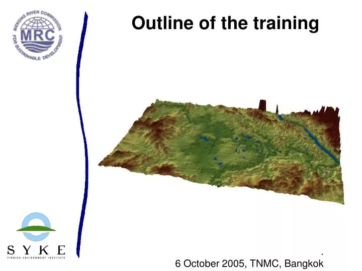
Outline of the training. . 6 October 2005, TNMC, Bangkok. Training objectives. updating the data and model development issues deepening the knowledge of the EIA 3D hydrodynamic models with practical training planning of the future activities. Schedule. Brushing up.

E N D
Outline of the training . 6 October 2005, TNMC, Bangkok
Training objectives • updating the data and model development issues • deepening the knowledge of the EIA 3D hydrodynamic models with practical training • planning of the future activities
Brushing up.... • HBV and VMod hydrological models • Validation results • Development and continuation • VMod manual • 3D Hydrodynamic model • Current status of the application • Validation • Development and continuation • Field work • Preliminary results from the field work in Si Songkram
HBV and VMod • Data • Latest results • Continuation
13126 km2 Heights min 135m max 675 m Elevation
Weather data • 16 precipitation stations • Temperature data from one station • Evaporation, three stations used • Some data gaps • Temperature missing 1994-2002 • Some days and months missing in Pan evaporation
2943 1850 1979 1976 2665 1796 1984 2366 2290 1446 1339 1432 1254 1175 1564 1128 Average yearly precipitation
Ban Tha Sri Chomchun Ban Nong Yang Ban Tha Kok Daeng Ban Khon Sai Ban Phok Yai Modelling: HBV • HBV model has been set up for five subcatchments in the Nam Songkhram watershed • The size of the model areas is between 625 and 5029 km2
Modelling: HBV • Simple optimisation of the model parameters completed • Model results in calibration period (1987-1991) very good to moderately good • Model result in test period (1992-1995) good to moderately good
HBV results • The R2 in calibration period was • 0.92 for Nam Songkhram at Ban Tha Kok Daeng • 0.81 for Nam Oon at Ban Phok Yai • 0.74 for Nam Yam at Ban Khon Sai • 0.86 for Huai Khong at Ban Tha Sri Chomchun • 0.86 for Huai Hi at Ban Nong Yang • The R2 of the test period (1992-1995) was • 0.83 for Nam Songkhram at Ban Tha Kok Daeng • 0.81 for Nam Oon at Ban Phok Yai • 0.73 for Nam Yam at Ban Khon Sai • 0.77 for Huai Khong at Ban Tha Sri Chomchun • 0.76 for Huai Hi at Ban Nong Yang
Modelling :VMod • 2D distributed hydrological model coupled with a 1D hydrodynamic river, reservoir and lake model • Physical model of the application area that takes into account variability in elevations, soil properties, vegetation, land use etc.
Landuse/Irrigated area • Landuse (1997) types are • Water • Agriculture • Irrigated agriculture • Evergreen/mixed forest • Deciduous forest/scrub • 89% of landuse agriculture or irrigated agriculture • Irrigated 3280 km2 (24% of catchment, 2001) • New landuse data (2002)
Soils slope complex (plinthic) acrisol alluvial soils • Five soil types • 80 % acrisol/plintic acrisol • Low water retention and conductivity floodplain water
Modelling: VMod • 1 km model grid (resolution can and probably will be increased) • Flow network computed from DEM and corrected • The number of landuse and soil classes has been reduced to make the calibration and use of the model easier and clearer • 5 landuse classes • 5 soil classes
Modelling: VMod, newest developments • Data from four new discharge station added to the model • Calibration of the model has continued with this new data • New developments of the irrigation practices include the possibility to subtract water from the river to be used in irrigation
VMod flow computations, Ban Tha Kok Daeng • Computed flow at Ban Tha Kok Daeng compared to measured data • The results are much better than the previous results, but there is still room for more improvement • R2 is 0.91 in calibration period, 0.84 in test period
VMod flow computations, other stations • The other four stations with discharge measurement have been included in the model and their calibration is only in the beginning • The computed vs. measured in these new stations is not as good as in Ban Tha Kok Daeng • The R2 in calibration period was • 0.55 for Nam Oon at Ban Phok Yai (there are still problems with irrigational practices and with the Nam Oon dam here) • 0.65 for Nam Yam at Ban Khon Sai • 0.58 for Huai Khong at Ban Tha Sri Chomchun • 0.80 for Huai Hi at Ban Nong Yang
VMod: Future tasks • Develop further the agricultural water practices (water trapping, discharge and evaporation from paddy fields etc.) • Check the floodplains in the hydrological model • Add structures that may affect flow • Check river dimensions (cross sections) • Further calibration of the model • Include water quality and erosion components to the model and calibrate these • Clarify and execute scenarios (e.g. irrigation, land use and climatological changes)
EIA 3D Model • Latest development • Some preliminary results
3D hydrodynamic and WQ application • 3D hydrodynamic model coupled with a water quality model • 3D hydrodynamics • flood arrival time, duration and depth in different locations of the modelled area, other flood characteristics • Water quality: sediment concentration, net-sedimentation, oxygen, etc • Run through a GIS-type graphical user interface
Input data for the 3D model • River and floodplain topography • Hydrographic atlas data • river cross-sections for Nam Songkhram • digital elevation map (DEM) for floodplain • Boundary conditions • Upstream discharge and water level in Mekong • Upstream dishcarge in Nam Songkhram • Downstream rating curve (in Mekong) • Landuse • Wind • (Precipitation)
Modelling: 3D • The main tribuaries of the Nam Songkhram have been included in the model (Nam Oon, Nam Yam, Huai Hi...) • Model calculation have been visually compared to data from inundated areas • Effect of Mekong mainstream waterlevel (backwater effect) • Sensitivity to parameter values has been analysed • Channel dimension and elevations have been modified (still in progress)
Flood duration Flood arrival time
Flood depth- Mekong water level low Flood depth- Mekong water level high
Output • Tool to understand the hydrodynamic of the Nam Songkhram flood plains • Scenarios and their impact on the flooding • Landuse • Climate change • Irrigation development • Reservoir development • Interaction between Nam Songkhram and Mekong • Reverse flow • Back water effect
EIA 3D modelling: Future tasks • Include new river cross sections in to the model • Check grid heights • Include structures that affect flow (enbankments, dams, weirds) • Calibrate and verify the model • Include water quality calculations • Clarify and execute scenarios (e.g. irrigation, land use and climatological changes)
Current meter RM9 • Current speed • Current direction • Temperature • Conductivity • Pressure • Turbidity • Oxygen
Current speed & direction Mekong