Download

1 / 40
400 likes | 497 Vues
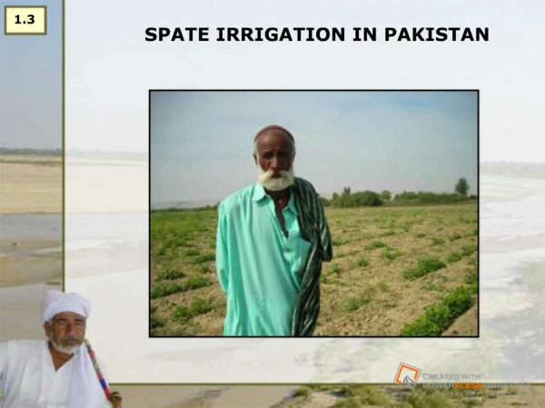
6.1 Understanding the Spate Rivers. John Ratsey [john.ratsey@ntlworld.com]. Hydrology of Ephemeral Rivers. Engineering in spate irrigation is entirely different from that on perennial flows

E N D
6.1 Understanding the Spate Rivers John Ratsey [john.ratsey@ntlworld.com]
Hydrology of Ephemeral Rivers • Engineering in spate irrigation is entirely different from that on perennial flows • The classic feature of wadi hydrology is the floods, which rise very quickly and then recede over a period of hours or days • The peak of the spate will progressively reduce once it is in the flood plains and the water is diverted or can naturally spread • Ephemeral rivers are marked by: • Sediment loads • Transport of trash • Strong scour • Especially lower down the gravel fans frequent change of river course
Wadi Mawr Hydrographs There is always a spread of big and small floods
A Wadi Rima Spate Often another spate arrives before the first has receded Hydrological statistics based on upstream gauging stations (peak flow, base flow, flow volumes) may not be completely applicable to the diversion sites
Wadi Zabid – Frequency of Floods An average of 5.7 floods per year between 50 and 100m³/s. 5.7 + 2.4 +1.1 + 0.4 = 9.6 floods per year exceeding 50m³/s
Annual flow – Wadi Zabid Wettest years have over four times the volume of the driest years
Wadi Zabid – Annual Number of Floods and Flood Volumes Variation from year to year Less than 20 to more than 80 spates per year
Baseflow • There may also be a base flow in the ephemeral river which may be continuous through all (annual) or part (seasonal) of the year • Do not forget the base flow that is subsurface • In some rivers the base flow has reduced or disappeared during the past 30 years due to increased abstraction of upstream • The proportion of water coming as floods therefore increases – for instance in Kenya river become more ‘spate rivers’
Baseflow volume • The total volume of a small baseflow for a long time can be substantial • 1m³/s for 365 days per year = 31.5 million m³ • But it does not require much small-scale upstream development to use 1m³/s
Flood flow and base flow Total flow volume Baseflow volume Flood flow volume
Question: • Compare 1993 and 1994 – is there something striking? • What does this tell us about flood prediction?
Wadi Zabid – Flood Volume Distribution 80% of water is in flood flows of less than 100m³/s
Spate flows - characteristics • Sedimentation • Trash transport / blockage • Scour • Changing of river course
Sediment • Sediment is a major feature of the floods • Spate irrigation is as much about managing sediment as it is about managing water • The sediment includes fertile soil which the farmers want • And also includes sand / gravel / boulders which can damage structures and block canals
Floods can transport sediment – 10% or more by volume during a major flood
WITHIN THE EPHEMERAL RIVER SYSTEM A MIX INCLUDING COARSE MATERIAL IS USUALLY FOUND IN THE UPPER SECTIONS
Fine sediments are transported through canals to the fields A major feature - spate systems build their own soils Field rise rates of 5 or more cms/ year observed in some systems, older spate irrigated areas have silt deposits many metres thick. Rising command levels are a feature of spate irrigation systems
Boundary between irrigated on non irrigated land – Wadi Zabid (Yemen)
Abrasion from sediment load Reinforced concrete slab being eroded
Sediment can erode concrete Concrete being eroded once the stone protection layer has been removed
baffle blocks are very vulnerable Baffle blocks in sluiceways are very vulnerable to damage
Question: • What stands out from this graph?
Trash • Intakes are usually designed to catch the cleaner surface water • However, the cleaner surface water is where the floating trash is concentrated • Trash screen collects big trash • Bigger trash collects medium trash • Medium trash collects small trash • Intake blocked
Avoiding trash problems • Try to provide intakes which can pass big trash without any screens: • Headworks at angle • Outer bend • Clever screens (at angle) • Make provision for trash removal
Waqar weir: but try to get the right angle The trash floating down the wadi cannot turn over the weir and goes straight to the intake. Difficult to fix, but note for future designs
Scour • Scour is one of the major mechanisms of flood damage • Scour is the movement of bed or bank material during floods
Big floods have energy Flow Turbulence caused by flows in two channels converging
Floods do not like obstacles Flood water hitting bridge piers has nowhere to go except upwards! Flow
Scour locations • Scour may happen anywhere in the wadi channel but is most severe on the outside of bends or where obstacles in the wadi cause flow turbulance • The depth of scour may not be evident after the flood since scour holes tend to be infilled during the recession – only the consequential damage remains
Scour damage to spur Scour hole largely filled in again Nose of spur has been undermined and has collapsed
Scour may occur, if spate is attracted to flood channel (especially in outer bend) Old Riverbed HASANLISO (ETHIOPIA) TRADITIONAL FLOOD CHANNEL IN OUTER BEND CAUSED RIVER TO ERODE OUTER BANK New Bend