Download
1 / 24
240 likes | 418 Vues
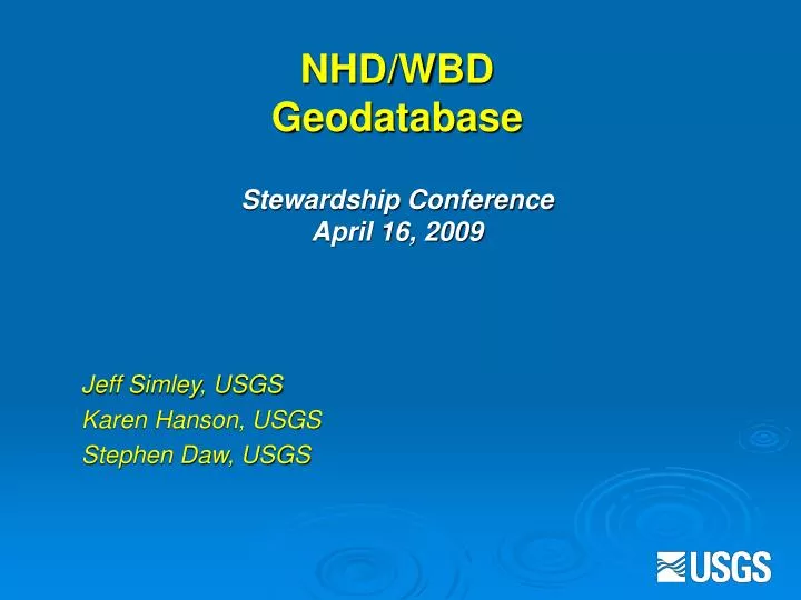
NHD/WBD Geodatabase Stewardship Conference April 16, 2009. Jeff Simley, USGS Karen Hanson, USGS Stephen Daw, USGS. NHD GEODATABASE. FLOW TABLE. NHD FEATURE DATASET. COM_ID to COM_ID. NHD_FLOWLINE FEATURE CLASS. SOURCE CITATION. REACHCODE. COM_ID. STATUS. NHD_WATERBODY. PROCESSING

E N D
NHD/WBD GeodatabaseStewardship ConferenceApril 16, 2009 Jeff Simley, USGS Karen Hanson, USGS Stephen Daw, USGS
NHD GEODATABASE FLOW TABLE NHD FEATURE DATASET COM_ID to COM_ID NHD_FLOWLINE FEATURE CLASS SOURCE CITATION REACHCODE COM_ID STATUS NHD_WATERBODY PROCESSING PARAMETERS NHD_AREA FEAT-META METADATA COM_ID COM_ID COM_ID GEOMETRIC NETWORK
NHD GEODATABASE FLOW TABLE Hydrography FEATURE DATASET Hydrologic Units FEATURE DATASET COM_ID to COM_ID NHD_FLOWLINE FEATURE CLASS SOURCE CITATION REACHCODE SUBBASIN FEATURE CLASS COM_ID HUC 8 CODE HUC 8 NAME STATUS NHD_WATERBODY PROCESSING PARAMETERS NHD_AREA FEAT-META METADATA COM_ID COM_ID COM_ID GEOMETRIC NETWORK
HYDROGRAPHY GEODATABASE FLOW TABLE NHD FEATURE DATASET WBD FEATURE DATASET COM_ID to COM_ID WBD_SUBWATERSHED FEATURE CLASS NHD_FLOWLINE FEATURE CLASS SOURCE CITATION HUC 12 CODE AREA HUC 12 DOWNSTREAM MODIFICATIONS TYPE OF DRAINAGE NON-CONT. AREA REACHCODE STATUS COM_ID PROCESSING PARAMETERS MEASURE NHD_WATERBODY GNIS GNIS_NAME GNIS_ID NHD_AREA COM_ID OUTFLOW ADDRESS FDate_Frrst FDate_Last FEATURE- METADATA METADATA COM_ID Other Feature Classes COM_ID COM_ID GEOMETRIC NETWORK WBD_SUBBASIN FEATURE CLASS
Benefits of incorporating the WBD into the NHD Geodatabase • Take advantage of established and proven concepts in the NHD design to advance the WBD design • Take advantage of geodatabase technology • Improve interoperability between the two datasets • Allow the use of NHD GeoEdit toedit NHD and/or WBD
Benefits (cont’d) • Allow WBD edit transactions to be generated and input into the joint database • Allow the joint stewardship of NHD and WBD • Allow the joint management of both datasets • Allow the joint distribution of both datasets • With the completion of the WBD, the timing is excellent to carry out this integration
Geodatabase structure • The NHD geodatabase will be subdivided into a NHD feature dataset and a WBD feature dataset • The full complement of the WBD, plus new additions will be made to the WBD data design to help it integrate better with the NHD • It is a multi-level design that organizes data to best facilitaterelational functionalitywhile conserving the design to boost efficiency • House multiple datasets that can share characteristics • House multiple feature classes that can also share characteristics • Tables and relationships can also be housed by the geodatabase to facilitate the functionality
NHD WBD Integration • Spring 2008 • USGS and NRCS agreed that the WBD database should be integrated with the NHD geodatabase • Summer 2008 • An MOU was signed to that affect • Summer 2008 • Geodatabase interagency design team was formed • A series of teleconferences were held to outline: • WBD user needs • Outlined detailed design for WBD database • Storage • Retrieval • Editing • Metadata tracking • ..
Geodatabase Design and Implementation Schedule • Initial design completed – June 2009 • Metadata handling evaluation • Database implementation (NHD Model 2.0) – August 2009 • Develop WBD load capability – August 2009 • Load WBD into the geodatabase – September 2009 • Develop maintenance tools/process – November 2009 • Test WBD maintenance using new tools – November 2009 • Moratorium on maintenance/load final version - December 1, 2009 • Go live – January 2010 • Implement stewardship operations – January 2010 • Implement joint data distribution – January 2010 • Complete geodatabase integration – September 2010 • Major spatial discrepancies • Pour points calculated
Delivery: Once fully implemented the NHD and WBD will be jointly housed in Denver, and Denver will be the interface node for stewardshipmaintenance transactions The NRCS will house a replicate of this database for distribution only National Sites that customers will obtain NHD and/or WBD data through (1) The National Map, (2) the NRCS Data Gateway, and (3) a hydrography specific web site (http://nhd.usgs.gov). Users will have several options for downloading. This will include (1) NHD-WBD options, (2) areas of coverage, and (3) levels of hierarchy Stewardship of the WBD will be folded into the NHD stewardship program using a similar NHD technical and programmatic approach
Personnel to implement integration: Project Sponsors:Carl Zulick, Deputy Chief, USGS-GIIA; Katherine Lins, Chief Office of Water Information-USGS; Bill Adams, Acting Chief, NCGC-NRCS, Wendy Blake-Coleman, USEPA • Initiate and authorize this project • Approve resources needed and timelines NHD Program Manager:Jeff Simley, USGS-Geospatial Program Office • Responsible for overall project decisions, monitoring milestones, keep project on track, ensure objective are met, keep stakeholders abreast of progress, define resource needs • Responsible for programmatic implementation
Personnel cont’d: Integration Project Manager:Stephen Daw, USGS-NGTOC • Technical implementation of joint database, transaction posting and update and editing processes and software • Manage day-to-day activities of the project and will assure milestones are met WBD Program Manager:Karen Hanson, USGS, Water Resources • Assure throughout program integration, objectives of the WBD programare maintained • Assist with the load of the WBD into the joint database • Implementation of a WBD stewardship program combined with the NHD stewardship program Hydrography Section Chiefs:Paul Kimsey, Carl Nelsen,USGS-NGTOC • Responsible for maintaining the integrity of the NHD stewardship program and assuring that WBD stewardship operations are fully assimilated into a joint program Multi-agency team • Working on the new geodatabase architecture Programmers……….
Geodatabase Design • Incorporate current WBD attributes, as well as attribution needed for NHD integration • Additional attribution will be added to improve functionality and interoperability • WBD will migrate from shapefile format to geodatabase format • WBD Metadata will be patterned after NHD, but a separate table is needed to account for WBD specifics • Recognize potential future improvements, enhancements, additions • Coastal, 7th and 8th level, international, names, etc.
Current WBD Attribution - line • Level (0-6) • Linesources • Metadata version
Current WBD Attribution - polygon • 8- 10- and 12-digit coding, as well as downstream coding for 10- and 12-digits • Naming at 10- and 12-digit • Size reported as acreage • State(s) that subbasin falls in • Type at 10- and 12-digit • Modifications at 10- and 12-digit • Non-contributing with acreage • GNIS # at 10- and 12-digits • Metadata version
Future WBD Attribution – polygon Issues being discussed for future inclusion -pending June 2009 meeting • OBJECTID • Shape • HUC 2 CODE • HUC 4 CODE • HUC 6 CODE • FDate_First • FDate_Last • ComID
Future WBD feature classes Preliminary-pending June 2009 meeting • Region - Empty • Subregion - Empty • Basin - Populated • Subbasin – Populated • Watershed - TBD • Subwatershed – Populated
Future WBD object class table-WBD name Preliminary-pending June 2009 meeting • ComID • HUC 2 NAME • HUC 2 GNIS ID • HUC 4 NAME • HUC 4 GNIS ID • HUC 6 NAME • HUC 6 GNIS ID • HUC 8 NAME • HUC 8 GNIS ID • HUC 10 NAME • HUC 10 GNIS ID • HUC 12 NAME • HUC 12 GNIS ID
Future WBD object class table-WBD outflow Preliminary-pending June 2009 meeting • ComID • ReachCode • Measure • ReachSMDate • EventDate • ReachResolution
Future WBD object class table-WBD metadata Preliminary-pending June 2009 meeting • DuuID • LAT_Point_1 • LONG_Point_1 • LAT_Point_2 • LONG_Point_2 • ProcessDescription – this is where the bulk of the information goes • ProcessDate • AttributeAccuracyReport • LogicalConsistencyReport • CompletenessReport • HorizontalAccuracyReport • MetadataStandardName • MetadataStandardVersion • MetadataDate • DataSetCredit • ContactOrganization • AddressType • Address • City • StateOrProvince • PostalCode • ContactVoiceTelephone • ContactInstructions • ContactEmailAddress • Additional fields as needed by the WBD
Future WBD object class additional tables Preliminary-June 2009 meeting • NHDFeatureToMetadata • NHDProcessingParameters • NHDSourceCitation – WBD sources can go in here • NHDStatus
NHD GeoEdit Tool • The WBD edit tool will be created and incorporated into the NHD GeoEdit Tool • The GeoEdit Tool will be used to jointly maintain WBD and NHD • NHD currently has rules inside the tool, WBD will need these added • Use of organization code to restrict access • Managing attributes • QA/QC • Track metadata • WBD will carry NHD Reach-code and Com-id (increased utilization of data)
Transaction process • Mimics NHD, except that……….. • Transactions that arrive at the USGS will be handed off to USGS/NRCS reviewers to determine WBD compliance prior to acceptance
Current WBD maintenance practices • Maintenance of the WBD using the NHD process will only be implemented once all processes, tools, functions, and databases are ready • Laura Davenport, NRCS will discuss the current WBD maintenance practices