Download
1 / 18
180 likes | 309 Vues
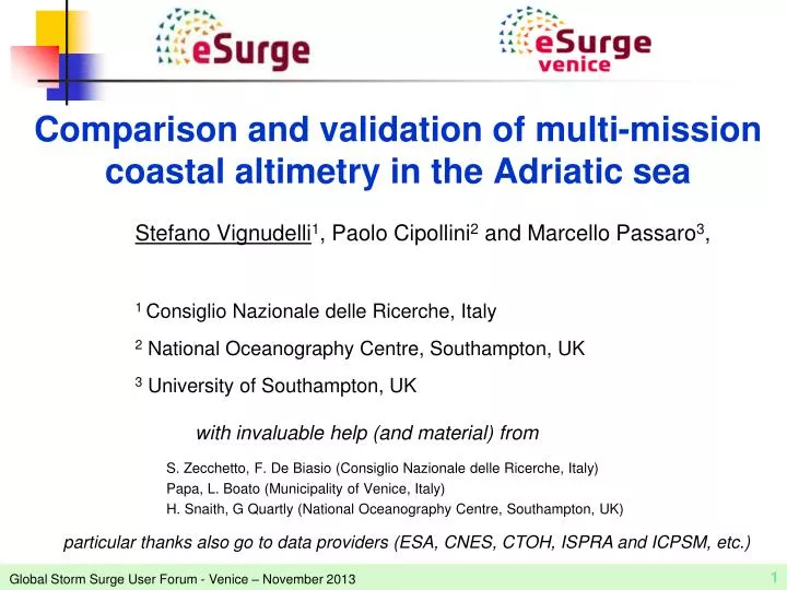
Comparison and validation of multi-mission coastal altimetry in the Adriatic sea. S. Zecchetto, F. De Biasio ( Consiglio N azionale delle Ricerche , Italy) Papa, L. Boato (Municipality of Venice, Italy) H. Snaith, G Quartly ( National Oceanography Centre, Southampton, UK).

E N D
Comparison and validation of multi-mission coastal altimetry in the Adriatic sea S. Zecchetto, F. De Biasio (ConsiglioNazionaledelleRicerche, Italy) Papa, L. Boato (Municipality of Venice, Italy) H. Snaith, G Quartly (National Oceanography Centre, Southampton, UK) Stefano Vignudelli1, Paolo Cipollini2and Marcello Passaro3, 1 ConsiglioNazionaledelleRicerche, Italy 2 National Oceanography Centre, Southampton, UK 3University of Southampton, UK with invaluable help (and material) from particular thanks also go to data providers (ESA, CNES, CTOH, ISPRA and ICPSM, etc.)
Storm surges in the Adriatic Sea • a regional phenomenon • due to the Sirocco wind, directed along the main axis of the basin • The stronger signal is in the northwestern part, especially in the city of Venice where the well-known “Acqua Alta” (High Water) takes place • The challenge is to forecast the height of water at time of a surge event and the extent to which it will inundate the city
Altimetry on the ground: relative • The height of water is usually measured by tide gauges • It is referred to a vertical reference (called tidal datum) computed averaging heights over an epoch Punta Salute The vertical reference in Venice area is the Mean Sea Level of the years 1884-1909 (conventionally referred to 1897 and called Zero Sea Level at Punta della Salute (Italian acronym: ZMPS) • Every altimetric level in town is referred to this Mean Sea Level (ZMPS) • By using the same reference for height of water and land elevations allow people to know if their house will be flooded or not when a surge is predicted
Altimetry from space: absolute Radar altimetry is designed to measure heights at sea (globally so even where there are no tide gauges) Can be done using GPS, radars and gradiometry GPS provides heights of any arbitrary points of land. Unfortunately not easily done at sea, except in few dedicated sites (usually oil platforms or buoys) Gradiometrytechnique used to measure geoid heights (one global levelling system). • Integrating height data sets from different data sources is not as simple as it seems! • e.g., the various satellite height data may use different vertical references depending on the original purpose of the measurements • The great advantage is that each spaceborne technique can be referenced to the same ellipsoid everywhere • This is not immediate with a tidal datum • The Venice area has its own tidal datum • The other areas of the Adriatic Sea refer to the official Italian reference i.e. the Mean Sea Level in Genoa between 1936-1940!
How satellite radar altimetry can contribute ? ENVISAT JASON Satellite radar altimetry provides the ‘true’ water level measured by an observer at the coast (i.e. what the storm surge community calls “total water level envelope”, TWLE ) • Facts in the Adriatic Sea • Satellite radar altimetry not yet exploited for storm surge research • eSurge is filling this gap by providing a consistent high resolution multi-mission data set, reprocessed with optimized techniques CRYOSAT • Along-track only, but everywhere, i.e. also in zones with no tide gauges around • Low temporal sampling (at the moment) but we can densify it by merging multiple missions • With a better processing we can extend the measurements to the coastal strip, and at higher resolution (18/20 Hz) than usual (1 Hz)
Objectives, datasets and methods • to assess of how closely the altimeter-derived TWLE estimates from various altimetric products correspond to the in situ values measured at tide gauges • Two case-studies: • Tide gauges at “Acqua Alta” platform and Trieste • Envisat , Jason-1, Jason-2 and CryoSat-2 • Altimeter data sources • CTOH - post-processed operational coastal product at 1 Hz ( 7 km) • SGDR - operational standard product at 18 Hz (0.37 km along track) • eSurge - pre-processed experimental product 18 Hz (0.37 km along track) • Altimeter-derived quantities • Sea surface height referred to WGS84 with no correction for tidal and atmospheric (wind & pressure) effects • Sea surface anomaly (i.e. a sea surface height anomaly with respect to a mean sea surface) • TG-derived quantity is the sea surface height referred to the local tidal vertical reference (Mean Sea Level called ZMPS) • Relative and absolute validation tests according to proposal “Validation of Coastal ALtimetry from Sentinel-3 (VOCALS3)” approved by ESA under call “Sentinel-3 validation team” • Zero-lag correlation • Rms error of differences
What in situ measurements tell us about 14 km offshore of the Venice Lido Island, one of the two sandbars separating Venice lagoon from the open Adriatic Sea Acqua Alta Platform • The richness of the spectrum • Tidal constituents relevant in the Adriatic Sea are well identified • Also the seiche signal (having slightly broader bandwidth than tides) can be captured, with fine-tuning of spectral analysis • High variability in time • Storm surge events are well captured (see events where the height of water is more than 1 meter)
Howaltimetry captures the variability of the sea level 18 Hz Distance:13 km Envisat pass 0543 • Bias due to the use of different MSS • Vertical references can differ from one dataset to the other due to different averaging periods, different data sources, different merging techniques. • Need to use a common vertical reference to ensure that TWLE from each mission/product comparable to each other • MSS used in SGDR reproduces better the local MSL • Good agreement although still some missing data and discrepancies • Note that during this example year Envisat never passed near TG during a storm surge! TWLE here is the SSH ‘anomaly’ 1 Hz
Envisat pass 0543 – Along track distribution of outliers Land • We compare the percentage of outliers between the standard SGDR product and the new eSurge data from the ALES retracker • The percentage of outliers rises approaching coastline, as expected • ALES is able to capture more valid data in some cases • In particular ALES is better than SGDRvery close to the coastline
Envisat pass 0543 – Along track correlation with TG at “Acqua Alta” platform eSurge data 18 Hz 1 Hz • Along track slowly changing correlation • eSurge high resolution data allows much shorter scales to be resolved • Of course the 18Hz data are noisier ( lower correlations)
Correlation coefficient between “Acqua Alta” TG and Env 543 for the various altimetric datasets “Acqua Alta” TG location Land • ALES improvement in correlation compared to SGDR is widespread. • ALES maintains correlation above 0.8 over most of the 18-Hz locations except for some drops. • The correlation for the CTOH 1-Hz series is only marginally higher. This is expected being ALES a high-rate non-filtered product.
Relative vs absolute This difference is corrected artificially by computing anomalies Altimeter TWLE at closest TG point’ Both referred to absolute level (ellipsoid or geoid) Land Often altimeter/tide gauge intercomparison is RELATIVE, that is the common bias is removed and anomalies are computed and compared • WE aim at performing an ABSOLUTE calibration, i.e. closing the altimetric height budget using absolute references (WGS84 ellipsoid), without removing any biases by hand, and working with absolute levels.
Absolute RMS difference between “Acqua Alta” TG and Env 543 for the various altimetric datasets “Acqua Alta” TG location Land • RMS error decreases in points in close proximity to the TG • RMS error below acceptable threshold (< 15 cm near TG, with average this can get below 10 cm)
Absolute RMS difference between TG at Trieste and Envisat, Jason-1 and Jason-2 for the various altimetric datasets • RMS error decreases until 2.5 km along track from the Istrian coast for Env 416 and 1.8 km for J-1 161. • RMS error more oscillating in the gulf, in particular for Env 416, but the comparison with the SGDR output for the same waveforms highlights the improvements • J-2 196 at greater distance from tide gauge. To be noted the geoid height difference between the altimetry track and the TG location. Land
Comparison Envisat SGDR vs Envisat reprocessed vs Cryosat-2 Env 543 19 cycles (OceanCS) Cryosat 26/07/2012 (SAMOSA3) (bias removed) ~5km ~3km Land • CryoSat consistent with Envisat • Envisat SGDR: up to 5km from the coast • Envisat (retracked with OceanCS - subwaveform): up to 3 Km from coast; • CryoSat-2 SAMOSA3: all the way to the coast
Cryosat-2- relative to “Acqua Alta” TG • The RMS difference with the tide gauge, computed with anomalies, is of the order of 8 cm. • Unresolved bias problems prevent an absolute RMS calculation so far
Summary and next steps • Altimeter data available ...yet are not applied in the Adriatic Sea for storm surge research • A new opportunity thanks to eSurge • Optimized reprocessing (with the new ALES retracker) of nearly 20 years of a consistent high resolution multi-mission data set • Data analysis and comparisons with tide gauges tell us: • More data can be recovered in open ocean and closer to the coast • The quality is better than SGDR 18-Hz • Differences with CTOH are due post-processing • Cryosat-2 data show an even better performance very close to the coast, with noise levels compared to the offshore ones up to less than 1 km from the coast • Recommendation: • The estimated error at <10-15 cm for 18Hz data is promising for assimilation in models, but this will have to be fully tested by the modellers • Work in progress: • Extending comparisons to other tide gauges around coasts (e.g. Ancona) • More “downstream” work on exploitation is needed