Download
1 / 30
300 likes | 474 Vues
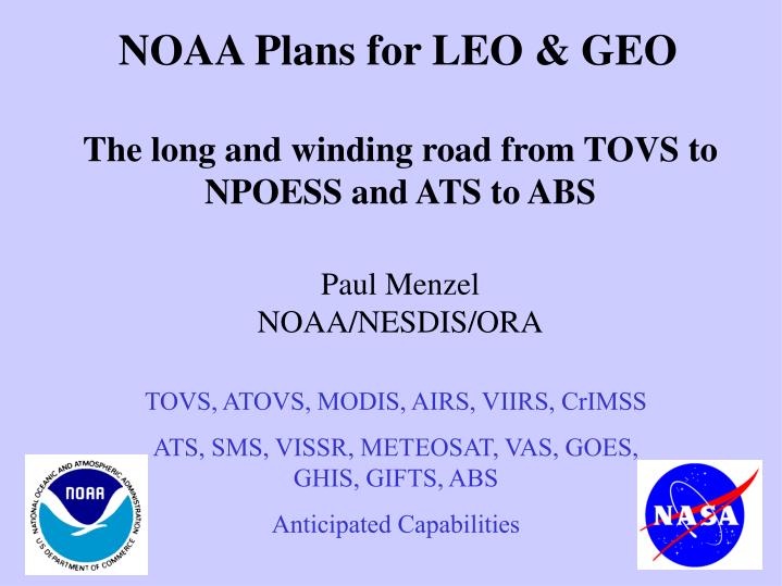
NOAA Plans for LEO & GEO The long and winding road from TOVS to NPOESS and ATS to ABS Paul Menzel NOAA/NESDIS/ORA. TOVS, ATOVS, MODIS, AIRS, VIIRS, CrIMSS ATS, SMS, VISSR, METEOSAT, VAS, GOES, GHIS, GIFTS, ABS Anticipated Capabilities. Long Range Integrated Satellite Transition. 99. 00.

E N D
NOAA Plans for LEO & GEOThe long and winding road from TOVS to NPOESS and ATS to ABSPaul MenzelNOAA/NESDIS/ORA TOVS, ATOVS, MODIS, AIRS, VIIRS, CrIMSS ATS, SMS, VISSR, METEOSAT, VAS, GOES, GHIS, GIFTS, ABS Anticipated Capabilities
Long Range Integrated Satellite Transition 99 00 01 02 03 04 05 06 07 08 09 10 11 12 13 14 15 16 17 18 19 20 21 CY POLAR 0530 NPOESS DMSP WindSat 0730- 1030 NPOESS DMSP METOP POES Local Equatorial Crossing Time Terra Integrated System NPP C2 or C1 NPOESS 1330 POES Aqua GEO GIFTS GOES GOES – R Series GOES GOES – R Series GIFTS/IOMI
AVHRR HIRS SARR POES (K-N`) Instruments
Orbit type (equatorial crossing times) Future Additional Satellites Operator launch date Other information “Morning” (6:00 – 12:00) (18:00 – 24:00) NOAA-M NPOESS-1 NPOESS-4 NOAA NOAA NOAA 6/2002 2010 2015 (9:30) (9:30) Sun-synchr. “Afternoon” (12:00 – 16:00) (00:00 – 04:00) NOAA-N NOAA-N’ NPOESS-2 NPOESS-5 NOAA NOAA NOAA NOAA 6/2004 3/2008 2011 2017 (13.30) (13.30) (13.30) (13.30) “Early morning” ( 4:00 - 6:00) (16:00 – 18:00) DMSP-S16 DMSP-S17 DMSP-S18 DMSP-S19 DMSP-S20 NPOESS-3 NPOESS-6 NOAA NOAA NOAA NOAA NOAA NOAA NOAA 2001 2002 2003 2005 2007 2013 2018 (5:30) (5:30) Planned Leo Launches
New environmental remote sensing capabilities are offering higher spatial resolution more spectral bands higher spectral resolution higher temporal resolution better calibration better science Synergy is increasing between POES and GOES sensors research and operational sensors US and international sensors Opportunities can be realized with new approaches new partnerships early involvement in science teams and associated field programs VIS IR MW active passive land ocean atmosphere weather climate
NPOESS Instruments US 0530US 0930US 1330EUM 0930 VIIRS VIIRS VIIRS CMIS CMIS CMIS CrIS IASI ATMS AMSU/MHS OMPSGOME GPSOS GPSOS GRAS SESS SESS SEM CERES TSIS ALT ASCAT DCS DCS DCS SARSATSARSATSARSAT
VIIRS, MODIS, FY-1C, AVHRR CO2 O2 O3 H2O O2 H2O H2O H2O O2 H2O H2O CO2
VIIRS MODIS Earth emitted spectra overlaid on Planck function envelopes
176 kg 170 W 10.5 Mbps Visible/IR Imaging Radiometer Suite (VIIRS) (Artist Conception) SBRS NPOESS Instruments in Development/Production Phase 87 kg 91 W 1.8 Mbps Cross-track IR Sounder (CrIS) (Engineering Development Unit) ITT 66 kg 85 W 30 kbps 45 kg 45 W 180 kbps Ozone Mapping & Profiler Suite (Artist Conception) Ball Advanced Technology MW Sounder (ATMS) (GSFC Notional Design) Aerojet
NPP PROPOSED INSTRUMENTS FROM IPO VIIRS (VISIBLE INFRARED IMAGER RADIOMETER SUITE) 21 CHANNELS (INCLUDING .4, .5, .6, .7, .8, .9, 1.2 1.4, 1.6, 2.3, 3.7, 8.6, 10.3, 11.0, 12.0 UM) 12 BIT, 0.8 KM RES, VIS CAL, IRW NEDT OF .1 K CRIS (CROSS TRACK IR SOUNDER) INTERFEROMETER COVERING SW (4.0 UM) TO LW (15.4) 1 KM (VERT), ~10 KM (HOR), AND 1 K RES LEVERAGED FROM NASA ATMS (ADVANCED TECHNOLOGY MICROWAVE SOUNDER) COVERING 23, 31, 50, 57, 89, 166, AND 183 GHZ BANDS 10 KM FOV AT 183, S/N AS GOOD AS AMSU IN CRIS FOV, 118 GHZ ALSO BEING EXPLORED
Suggested ATMS Channels Chn(GHz)BW(GHz)Characteristic 1* 23.8 0.27 split window-water vapor 100 mm 2* 31.4 0.18 split window-water vapor 500 mm 3* 50.3 0.18 window-surface emissivity 4 51.76 0.40 window-surface emissivity 5* 52.8 0.40 surface air 6* 53.596±.115 0.17 4 km ~ 700 mb temp and precip 7* 54.4 0.40 9 km ~ 400 mb temp and precip 8* 54.94 0.40 11 km ~ 250 mb 9* 55.5 0.33 13 km ~ 180 mb 10* 57.2903 0.33 17 km ~ 90 mb 11* 57.2903 ±.217 0.078 19 km ~ 50 mb 12* 57.2903 ±.322 ±.048 0.036 25 km ~ 25 mb 13* 57.2903 ±.322 ±.022 0.016 29 km ~ 10 mb 14* 57.2903 ±.322 ±.010 0.008 32 km ~ 6 mb 15* 57.2903 ±.322 ±.004 0.03 37 km ~ 3 mb 16* 89.0 6.0 window-precip and water vapor 150 mm 17 166.31 4.0 H2O 18 mm 18* 183.31±7 2.0 H2O 8 mm 19 183.31±4.5 2.0 H2O 4.5 mm 20* 183.31±3 1.0 H2O 2.5 mm 21 183.31±1.8 1.0 H2O 1.2 mm 22* 183.31±1 0.5 H2O 0.5 mm * In common with AMSU/HSB
GOES Satellites Imager 120 kg 177 W 2.62 Mbps GOES-I Series 2105 kg Sounder 132 kg 178 W 40 kbps GOES-N Series 1615 kg IOO 35 kg 150 W 100 kbps SXI 23 kg 57 W 100 kbps
Sector Future additional satellites operator Planned launch (Planned location) Other remarks E-Pacific (180°W-108°W) and West Atlantic (108°W-36°W) GOES-N GOES-O GIFTS GOES-P GOES-R NOAA NOAA NASA/ NOAA NOAA NOAA 4/2003 2005 2006 2007 2012 135° or 75° W 135° or 75° W 135°,100 °, 75° W, then Indian Ocean 135° or 75° W 135° or 75° W Planned Geo Launches
"Normal people ... believe that if it ain't broke, don't fix it. Engineers/Scientists believe that if it ain't broke, it doesn't have enough features yet."
Advanced Baseline Imager on GOES-R • ABI addresses the NWS Imager concerns by: • - increasing the spatial resolutions • (the NWS goal is 0.5 km for the IR) • - improving temporal sampling • (faster scanning plus more regions scanned) • - adding spectral bands • (enables new and/or improved products) • A view into the future: simulations of improved cloud, moisture, and surface products with ABI.
Simulated ABI (from MODIS)All images are displayed at 2 km resolutions Two visible bands, two near IR and eight IR bands (10.3 not shown)
Simulated GOES (from MODIS)All images are displayed at 2 km resolutions One visible (at a higher resolution) band and four IR bands
Ice On Lake Erie: Visible February 12, 2001 16:27 UTC MODIS 1 km MODIS 0.5 km MODIS 0.25 km 0.25 km data represents possible future (beyond ABI) GOES visible imagery.
MODIS RGB composite shows one application of the 0.47 m on the ABI. UW/CIMSS
Advanced Baseline Sounder on GOES-R *Addresses NWS concerns by improving- temporal resolution: ‘sounding disk’ in 1 hour - vertical resolution 1 km for temp, 2 km for moisture - spatial resolution to 10 km for independent obs * Geo - Interferometer combines several advanced technologies - large focal plane detector arrays - Fourier Transform Spectrometry - on-board data processing. * ABS will provide moisture and cloud information as never before.
Spatial Coverage Areas within 62 degrees local zenith angle from GOES-East and GOES-West sub-satellite points are indicated. Threshold coverage rate calls for the 62 arc region, excluding half of over-lap, to be scanned each hour. Current GOES -E and -W sounder hourly coverage is also shown. UW-Madison/CIMSS
These water vapor weighting functions reflect the radiance sensitivity of the specific channels to a water vapor % change at a specific level (equivalent to dR/dlnq scaled by dlnp). Moisture Weighting Functions Pressure Weighting Function Amplitude Wavenumber (cm-1) UW/CIMSS The advanced sounder has more and sharper weighting functions
(~1600) Geostationary Sounders (# of channels) Advanced Baseline Sounder (operational) (~1600) GIFTS (experimental) (18) GOES Sounder (operational) The ABS is the next logical step from experimental low spectral resolution to finally operational high-spectral resolution sounders. (12) VAS (experimental) time
Long Range Integrated Satellite Transition 99 00 01 02 03 04 05 06 07 08 09 10 11 12 13 14 15 16 17 18 19 20 21 CY POLAR 0530 NPOESS DMSP WindSat 0730- 1030 NPOESS DMSP METOP POES Local Equatorial Crossing Time Terra Integrated System NPP C2 or C1 NPOESS 1330 POES Aqua GEO GIFTS GOES GOES – R Series GOES GOES – R Series GIFTS/IOMI
Summary The satellite remote sensing capability has had many positive consequences: • it has saved thousands of lives and millions of dollars from the ravages of storms; • it has made meteorological satellite data routinely available to nations around the globe; • in conjunction with improvements in numerical weather prediction, it has helped to improve forecast skill significantly; • and as valuable part of GOS it will help discern climate trends. NOAA is investigating the opportunities for further evolving the geostationary and polar orbiting remote sensing capabilities:
Remote sensing of gradients in spectra, space, and time will be better than ever The business of looking down is looking up