Download
1 / 26
270 likes | 296 Vues
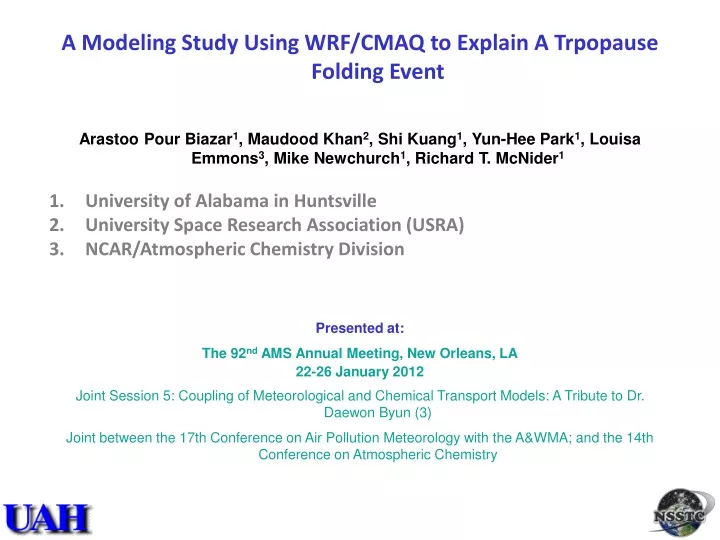
A Modeling Study Using WRF/CMAQ to Explain A Trpopause Folding Event Arastoo Pour Biazar 1 , Maudood Khan 2 , Shi Kuang 1 , Yun-Hee Park 1 , Louisa Emmons 3 , Mike Newchurch 1 , Richard T. McNider 1 University of Alabama in Huntsville University Space Research Association (USRA)

E N D
A Modeling Study Using WRF/CMAQ to Explain A Trpopause Folding Event • Arastoo Pour Biazar1, Maudood Khan2, Shi Kuang1, Yun-Hee Park1, Louisa Emmons3, Mike Newchurch1, Richard T. McNider1 • University of Alabama in Huntsville • University Space Research Association (USRA) • NCAR/Atmospheric Chemistry Division • Presented at: • The 92nd AMS Annual Meeting, New Orleans, LA • 22-26 January 2012 • Joint Session 5: Coupling of Meteorological and Chemical Transport Models: A Tribute to Dr. Daewon Byun (3) • Joint betweenthe 17th Conference on Air Pollution Meteorology with the A&WMA; and the 14th Conference on Atmospheric Chemistry
Motivation Is it possible for ozone rich stratospheric air to reach lower troposphere as far south as Gulf of Mexico? • On November 6, 2010, ozonesonde measurements at Huntsville, Alabama, indicated a strong stable and extremely dry layer of air with high ozone concentration right above the boundary layer from 2-km to 3-km altitude. This lamina had all the characteristics of stratospheric air. • Examination of weather charts indicated the presence of a deep trough over the eastern United States. The weather system started forming on November 4 and became deeper and stronger as it moved over the eastern US. • Examination of GOME total ozone observations for November 5-6 also indicated increased total column ozone along the through, further pointing to a substantial drop in the tropopause height along the trough. • Fortunately, during this period the tropospheric ozone Differential Absorption Lidar (DIAL) at Huntsville, Alabama (co-located with ozonesonde at NSSTC) was partially operating. Lidar provides continuous vertical ozone profile over the site. Lidar measurements also shows an elevated ozone layer for several hours over NSSTC. • Thus the questions needed to be addressed were: • Is the elevated ozone over NSSTC on November 6, 2010, of stratospheric origin and the result of a stratospheric intrusion event (tropopause folding event)? • Will the model (WRF/CMAQ) be able to capture this event and help explaining the STE?
Stratospheric Ozone incursion of November 6, 2010 Ozonesonde profile at Huntsville, Alabama, from November 6, 2010 shows a strong stable and extremely dry layer of air with high ozone concentration right above the boundary layer (from 2- to 3-km). This layer has all the characteristics of stratospheric air. Notice the increase in temperature and ozone mixing ratio (up to 100 ppb) in this layer. High ozone Stable air Extremely dry
Weather charts from Nov. 5-6, 2010, shows a deep trough in the eastern United States Nov. 5 Nov. 6 500 mb SFC
Satellite Observation of Total Ozone also Indicates an Increased Column Ozone Extending to the SE US on Nov. 5
Lidar Ozonesonde profile at 18 GMT on Nov. 7, 2010 Lidar Measurements on November 5-7, 2010 • Huntsville ozone Differential Absorption Lidar (DIAL) makes retrievals from 0.5 to ~10 km above ground level (AGL) during both daytime and nighttime with a typical temporal resolution of 10 min and range resolution of 750 m [Kuang, et al., 2011]. • An iterative aerosol correction is applied to reduce errors arising from differential aerosol backscattering typically encountered below 6 km. • The validation of the lidar measurements using ozonesondes has shown that the uncertainties for a 10-min retrieval are less than 10% below 4 km AGL and less than 20% below 8 km. Generally, signals contaminated by clouds below 3 km are automatically discarded by the software and higher altitude cloud interference is removed manually.
Adapted from EPA, 2006; Shapiro, 1980 Background High ozone, low water vapor • The mechanism for stratosphere-troposphere exchange (STE) and tropopause folding is relatively well understood. • Tropopause folding occurs in areas with large vertical shear and strong meridional thermal gradients Low ozone, high water vapor Tropopause Wind direction Cross section through a tropopause folding event on March 13, 1978 at 0000 GMT. Potential temperatures (K) are represented by thin solid lines. Wind speeds (m s!1) are given by thin dashed lines. The hatched area near the center of the figure indicates the location of the jet stream core. The tropopause defined by a potential vorticity of 100 × 10!7 K mb!1 s!1 is shown as the heavy solid line. The two Sabreliner flight tracks through this cross section are shown as a heavy solid line with filled arrows and heavy dashed line with open arrows. Longitude is shown along the x-axis . Upper air soundings were taken at Vandenberg AFB, CA (VBG); San Diego, CA (SAN); Winnemucca, NV (UCC); and Ely, NV (ELY). Jet stream
Model Configuration WRF CMAQ • Simulation period: November 1 through November 10, 2010. • IC/BC: NCEP GFS FNL analysis (http://dss.ucar.edu/datasets/ds083.2) • Grid: LC projection, center: 47N,90W, parallels: 33N and 45N; top fixed at 50 mb; 148X112X41; 36-km horizontal grid spacing and 41 non-uniform vertical layers. • Radiation SW: Dudhia, LW: RRTM; LSM: NOAH; PBL: YSU; Microphysics: Lin; Convective parameterization: KF • Simulation period: November 1 through November 10, 2010. • IC/BC: MOZART-4 forecast fields (http://www.acd.ucar.edu/acresp/forecast/). • Horizontal and vertical advection: YAMO; Horizontal diffusion: MULTISCALE; Vertical diffusion: ACM2; Gas-phase chemistry and solver: EBI_CB4; Gas and aqueous phase mechanism: CB4_AE3_AQ; Aerosol chemistry: AERO3; Dry deposition: AERO_DEPV2; Cloud dynamics: CLOUD_ACM
Decreased vertical spacing Z < 2 km Z > 8 km
Decreased vertical spacing P > 900 mb P < 300 mb
Nov. 5, 2010, 18:00 GMT 40 N 40 N 35 N 35 N
Nov. 6, 2010, 18:00 GMT 40 N 40 N 35 N 35 N
CMAQ/Lidar Comparison CMAQ filling the gap for the time lidar was down [GMT] Lidar CMAQ
Model Ozone at 3-km Altitude, 0 GMT on Nov. 6, 2010 The event detected at Huntsville was a fragment of the high stratospheric ozone that passed through the Gulf of Mexico region
Model Ozone at 3-km Altitude, 6 GMT on Nov. 6, 2010 The event detected at Huntsville was a fragment of the high stratospheric ozone that passed through the Gulf of Mexico region
Model Ozone at 3-km Altitude, 12 GMT on Nov. 6, 2010 The event detected at Huntsville was a fragment of the high stratospheric ozone that passed through the Gulf of Mexico region
Model Ozone at 3-km Altitude, 18 GMT on Nov. 6, 2010 The event detected at Huntsville was a fragment of the high stratospheric ozone that passed through the Gulf of Mexico region
Ozone Increase Over Background at 5-km Altitude, 12-18 GMT on Nov. 5, 2010 Model simulated ozone shows the extent of the stratospheric incursion on November 5 (at 5-km altitude) that extended to coastal areas of Louisiana, Mississippi, Alabama, and Florida.
Conclusion • Model was able to capture and explain the stratospheric intrusion of November 5-6, 2010. The non-uniform vertical grid spacing proved to be the key in model performance. • The exceptional agreement in ozone profiles between model and lidar measurements indicated that the model was able to reproduce the transport reasonably well. It also meant that the Mozart fields for LBC were reasonable. • Surprisingly, model indicated that the bulk of stratospheric ozone that transported to lower troposphere was over southeastern United States, with the highest concentrations over the Gulf of Mexico
Acknowledgment The findings presented here were accomplished under partial support from NASA Science Mission Directorate Applied Sciences Program. Note the results in this study do not necessarily reflect policy or science positions by the funding agencies.
CMAQ/Lidar Comparison CMAQ filling the gap for the time lidar was down [GMT]