Download
1 / 36
360 likes | 503 Vues
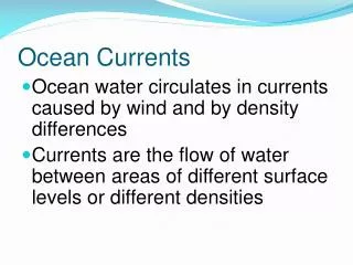
Ocean Currents. Why is Ocean Circulation Important?. Transport nutrients and organisms Influences weather and climate Influences commerce. Density of air. Warm, low density air rises Cool, high density air sinks. 90 o. High pressure, dry climate. 60 o. Low pressure, wet climate.

E N D
Why is Ocean Circulation Important? • Transport nutrients and organisms • Influences weather and climate • Influences commerce
Density of air • Warm, low density air rises • Cool, high density air sinks
90o High pressure, dry climate 60o Low pressure, wet climate High pressure, dry climate 30o ITCZ intertropical convergence zone= doldrums Low pressure, wet climate 0o 30o 60o 90o
The Coriolis effect • The Coriolis effect • Is a result of Earth’s rotation • Causes moving objects to follow curved paths: • In Northern Hemisphere, curvature is to right • In Southern Hemisphere, curvature is to left
Ocean Currents • Surface Currents • The upper 400 meters of the ocean (10%). • Deep Water Currents • Thermal currents (90%)
Wind-Driven and Density-Driven Currents • Wind-driven currents occur in the uppermost 100 m or less
Sailors have know about ocean currents for centuries Sailors have know that “rivers” flow in the seas since ancient times. They used them to shorten voyages, or were delayed by trying to stem them. If navigators do not correct to deflection by currents, they may be far away from where they think they are and meet disaster.
Matthew Fontaine Maury The first systematic study of currents was done by Maury based on logbooks in the US Navy’s Depot of Charts and Instruments. His charts and “Physical Geography of the Sea” assisted navigators worldwide. http://www.npg.si.edu/exh/brady/gallery/97gal.html
Current Gyres • Gyres are large circular-moving loops of water • Five main gyres (one in each ocean basin): • North Pacific • South Pacific • North Atlantic • South Atlantic • Indian • Generally 4 currents in each gyre • Centered about 30o north or south latitude
What do Nike shoes, rubber ducks, and hockey gloves have to do with currents?
Duckie Progress • January 1992 - shipwrecked in the Pacific Ocean, off the coast of China • November 1992 - half had drifted north to the Bering Sea and Alaska; the other half went south to Indonesia and Australia • 1995 to 2000 - spent five years in the Arctic ice floes, slowly working their way through the glaciers2001 - the duckies bobbed over the place where the Titanic had sunk • 2003 - they were predicted to begin washing up onshore in New England, but only one was spotted in Maine • 2007 - a couple duckies and frogs were found on the beaches of Scotland and southwest England.
2004-2007 Barber’s Point
North Pacific Subtropical Gyre • “Great Pacific Garbage Patch” • Estimate: 46,000 pieces of floating garbage/mi2.
North Pacific Subtropical Gyre 135° to 155°W and 35° to 42°N
North Pacific Subtropical Gyre Great Pacific Garbage Patch- Good Morning America 2010 http://www.youtube.com/watch?v=uLrVCI4N67M&feature=player_embedded http://marinedebris.noaa.gov/info/patch.html#6
Upwelling and downwelling Vertical movement of water () • Upwelling = movement of deep water to surface • Hoists cold, nutrient-rich water to surface • Produces high productivities and abundant marine life • Downwelling = movement of surface water down • Moves warm, nutrient-depleted surface water down • Not associated with high productivities or abundant marine life
El Niño • El Niño = warm surface current in equatorial eastern Pacific that occurs periodically around Christmastime
El Niño • Oceanic and atmospheric phenomenon in the Pacific Ocean • Occurs during December • 2 to 7 year cycle • Sea Surface Temperature • Atmospheric Winds • Upwelling
Non El Niño El Niño 1997
Non El Niño upwelling El Niño thermocline
Surface and Deep-Sea Current Interactions Unifying concept: “Global Ocean Conveyor Belt” http://seis.natsci.csulb.edu/rbehl/ConvBelt.htm
Matter Transport and Surface Currents • Currents also involved with gas exchanges, especially O2 and CO2 • Nutrient exchanges important within surface waters (including outflow from continents) and deeper waters (upwelling and downwelling) • Pollution dispersal • Impact on fisheries and other resources
Thermohaline Circulation Global ocean circulation that is driven by differences in the density of the sea water which is controlled by temperature and salinity.
Thermohaline Circulation White sections represent warm surface currents. Purple sections represent deep cold currents
Thermohaline Circulation What effect does global warming play in thermohaline circulation? http://www.youtube.com/v/MZbsMlr9WRI?version=3
Thermohaline Circulation 1 2 3 4 Atmospheric and ocean temp Subtropical evaporation High latitude precipitation & runoff CO2 fossil fuel combustion North Atlantic regional cooling Deep water formation & thermohaline circulation Nordic seas salinity & deep convection Potential feedback of increased tropical salinity 6 5 Global climate interconnections
Conclusion • What is a convection cell? • Which direction do currents get deflected in the Southern Hemisphere? • What depth should the water be for an Ekman spiral to occur? • How are surface currents created? • What is a gyre? • How can an El Nino impact upwelling? • Coriolis Effect is strongest near the _____?