Download
1 / 12
120 likes | 126 Vues
Setting up and Using Collector for ArcGIS Vancouver GIS Users Group 2016 October 12 th Chen-Ting Wang. Background. Paper maps and notes + GPS unit + 3 ESRI app are available on City phones (keyword: cnwgis) Explorer for ArcGIS Collector for ArcGIS ArcGIS (retired late 2015 Aug)

E N D
Setting up and Using Collector for ArcGIS Vancouver GIS Users Group 2016 October 12th Chen-Ting Wang
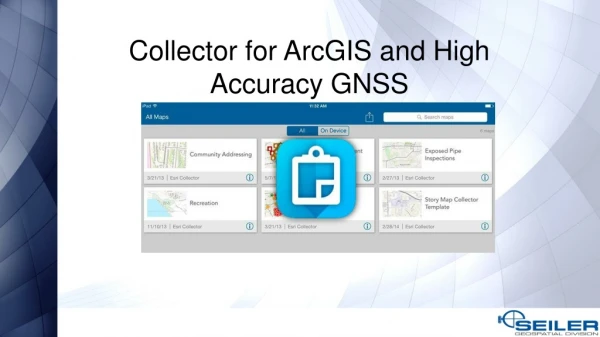
Background Paper maps and notes + GPS unit + 3 ESRI app are available on City phones (keyword: cnwgis) Explorer for ArcGIS Collector for ArcGIS ArcGIS (retired late 2015 Aug) + Using Collector for ArcGIS on our first app
Public Garbage Container (PGC) – Set up Objective: Identify the locations of different types of garbage containers Point Feature class using subtypes and domain w/ photo attachments
ArcGIS online web map: • Add the service • Add a background • Configure fields display and/or edit PGC – ArcMap -> ArcGIS Online Web Map 99.9% ArcMap: Set up feature templates Publish a service w. mapping and feature access capabilities
Sidewalk Maintenance Existing data Polygons and points Requirements Record current sidewalk conditions and trip locations View photos Keep history
Sidewalk Maintenance – Set Up Stand Alone Sidewalk Polygon Sidewalk Rating Polygon Trips Location Point Relationship Class Sidewalk Polygon Feature class Rating Table Trips Location Point w/ domain w/ photo attachments
Two services Mapping (display) • Trips - fixed or not; level 1 or 2 • Ratings - 2016 only Feature access (edit) • Sidewalk polygon • Rating table • Trip point Sidewalk Maintenance
What we’ve learned Data structure and field ordering; future use Global ID Domain & Subtypes Min. number of layers/fields for updating Symbology Test & feedback Benefit Real time update Data can be used right away for analysis and report Help improving public safety Easy to set up Easy to use Multiple users Inspection
Other use Examples from ESRI e.g. Damage assessment survey Recreation Trial Organization Account Valid for 60 days
Thank You! Thank you & Thanks Doug for organizing the event Thanks Geological Survey of Canada for providing the space Any questions? Chen-Ting Wang ctwang@newwestcity.ca