Download
1 / 32
320 likes | 326 Vues
Collector for ArcGIS and High Accuracy GNSS. Senior Mapping Tech Support and Trimble Certified MGIS Trainer : Jay Riester Trimble Mapping Sales Representative : Mike DeMory. Today’s agend a. Collector for ArcGIS Trimble GNSS Receivers

E N D
Senior Mapping Tech Support and Trimble Certified MGIS Trainer: Jay Riester Trimble Mapping Sales Representative: Mike DeMory
Today’s agenda • Collector for ArcGIS • Trimble GNSS Receivers • How ArcGIS Collector handles metadata associated with data collection
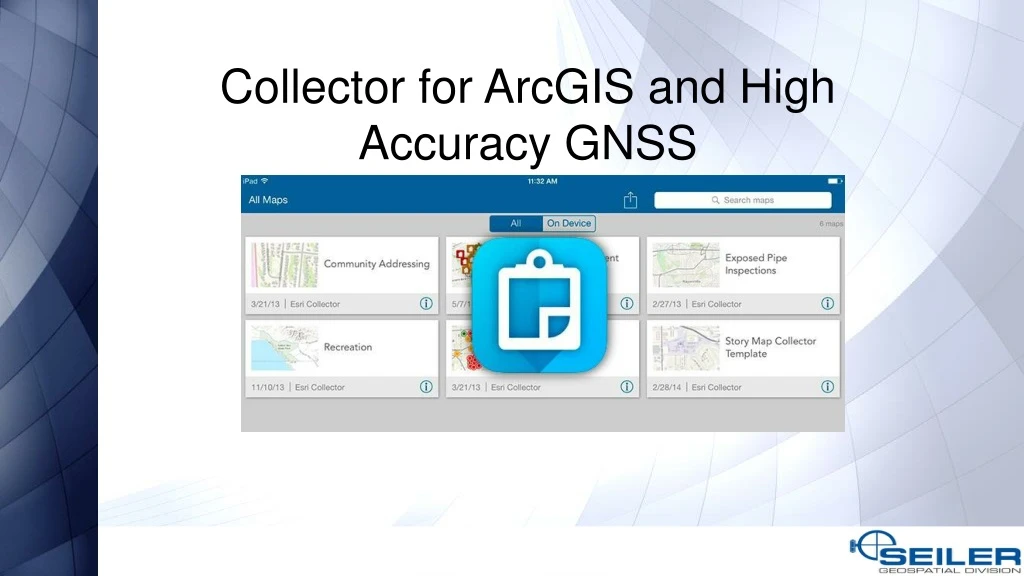
What is ESRI Collector? • A smart device application used in the field to collect and update spatial data • Map Centric App • Puts mapping in the hands of field workers to improve the accuracy of your spatial data • Use your smartphone or tablet to collect in real time or disconnected
Uses for Collector • Track emergency vehicles during the Boston Marathon • Manage large events such as NASCAR, Super Bowl and Olympics • Emergency Management • Disaster Relief • Inventory and Inspections: • Utilities • Signs • Public works • Trees • Environmental • Many more….
ESRI Collector for ArcGIS • Simple toolbar • Common smart device zoom and pan methods • Swipe • Pinch to zoom and Expand • ESRI Background Maps
ESRI Collector for ArcGIS • System Requirements: • Android 4.2 or later • iOS 8 or later • Windows 10
ArcGIS Online Account Requirements • Level 2 Member • Can view, create, and share content • Portal for ArcGIS 10.4.1 is supported
Limitations with Consumer-Grade Smart Devices • Availability (network) • Accuracy level • Assisted GPS (A-GPS) • ~ 5-8 m • Wi-Fi Positioning • ~ 74 m • Cellular Network Positioning • ~ 600 m
A Comparison: Mapping-Grade GNSS Devices vs. Consumer-Grade Smart Devices
What are my options? • Bad Elf GNSS Surveyor, GPS Pro, and GPS Pro+ • Dual XGPS150A and XGPS160 • Eos Arrow Lite, Arrow 100, Arrow 200, and Arrow Gold • Garmin GLO¹ • GeneqSxBlue II and SxBlue III² • Juniper Geode • Leica GG03¹, GG04, and Zeno 20¹ • Septentrio Altus NR2 and Altus GeoPod² • Spectra Precision SP60¹ and MobileMapper300¹ • Trimble Catalyst • Trimble R1, R2, R8s¹, and R10¹
R1 GNSS Receiver • New Firmware: 5.09 • Fixed an issue where the receiver would crash after applying a firmware update • Add SV123 to EGNOS SV list (This does not pertain to the United States, but for the SBAS configuration in Europe) • Receiver is now discoverable over Bluetooth whenever it is switched on AND it is not connected to another device http://www.trimble.com/globalTRL.asp?nav=Collection-109385
R2 GNSS Receiver • New Firmware: 5.34 • WebUI invalid login email alert not working • Update is done via Trimble Installation Manager • See January 23, 2018 Seiler Blog that has a YouTube video on how to update. http://www.trimble.com/globalTRLTAB.asp?nav=Collection-115212
a software GNSS receiver and subscription service that runs on Android smartphones and tablets a small, lightweight antenna for quality GNSS signal reception Trimble or 3rd Party apps that use the Catalyst position Catalyst Solution Trimble Catalyst is a solution that includes:
Catalyst Solution Software GNSS Technology A software GNSS receiver allows for users to access a range of GNSS accuracy levels on their mobile device, from 1 meter to a few centimeters, on-demand. Many applications need higher precision than a phone or tablet’s internal GNSS solution can provide, but they don’t need it all the time or can’t justify an up front capital investment. Catalyst is available as a subscription to meet this type of demand.
Catalyst Solution DA1 Digital Antenna High accuracy GNSS needs to have high quality signal reception from GNSS constellations. Trimble created the DA1 digital antenna to plug directly into Android phones and Tablets to achieve this, while remaining lightweight and compact enough to fit into a backpack or vehicle glove box. Catalyst Website
Catalyst Solution Subscription Accuracy Levels
Customer Story – Collector & Catalyst • City of Centennial, CO and CH2M
GNSS Metadata • Besides geographic coordinates, you might also want to save other GPS metadata associated with a feature such as its accuracy and fix type • This metadata can be valuable to assess data quality and ensure data collection standards have been maintained • You can add GPS metadata fields to a point feature service so Collector can write GPS metadata to the respective fields when editing point features.
Publish a Map with GNSS Metadata • Configuring your Geodatabase to store GNSS metadata -Manually via ArcCatolog • Collector Toolbox • Script and • Or inside of ArcGIS Online.
Things to keep in mind • GPS metadata fields are populated on point layers only. • If a point feature is created or updated by long pressing the map instead of using GPS, the GPS metadata fields are cleared. • If a point feature is created or updated and GPS metadata information is not available for the GPS position, the GPS metadata fields are cleared. • GNSS Meta data can be created “Manually”, Collector Toolbox, Script and or inside of ArcGIS Online.
The Aurora Project • Better maps • Support for vector basemaps • Improved user experience • Better layout and easier to capture accurate data locations • Smarter Forms • Conditional logic, grouping, and ordering of attributes • Enhancements to High Accuracy 3D Data Collection • Vertical Datum Transformations • Aurora Project website
Contact Information Senior Mapping Tech Support and Trimble Certified MGIS Trainer: • Jay Riester – 314-302-9401 jriester@seilerinst.com Trimble Mapping Sales Representative: Mike DeMory – 317-690-8107 mdemory@seilerinst.com
Blog: https://www.seilergeo.com/blogs/or Email: mapping@seilerinst.comSt. Louis ● Kansas City ● Milwaukee ● Indianapolis ● Iowa ● Chicago