Download
1 / 68
730 likes | 1.05k Vues
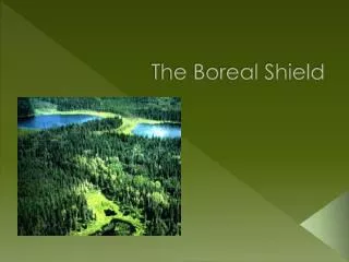
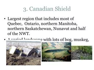
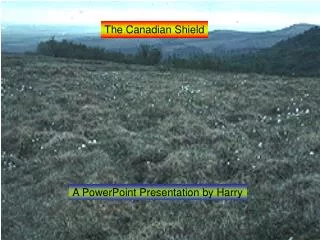
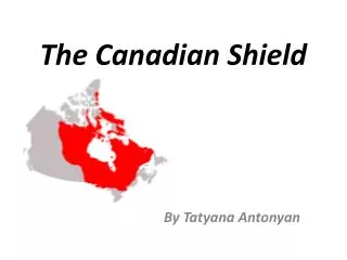
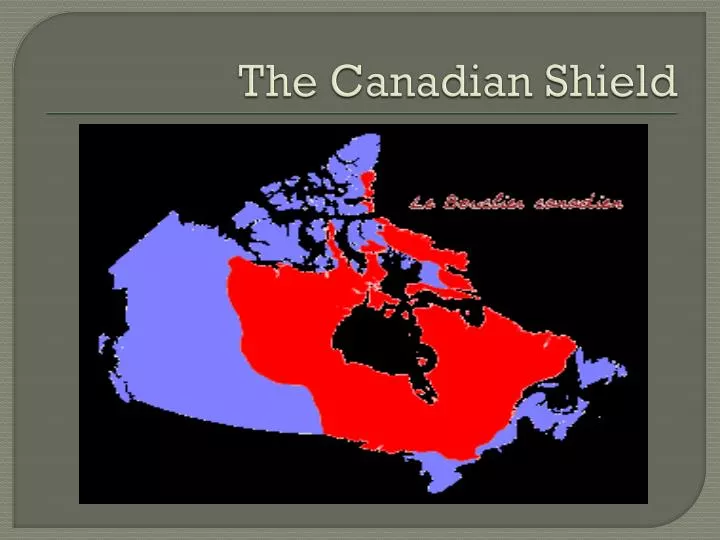
The Canadian Shield. The Canadian Shield. The geographic foundation of Canada Covers more than half of the Canadian Territory

E N D
The Canadian Shield • The geographicfoundation of Canada • Covers more thanhalf of the Canadian Territory • It spansacross 3 provinces (Alberta, Saskatchewan, Manitoba, Ontario, Québec, and Newfoundland and Labrador and 2 territories (Northwest Territories and Nunavut). • During the PrecambrianEra, the Canadian Shieldwas the only part thatexisted.
Why do we call it a shield? • The invertedform looks like a combat shield!
What types of rocks form the Canadian Shield? • Igneus and metamorphic rocks • Contain a large quantity of minerals • BUT, do not containcarbon, petroleum and naturalgas. Why? Where do theseminerals come from? • Becauselifeformsthatproducedthesemineralsdidn’texist in thisera!
Minerals in the Shield • The shieldisoftencalled the Canadian metalicreserve* • How are depositsfrommineralsformed?
Mineral Deposits Minerals were deposited in high concentrations when forced deep into cracks in surrounding rocks mining When minerals cool, they separate into layers according to their density. -lighter ones on top of the heavier ones * Ontario, Manitoba and Yukon are mining provinces.
Water in the Canadian Shield • The action of the glaciers affected the drainage of the Canadian Shield. • The scraping and gouging action of the ice (glaciers) createdgreatdepressions in the bedrocks. • Today the shieldiscovered by a thin layer of soil, and bedrockis visible.
The influence of Water • If the Shieldis made up of rocks, and Ontario and Quebec have greatlakes, how come the water does not go through? • The rocks are impervious, so water does not passthrough.
The influence of water • Glaciers depositedsand, gravel, and claywhichcreateddams for rivers and forcedthem to flow in different directions. • Rivers and swamps= breeding area for blackflies and mosquitoes
Activities in the Shield • What types of activity do you think we could do with the landscape of the shield? • Canoe, fish, hunt, camp.
Water Wealth An excellent source of water-energy Hydroelectric plants werebuiltwhere the rivers of the Shield flow towardsit’s center Hudson Bay The energyproduced by these stations istransmitted by power lines to cities and towns on and off the Shield
Your turn! Pg 105, # 7
The Lowlands • 3 lowland regions surround the Canadian Shield • Interior Plains • Lowlands of St Lawrence and Great Lakes • Hudson Bay and Arctic Lowlands
Formation Eroded sediments from the Canadian Shield form the sedimentary rocks in the lowlands*
Lowlands • Region= Spans from the Arctic ocean to the Gulf of Mexico • In the past, the plains included coral reef! • Coral reef= organisms responsible for the release of petroleum deposits • What resource do we get from this? • Oil!
Interior Plains • Today, coralreefisfoundunder the earth • It containsgas and petroleum, mostlyfound in Alberta and Saskatchewan • minerals= potashisextractedfrommineralsleft over by the sea (once evaporated) • Potash= used for fertilization, agriculture*
Interior Plains • Formation= 1) erosion of softersedimentary rocks • Softer rocks thaterodefaster= differentialerosion • Differentialerosion 3 elevationlevels in the prairies • The seperation of eachlevel= escarpement*
The interior Plains • Formation= 2) glaciation • Once melted, the glacial water formed lakes. • Le ground rose water flows towards ocean
Great Lakes- St. Lawrence Lowlands“Canada’s industrial and urban heartland”
Great Lakes- St. Lawrence Lowlands • Region= spans from the USA, close to Kingston, Ontario (Great Lakes), until the Atlantic Ocean (St-Laurent) • Made up of what type of rocks? • A foundation of sedimentary rocks
Great Lakes Lowlands Formation= glaciation created a rolling landscape Glaciers carried huge amounts of material (soil, sand, and gravel) from Canadian shield and dumped them throughout this region.
Great Lakes • Description: • Flat plains with glacial hills and deep river valleys. • Located in basins that were gouged out by glaciers. • Lakes used to be much bigger, over time they shrank as meltwaterdrained into ocean.
St Lawrence Lowlands • formation= a rift valley was formed by faulting • Faulting: movement along a crack (fault) or crack’s in earth’s crust
Great Lakes/ St Lawrence Lowlands • 14% of Canadian land • 50% population • 70% industry • Why? • Well-suited for agriculture because of excellent soil and warm climate*
Hudson Bay Lowlands “swamp” Known for it’s swampy forests formation= a layer of sedimentary rock resting on top of the ancient rock of the Canadian shield. * Canadian Shield= rock Lowlands=swamps
Arctic Lowlands • Made up of a series of islands, gently rolling landscape • Harsh climate= doesn’t permit farming, ground is frozen • islands= made up of sedimentary rocks containing lignite (a form of coal), oil and natural gas deposits. • Why no mines? • Too expensive for the equipment to break through ground!
Add to your maps! Add the lowland regions on your map!
Homework Define the terms in Ch 11 Pg 110, pg 1-4 Color this new region on your map of Canada
The highland mountains • Region-are found in the est, north, and westregions of the Canadian Shield and the lowlands* • Appalachians, Inuitians and the Western Cordillera
Appalachians Region- spansfrom Georgia (South of USA) to the north of Newfoundland (in the maritimes). Oldesthighlandmountains in Canada
Appalachians • Formation- • During the formation of Pangaea, NorthAmerica, Europe et NorthAfricacollided • The result – sedimentary rock layerswereuoplifted and folded. • EROSION has reduced the Appalachians, which were once jagged peaks • What type of EROSION? • Glaciation!
Appalachians Description: Rolling Hills, plateau, hills and mountains separated by wide glacial valleys.
Appalachians • Layers of sedimentary rocks= rich in non-metallic minerals • Ex) coal • The Plateaus contain metallic minerals • Iron and zinc
Appalachians • «drownedcoastline » pg 112 • Former river valleys that were drowned by rising sea levels from deep, irregular inlets.
Innuitians mountains • Formation-Shaped in the middle of the Mesozoicerawhen the North American plate movedNorthward. • Containsigneus and metamorphic rock, but primarily SEDIMENTARY rock. • No vegetationcan survive • Rigid, cold climate • Too young, not much erosion has taken place*