Download
1 / 26
260 likes | 458 Vues
Physical Georgia. Geography of our state. Georgia-What do you KNOW?. Georgia. Where We Are. Georgia’s Location. We are in the Northern and Western Hemispheres. Our continent is North America. Our country is the United States. Our region is the Southeast. Absolute and Relative.

E N D
Physical Georgia Geography of our state
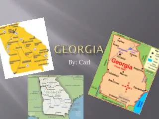
Georgia-What do you KNOW? Georgia
Georgia’s Location • We are in the Northern and Western Hemispheres. • Our continent is North America. • Our country is the United States. • Our region is the Southeast.
Absolute and Relative • Absolute location shows exactly where something is found. • Ex: Georgia’s coordinates are 32 N latitude and 83 W longitude. • Relative location shows where something is in relation to something else. • Ex: Georgia is North of Florida
The Appalachian Plateau • Smallest physiographic region. • Lookout Mountain and Chickamauga. • Land used for hardwood forest and pasture.
Valley and Ridge • Rich soil in valleys grows fruits, grains and vegetables. • Known for textile and carpet manufacturing.
The Blue Ridge Mountains • A Part of Appalachian Mountains. • Brings tourism and timber products. • Appalachian Trail-Starts in Georgia and ends in Maine. • Brasstown Bald-Georgia’s highest mountain at 4786 ft.
The Coastal Plain • Once covered by ocean. • Largest physiographic region. • Lower Coastal Plain- Poor soils for agriculture. • Upper Coastal Plain-Rich soils for agriculture- (cotton, soybeans, and peanuts)
The Piedmont • Means “at the foot of the mountains.” • Where almost half the population lives. • Major Cities: Atlanta, Columbus, Athens, Augusta. • Characterized by rolling hills. • Granite and marble are mined.
Terms to Know • Region • Fall Line • Aquifer • Climate • Weather • Drought • Precipitation • Barrier Island Use your BYLD Device to look up these terms. Some students may use the computers.
The Fall Line • The Fall Line separates coastal plain and piedmont. • Many waterfalls along rivers of coastal plain. • Numerous cities such as Augusta , Macon and Columbus grew up where rivers crossed it and boats could no longer navigate. • Kaolin, a whiteclay used in paints and porcelain is found there.
Five Regions QuizNumber a lined piece of paper from 1-10 and answer each question using True or False (not T or F) • The Piedmont is the largest physiographic region in Georgia. • The upper Coastal Plain has rich soils for agriculture. • Most of Georgia’s major cities are found in the Coastal Plain. • The Appalachian Trail begins in the Blue Ridge Mountains. • The Appalachian Plateau includes Lookout Mountain. • Brasstown Bald is the highest point in the state of Georgia. • Marble and granite are mined in the Valley and Ridge region. • Atlanta is located in the Piedmont region. • Carpet manufacturing is important in the Coastal Plain region • Georgia is located on the continent of South America.
Chattahoochee River • Important for drinking water, recreation, and hydroelectric power. • Powered mills during Civil War era. • Water rights are disputed between Georgia, Alabama and Florida
Savannah River • Boundary between South Carolina and Georgia. • Savannah is one of the nation’s busiest ports. • Important for drinking water, recreation, and hydroelectric power.
St. Mary’s River • Forms the southern border between Georgia and Florida.
Okefenokee Swamp • Okefenokee means “land of the trembling earth” • Largest swamp in North America covers 700 square miles of Southeast Georgia. • It is a National Wildlife Refuge that protects a unique and healthy ecosystem.
Barrier Islands • Form a barrier between the mainland and the ocean. • Protect the coast from major storms like hurricanes. • Tourists come to the many resorts and beaches.
Climate in Georgia • Mild climate-Cool winters and warm summers. • Coastal Plain and Piedmont are more humid and tropical. • Blue Ridge Mountains are cooler and get the most rain. • Rainiest season is summer.
Impact of Climate on Georgia • Climate-Average weather condition over long period of time. • Mild climate encourages year round agriculture such as cotton, forestry and chickens. • Mild climate brings major tourism to the state.