Download
1 / 12
170 likes | 324 Vues
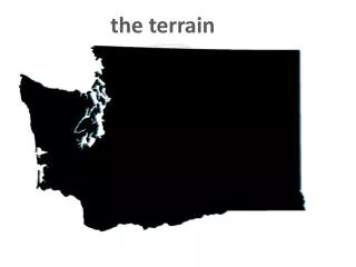
Terrain Representation Workshop. Introduction. Focus of the workshop. Concepts and techniques involved in creating mono- and multicolor cartographic displays of the terrain as seen in plan view. Content of the workshop. Sources of DEM data used to create terrain representations

E N D
Terrain Representation Workshop Introduction
Focus of the workshop • Concepts and techniques involved in creating mono- and multicolor cartographic displays of the terrain as seen in plan view
Content of the workshop • Sources of DEM data used to create terrain representations • Transforming raw data onto a map projection surface through raster resampling • Principles behind analytical hillshading • Hypsometric tinting schemes • How to combine tinting with hillshading • Advanced hillshading and layer tinting techniques • Creating an appropriate legend for your map • Outputting and printing the maps
Resources • Materials to teach about terrain representation • A one-day workshop on or teach yourself • Lectures • Exercises • Data • Styles • Available on mappingcenter.esri.com
Agenda • DEM Data Sources • Datum Transformations • Raster Resampling • Hillshading and Layer Tinting • Advanced Hillshading Techniques • Modifications to Layer Tints • Terrain Representation Legends • Bump Mapping • Printing and Outputting • Conclusion
Final Project • We would like you to create a final project map that combines what you learned in the workshop with a topic of special interest to you • Use data that you now know you can download • Use Swiss hillshading – combine it with MDOW if appropriate • Add an appropriate layer tint • Create a legend for your map • Add a title, your name and text describing the data sources
Detailed agenda - 1 • LECTURE: Introduction (TerrainRep_2008_Introduction.ppt) • Introduction to the workshop • DEMO: SPATIAL ANALYST • EXERCISE: Enabling the Spatial Analyst Extension (TerrainRep_2008_SpatialAnalyst.doc) • LECTURE: DEM Data Sources (TerrainRep_2008_DEMDataSources.ppt) • Data • Sources for DEMs • Structure of DEMs • Linear units vs. angular units • Raster data other than elevation • Discrete raster data (land cover) • EXERCISE: Working with Etopo2 Data (TerrainRep_2008_Etopo2Data.doc)
Detailed agenda - 2 • LECTURE: Datum Transformations (TerrainRep_2008_DatumTransformations.ppt) • NAD 83 Adjustment of NAD 27 • Latitude, Longitude on Topographic Maps • Latitude, Longitude Shifts in Arc Seconds • UTM or State Plane NAD27 to NAD83 Grid Conversion • LECTURE: Raster Resampling (TerrainRep_2008_RasterResampling.ppt) • DEM manipulation • Datum Transformation • Raster Resampling with Nearest Neighbor • Map Projection • Display with Bilinear Interpolation • EXERCISE: Projecting the Etopo2 Data (TerrainRep_2008_ProjectEtopo2Data.doc)
Detailed agenda - 3 • LECTURE: Hillshading and Layer Tinting (TerrainRep_2008_HillshadingAndLayerTinting.ppt) • Hillshading • Mathematical method • Azimuth (image inversion), altitude (with examples), shadows • Contrast stretching (standard deviation stretch) • Layer tinting • EXERCISE: Creating a Hillshade (TerrainRep_2008_CreateAHillshade.doc) • EXERCISE: Contrast Stretching a Hillshade (TerrainRep_2008_ ContrastStretchAHillshade.doc) • EXERCISE: Setting the Display Resampling Method (TerrainRep_2008_ DisplayResampling.doc) • EXERCISE: Layer Tinting the Hillshade Using Classified Values (TerrainRep_2008_LayerTintTheHillshade.doc) • EXERCISE: Displaying the Layer Tint Over the Hillshade (TerrainRep_2008_ DisplayTheLayerAndHillshade.doc)
Detailed agenda – 4 • LECTURE: Advanced Hillshading Techniques (TerrainRep_2008_.ppt) • Swiss Hillshade • MDOW Hillshade • Blue-yellow Hillshade • EXERCISE: Creating a Swiss Hillshade (TerrainRep_2008_CreateSwissHillshade.doc) • EXERCISE: Displaying a Swiss Hillshade (TerrainRep_2008_DisplaySwissHillshade.doc) • EXERCISE: Modifying the color ramps (TerrainRep_2008_ModifyColorRamps.doc) • EXERCISE: Creating an MDOW Hillshade (TerrainRep_2008_MDOWHillshade.doc) • EXERCISE: Combining the Swiss & MDOW Hillshades (TerrainRep_2008_CombineTheHillshades.doc) • EXERCISE: Symbolizing the Crater Lake Bathymetry (TerrainRep_2008_ SymbolizeTheBathymetry.doc) • EXERCISE: Creating a Blue-Yellow Hillshade (TerrainRep_2008_CreateABlue-YellowHillshade.doc)
Detailed agenda - 5 • LECTURE: Terrain Representation Legends (TerrainRep_2008_TerrainRepresentationLegends.ppt) • EXERCISE: Create a Terrain Representation Legend (TerrainRep_2008_TerrainRepresentationLegend.doc) • LECTURE: Bump Mapping (TerrainRep_2008_BumpMapping.ppt) • Bump Mapping • What it is & why to use it • How you do it • EXERCISE: Create a Bump Map (TerrainRep_2008_BumpMap.doc) • LECTURE: Printing and Outputting (TerrainRep_2008_PrintingAndOutputting.ppt) • Printing and Output • JPG or TIF with a world file • Flattening the rasters • EXERCISE: Flatten the Rasters (TerrainRep_2008_FlattenTheRasters.doc) • EXERCISE: Finish Your Map (TerrainRep_2008_FinishYourMap.doc)