Download
1 / 24
240 likes | 445 Vues
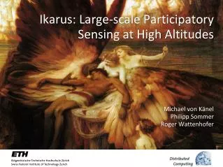
Ikarus : Large-scale Participatory Sensing at High Altitudes. Michael von Känel Philipp Sommer Roger Wattenhofer. Mobile Phones. Over 5 billion mobile phones worldwide ( 72.6% of world population) Smartphones account for 19% of sales in 2010. Phones as a Platform for Mobile Sensing.

E N D
Ikarus: Large-scale Participatory Sensing at High Altitudes Michael von KänelPhilipp Sommer Roger Wattenhofer
Mobile Phones • Over 5 billion mobile phones worldwide (72.6% of world population) • Smartphones account for 19% of sales in 2010
Phones as a Platform for Mobile Sensing • Smartphones have already many integrated sensors: • Camera • Microphone • GPS • Compass • Accelerometers • Gyroscope • Proximity sensor • Near-field communication
People-centric Sensing Applications • Sense your environment: • Air quality/pollution • Traffic congestion • Identify patterns in your behavior: • Heart rate/stress level • Personal fitness
From Sensor Networks to Participatory Sensing • Collection and analysis of sensor measurements Wireless Sensor Network Participatory Sensing
The Participatory Sensing Loop • How can participatory sensing be sucessful? • We identify three key challenges: • Incentives for participation • Ability to deal with faulty data • Concise data representation 2. 3. 1.
Related Work: Mobile Sensing Projects • Most former projects are only small scale CenceMe Biketastic 12 users 22 users BikeNet 5 users
The Ikarus System • Goal: • Use GPS flight records from paraglider pilots to generate maps of thermal active areas (hotspots) • Data provided by 2,331 unique users in Switzerland (2003-2009) • 30,000 flight tracks analyzed, several GByte of data processed
A Short Introduction to Paragliding • Recreational flying sport Flying... ... and Landing Launching...
A Short Introduction to Paragliding (2) Cloud Base Thermal band Breakoff point
Sensing Flights • Flight navigation devices used by paraglider pilots • Records time, GPS position • Accurate height measured by barometric pressure • Variometer reports climb rate • Data Integrity • Tracks are signed by the device Cheating is very hard!
Participation Incentives • How can we make pilots to share their recorded tracks? • Pilots share recorded flights on community websites • Tell friends about their flights (social networks) • Paragliding contests • Credits awarded fordistance or shape ofthe track (triangle)
Data Processing: Finding Thermal Columns Philipp Sommer, ETH Zurich @ HotMobile‘11
Data Quality • Hardware challenges of participatory sensing: • Sensor device is owned by the user • Different hardware • Bad calibration (time, altitude) Only 81.1% of all tracks could be used
Data Quality: Example • Pilot forgot to calibrate alititude before launch
Problem: Flight Distribution • Flight tracks are distributed very unequally Goms Valley, Switzerland, all flights from 2003-2010, 80 x 50 km
Solution: Probability based Thermal Maps • Assign an uncertainty value to each thermal trigger point
Closing the Loop • Feedback to users is crucial in participatory sensing • Increase awareness for data quality (calibration) • Encourage pilots to upload their flights
Feedback to pilots: Thermal maps • Thermal maps for flight preparation Google Maps Google Earth Website: http://thermik.kk7.ch
Feedback to pilots: Hotspots • Import thermal hotspots on the flight navigation device • XML file with coordinates of strong thermal uplift • Recommendation system during flights • Find good thermals in your area • Explore new areas • Future devices will likely include 3Gconnectivity • Get live feedback from other pilots?
Evaluation: Ikarus vs. TherMap • Comparison with a physical simulation of thermal uplift
Conclusions • Ikarus: Large scale participatory sensing with 2331 users • First thermal maps based on GPS flight logs