Download
1 / 19
190 likes | 194 Vues
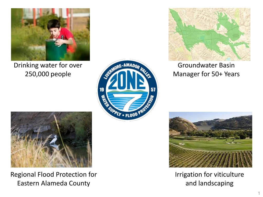
Zone 7 is a regional flood control and water conservation district providing drinking water, flood protection, and irrigation supplies for over 250,000 residents and businesses in Eastern Alameda County. They manage a groundwater basin and import water from the State Water Project to meet the region's demands.

E N D
Drinking water for over 250,000 people Groundwater Basin Manager for 50+ Years Regional Flood Protection for Eastern Alameda County Irrigation for viticulture and landscaping
Alameda County Flood Control & Water Conservation District 7 San Francisco Bay
What is Zone 7? • Flood protection for Eastern Alameda County (425 square miles) • State Water Project Contractor, importing an average of 48,000 acre feet annually to Valley; remaining demands (averaging 15%) met with local supplies • Treated water wholesaler (45,000 AFA) for over 240,000 residents and businesses served by: • City of Livermore • California Water Service Company (portion of Livermore) • City of Pleasanton • Dublin San Ramon Services District (including Dougherty Valley under special agreement) • Untreated water supplier (5,000 AFA) for: • 74 agricultural & irrigation customers (3,500 acres) • Primarily vineyards • Local wine industry estimated at $200 million/year • Sustainable Groundwater Management Agency (SGMA) • 250,000 AF underground basin with 126,000 AF operational storage
Dougherty Valley (hatched area) served with an out- of-service area agreement with DSRSD.
Drinking Water Supply • In any given year, Zone 7 meets demands (avg. 40,000 AF) using incoming supplies and water from storage. • Normalyears:Demands are met through a combination of imported supplies (Table A, SWP carryover, Yuba Accord and BBID), local surface water, and groundwater (primarily for peak demands). • Dry years:Water from the Kern County groundwater banks, dry year transfers, and Yuba Accord supplement supplies; additional groundwater is also pumped locally. Stored water in the form of SWP Carryover and Lake Del Valle storage are also used to supplement dry year supplies. • INCOMING SUPPLIES • Imported Supplies: • SWP – Table A: Table A amount of 80,619 AF, average of 50,000 AF per year; additional minor amounts available from Article 21 (surplus), and Turnback Pool; Yuba Accord water is also available during dry years • Dry Year Transfers: As needed, when available • BBID: In 1999, the Agency executed an agreement with the Byron-Bethany Irrigation District (BBID) to purchase up to 5,000 AF of water per year (pre-1914 water rights), with a minimum of 2,000 AF per year, when available • Local Surface Water: • Arroyo Valle: Runoff during the year captured in Lake Del Valle, average of 7,300 AF per year • SUPPLIES IN STORAGE • SWP Carryover: Typically target 7,000-10,000 AF; as of end of 2017: 10,100 AF (unused Table A) • Lake Del Valle: Storage varies depending on hydrology up to about 7,500 AF; as of end of 2017: 5,600 AF; DWR owns the lake; storage capacity shared by all SBA contractors; nearly half of capacity reserved for flood control • Main GW Basin: Water artificially recharged by the Agency into local groundwater basin using imported and local supplies with total capacity of 254,000 AF; emergency storage capacity: 128,000 AF; operational storage capacity: 126,000 AF; storage as of end of 2017: 246,000 AF • Kern County Groundwater Banks:Agreements with Semitropic Water Storage District and Cawelo Water District provide 198,000 acre-feet of storage capacity; storage as of end of 2017: 104,100 AF
Zone 7’s Water Supplies Water • Most of the region’s water supply served by Zone 7 and the retailers is imported, not local • Currently, about 70% of the supply comes from the State Water Project (SWP) via the Delta • Recycled water for irrigation supplies about 10% • Zone 7 stores excess imported surface water in the local groundwater basin, remote groundwater banks in Kern County, and in San Luis Reservoir • Zone 7 provides about 80% of the supplies served to the region Sources of Supplies
Water Supply: State Water Project (SWP) today provides over 80% of the Agency’s water supply Oroville Reservoir San Luis Reservoir Delta/SBA System Groundwater Banks (Semitropic and Cawelo) All of Zone 7’s imported supplies are delivered through the Delta/SBA System: • SWP Table A and Article 21 • SWP Carryover • SWP Turnback Pool/Yuba Accord • Dry Year Transfers • Banked Water: Semitropic & Cawelo • Other transfers (e.g., BBID)
Lake Del Valle: State Water Project Facility • Completed in 1968, southeast of Livermore • Max storage capacity: 77,000 acre-feet (40,000 AF for water management – remainder for flood protection) • Reservoir provides water storage, flood protection, fish & wildlife enhancement • EB Regional Park District manages park lands for recreation • Some SWP water stored for Zone 7, ACWD and SCVWD (SBA contractors) • Zone 7 & ACWD also use some storage capacity to capture local rain runoff • Zone 7 owns and manages large portion of watershed (5000 acres; former Patterson Ranch)
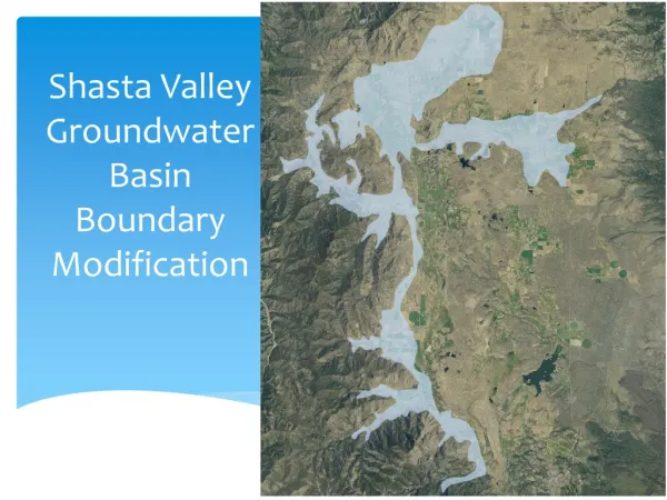
Groundwater Basin Management • The Agency overlies the Livermore Valley Groundwater Basin (the Basin) • The Main Groundwater Basin is the portion of the Basin that contains high-yielding aquifers. • The Main Basin has an estimated storage capacity of 254,000 AF and receives an annual average natural recharge of approximately 13,400 AF through percolation of rainfall, natural stream flow, and irrigation waters, and inflow of subsurface waters. • The Agency only pumps groundwater it has artificially recharged as natural recharge is allocated to users that pre-date the formation of the Agency. • Sustainable Groundwater Management Act (SGMA) • Zone 7 is the Groundwater Sustainability Agency (GSA) for all basins within our service area • Zone 7 submitted an Alternative Groundwater Sustainability Plan (Alt-GSP) for the Livermore Basin and is awaiting Dept. of Water Resources approval. • Zone 7 has begun the process to create a GSP for the Sunol Groundwater Basin. • Groundwater Basin Oversight • Drilling and Well Permits • Septic Tank Permits • Toxic Site Surveillance
Imported Water Sustainable Groundwater Management Historical Groundwater Elevations at a Key Well Ground Surface Operational Range Basin Overdraft Basin Recovery Actively monitoring & managing the Basin to maintain sustainable levels, while also providing a vital source of drought supply. Zone 7 Artificial Recharge started (imported water), 1962
Financial Overview – FY 2018-20 Budget Summary All funds except for Fund 100 comply with minimum reserve levels
Capital Improvement Plan (CIP) • The Capital Improvement Plan (“CIP”) document outlines the plans for capital projects and programs needed to carry out the goals and policy objectives of the Agency. The CIP incorporates the projects, costs, schedules, and priorities for the Water System and Flood Protection System. • In October 2017, the Board adopted the 10-Year Water System CIP Update. • Typically CIP is updated every other year. Next update due in 2019 • The Water System CIP plans for a total expenditure of $925 million (updated) • in projects starting in FY 2018-19 through FY 2027-28 broken down by • these three programs: √ The CIP does not include any additional debt over the next five years.
CIP: Ten-Year Water System CIP Summary (in millions)
FLOOD AND WATERSHED PROTECTION • Inspections, Routine Maintenance, and Emergency Projects • The winter storms of 2017 caused significant damage at 208 sites. Zone 7 usually repairs about 5-10 sites per year. Routine maintenance includes activities like mowing, tree trimming or removal, fence and road repairs, trash removal, graffiti abatement, sediment management and removal, rodent and vector control, addressing homeless encampments and public complaints, etc. • Stream Management Master Plan (SMMP) & Amendment • The purpose of the SMMP Amendment is to update and/or revise the 2006 SMMP project list, and determine what new projects might need to be implemented based on recent hydrologic/hydraulic modeling and ecological assessment of the Livermore Valley, while still meeting the goals and objectives of the 2006 SMMP. CIP projects will largely be developed from the SMMP Amendment. • Monitoring and Community Assistance • Example: Storm Central Website
Water Supply SMMP Amendment: Seeks to update completed or no longer needed projects, create a valley-wide model, provide an environmental baseline for permitting, refine and update costs, and identify any new projects to create a Flood CIP. Ultimately lead to and update of the development impact fee (DIF) and a flood asset management plan and financing strategy for future projects. Stream Management Master Plan (SMMP) Flood Protection An integrated approach to Flood Protection completed in 2006 that incorporates a holistic view of the Northern Alameda Creek Watershed Streams Groundwater Recreation Habitat
Storm Central WebsitePublic Resource Shows Storm Water Flows at Gauged Locations
Questions? QUESTIONS?