Download
1 / 30
400 likes | 830 Vues
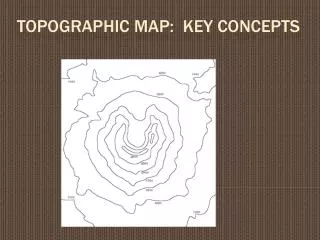
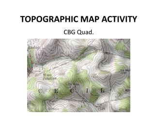
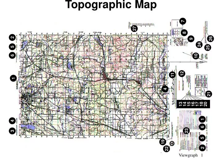
Topographic Map. 7. 27. 8. 2. 26. 9. 24. 5. 25. 6. 10. 12. 11. 1. 4. 21. 13 14 15 16 17 18 20. 1. 4. 6. 23. 3. 5. 19. 2. 22. Topographic Symbols. Contour Lines. Determine Elevation. 1. Check contour interval 2. Find given elevation

E N D
Topographic Map 7 27 8 2 26 9 24 5 25 6 10 12 11 1 4 21 13 14 15 16 17 18 20 1 4 6 23 3 5 19 2 22
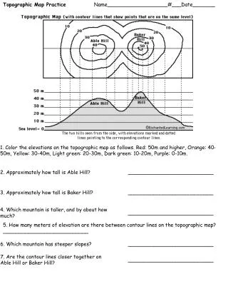
Determine Elevation 1. Check contour interval 2. Find given elevation 3. Determine direction of slope 4. Count contour intervals.
Point Terrain Features 1. .............Hill 2. .............Saddle 3. .............Depression 4. .............Cliff
18 1000 Meters 17 16 15 01 02 03 04 05 1000-Meter Reading
100 Meter Reading (PE) Determine the identity of each of the following: 1. Name of the cemetery in grid square__________ __________ 2. Name of the church in grid square__________ __________ 3. Name of the lake in grid square__________ __________ 4. Name of the cemetery in grid square__________ __________ 5. Elevation at the bench mark in grid square___________ __________
10 Meters 100 Meters 16 03 1000 Meter Reading FT035166
100 Meter Reading (PE)Grid Coordinates Determine the (6) Digit Coordinates of each of the Following: 1. Object_________ Coordinates_________ 2. Object_________ Coordinates_________ 3. Object_________ Coordinates_________ 4. Object_________ Coordinates_________ 5. Object_________ Coordinates_________
100 Meter Reading (PE)Grid Coordinates Identify the following object at each of the following: 1. Coordinates_________ Object__________ 2. Coordinates_________ Object__________ 3. Coordinates_________ Object__________ 4. Coordinates_________ Object__________ 5. Coordinates_________ Object__________
Graphic Scale Statute Miles Kilometers Nautical Miles
Curved Line Distance (PE) Measure the road distance in the following: 1. From the intersection in grid square_______ to the intersection in grid square______is_____ kilometers. 2. From the intersection in grid square_______ to the intersection in grid square______is_____ kilometers.