Download

1 / 67
1.5k likes | 3.32k Vues
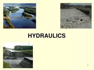
Hydrology & Hydraulics for Bridge Design. Bridge Hydraulics Overview. Topics for this presentation: Item 1 – Design discharges (Hydrology) Item 2 – Channel & Bridge Characteristics Item 3 – Hydraulic Analysis using HEC-RAS Item 4 – National Flood Insurance Program

E N D
Bridge Hydraulics Overview Topics for this presentation: Item 1 – Design discharges (Hydrology) Item 2 – Channel & Bridge Characteristics Item 3 – Hydraulic Analysis using HEC-RAS Item 4 – National Flood Insurance Program Item 5 – Scour Analysis & Channel Protection Item 6 – ODOT Submittal Requirements
Item 1: Hydrology Two primary methods used by ODOT to calculate flood discharges: • USGS report 89-4126 (rural) • USGS report 93-135 (small urban)
USGS Report 89-4126: Techniques for Estimating Flood-Peak Discharges of Rural, Unregulated Streams in Ohio • Provides multiple-regression equations to calculate discharges for gaged and ungaged streams • Provides a method to adjust discharges for gaged streams • Contains data from streamflow gaging stations
Supplement to the Gazetteer • Useful for calculating larger drainage areas • Available from ODNR, listed as an “out of print” publication on website
Discharge Calculation for Ungaged Stream: The Region C multiple-regression equation for 100-year flood peak discharges is chosen: Q100 = (RC)(CONTDA)0.756(SLOPE)0.285(STORAGE+1)-0.363 Basic characteristics for the ungaged site are determined: CONTDA = 0.290 square miles SLOPE = 93.0 feet per mile STORAGE = 0.0 percent These values are substituted into the Region C equation: Q100 = 236(0.290)0.756(93.0)0.285(0.0+1)-0.363 Q100 = 337 cubic feet per second
Confirm Suitability of Rural Equations • Check basin characteristics with ranges for region • Characteristics outside range occur infrequently
Use of Gaging Station Data • For ungaged sites on gaged streams • Confirm that drainage basin is rural and stream is unregulated • Site can be upstream or downstream of gauging station • Results of regression equations are adjusted to agree with data from nearby gaging stations
Peakflow Software • Applies regression equations • Performs gauging station adjustments • Download from ODOT website
USGS Report 93-135: Estimation of Peak-Frequency Relations, Flood Hydrographs, and Volume-Duration-Frequency Relations of Ungaged Small Urban Streams in Ohio • Procedure similar to that used for rural streams • Equations are not suitable for all urban streams • Q = f (Area, Slope, BDF)
Basin Development Factor (BDF): • A measure of urban development within a drainage basin 0 = No development 12 = Maximum development • Divide basin into three subdivisions • Estimate development in each subdivision
Upper 1/3 Middle 1/3 Lower 1/3 Channel Improvements 1 1 0 Channel Linings 1 1 0 Storm Drains 1 1 0 Curb & Gutter Streets 1 1 0 TOTAL 4 4 0 Basin Development Factor (BDF): BDF=4+4+0=8
Basin Characteristics Minimum Maximum Drainage Area 0.026 4.09 Precipitation 31.5 41.2 BDF 0 12 Confirm Suitability of Urban Equations
Other Sources for Discharge Estimates • HUD Flood Insurance Studies • U.S. Corps of Engineers Flood Studies • U.S. Soil Conservation Studies • Agencies responsible for flood control facilities (regulated streams)
ODOT Design Discharges Design Flood Frequency: Freeways/Controlled Access Facilities 50 years Other Highways (≥2000 ADT) 25 years Other Highways (<2000 ADT) 10 years
Item 2: Channel & Bridge Characteristics • Perform channel survey • Data Requirements: • Cross section geometry • Roughness values • Bridge characteristics
Field Survey for Waterway Crossings • Used to obtain channel cross-section data and establish roughness coefficients (“n” values) • Photographs are required • Determine and document nature of upstream property • Assess flood potential and Headwater controls • Look for evidence of scour
Channel Cross-Sections • Number of sections depends on uniformity of channel • Locate sections where bed profile, channel width or depth, or roughness change abruptly • Orientation perpendicular to direction of flow
Manning’s Roughness Coefficients • Various sources for “n” values • Roughness varies with season (Use worst case)
FHWA-TS-84-204: Guide for Selecting Manning's Roughness Coefficients for Natural Channels and Flood Plains (http://www.fhwa.dot.gov/bridge/wsp2339.pdf)
U.S.G.S Water Supply Paper 1849 (Available online, link found in HEC-RAS help menu) http://wwwrcamnl.wr.usgs.gov/sws/fieldmethods/Indirects/nvalues/index.htm
Item 3 – Hydraulic Analysis HEC-RAS Software – US Army Corps of Engineers (Hydraulic Engineering Center - River Analysis System).
HEC-RAS Software • Software and Users Manuals are downloadable for free from Corps of Engineers website (www.hec.usace.army.mil) • User inputs design flood flows, channel and structure survey information • HEC-RAS uses the Standard Step method to compute steady flow water surface profiles • HEC-RAS is capable of modeling subcritical, supercritical, and mixed flow
Standard Step Method • Also known as the “Step Backwater Method” • Uses the Energy Equation and Manning’s Equation to evaluate points along the water surface profile. Basic Assumptions • Steady flow • Flow type constant between sections • Normal depths considered vertical depths • Level water surface across channel • Sediment and air entrainment are negligible
Defining flow data in HEC-RAS Required input for steady flow analysis: - Discharge at cross sections with a change in flow. - Boundary condition • Downstream Channel Slope (Used to calculate Normal Depth) • Known value (If available)
Allowable Backwater • In general, the bridge should be designed to clear the design frequency flood • Meet NFIP (National Flood Insurance Program) requirements • Meet Conservancy District requirements • Limited to 1-foot raise in 100-year backwater if outside of NFIP jurisdiction (Ohio Revised Code, section 1521.13) • Backwater should not be allowed to flood “Unreasonably large areas of usable land” • Backwater should not be increased in urban areas
Item 4 - National Flood Insurance Program (NFIP) • Most Ohio communities participate • Each community adopts local ordinances • Enforced by local floodplain coordinator (see ODNR website for listing)
Floodways No encroachment allowed in the designated floodway unless analysis shows no increase in flood levels
NFIP Compliance • Obtain floodway map, flood insurance rate map, and flood insurance study for site. (All available on FEMA website) • If the site falls within a special flood hazard area, any construction must be approved by local floodplain coordinator • Obtain local floodplain ordinances for community
NFIP Compliance – HEC RAS Analysis • Obtain original model used for FIS, if possible • If original model cannot be obtained, use water surface elevations and flow rates from FIS to initiate analysis • If flow rates and water surface elevations are substantially different those based on the regression equations, include both on the structure site plan
Ohio’s Conservancy Districts http://www.miamiconservancy.org/Who_We_Are/What_Is_A_Conservancy_District/Ohios_Conservancy_Districts.htm
Item 5 – Scour Analysis and Channel Protection Hydraulic Engineering Circular No. 18 (HEC-18): Evaluating Scour at Bridges Published by FHWA Best source of information on scour analysis & countermeasures
Total Scour –three components: • Long term aggradation and degradation • Contraction scour • Local scour