Download
1 / 7
80 likes | 207 Vues
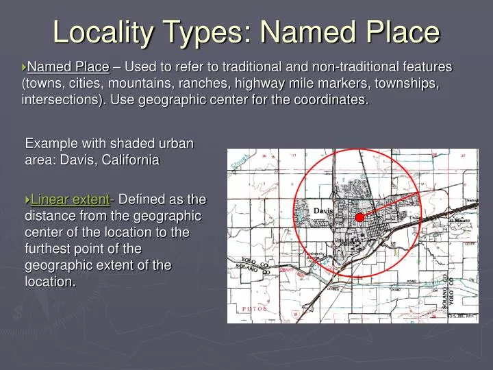
Locality Types: Named Place. Named Place – Used to refer to traditional and non-traditional features (towns, cities, mountains, ranches, highway mile markers, townships, intersections). Use geographic center for the coordinates. . Example with shaded urban area: Davis, California

E N D
Locality Types: Named Place • Named Place – Used to refer to traditional and non-traditional features (towns, cities, mountains, ranches, highway mile markers, townships, intersections). Use geographic center for the coordinates. Example with shaded urban area: Davis, California • Linear extent- Defined as the distance from the geographic center of the location to the furthest point of the geographic extent of the location.
Named Place – Small town Example: Jean, Nevada
Named Place – Remote A locality that does not have a clear boundary on the map. Olancha, California Extent is half the distance to the center of the next nearest named place (or feature), which is Grant, CA.
Named Place – Junction Junction of Hwy 80 and Hwy 9, Hidalgo, New Mexico Measure the extent of the junction as if it were a named place. Use the following standards for extent: 10 m for two lane city street or highway, 20 m for four lane highway 30 m for large highways with medians
Offsets: • Distance from a named place using the center of the named place as a starting point. Used with a heading to give direction and distance from named place. • These can be with a direction, direction and distance, direction along a path, etc. “5 miles north of Beatty, on US 95”
Locality Types: Offsets by road Error is smaller for by road than by air (5.261 miles), as there is no error in direction for offsets by road.