Download
1 / 42
420 likes | 570 Vues
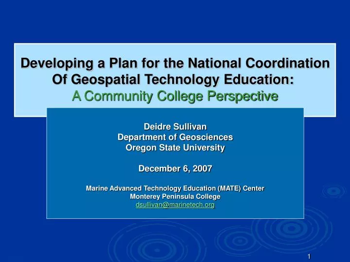
Developing a Plan for the National Coordination Of Geospatial Technology Education: A Community College Perspective. Deidre Sullivan Department of Geosciences Oregon State University December 6, 2007 Marine Advanced Technology Education (MATE) Center Monterey Peninsula College

E N D
Developing a Plan for the National Coordination Of Geospatial Technology Education: A Community College Perspective Deidre Sullivan Department of Geosciences Oregon State University December 6, 2007 Marine Advanced Technology Education (MATE) Center Monterey Peninsula College dsullivan@marinetech.org
Presentation Overview • Introduction • What are geospatial technologies and why are they important? • Challenges for the educational system • Project rationale • Project goals • Issues critical to GST education • Methods • Results • Discussion and Conclusions • Acknowledgements
What are geospatial technologies? • GIS, GPS and remote sensing (GST) • Assist the user with the collection, analysis and interpretation of spatial data • Cross cuts nearly every sector of the economy • $5 billion industry in 2002, 2005 > $30 billion • Projected to increase to $700 billion by 2015 • A U.S. Department of Labor high growth job initiative • GST are transformativetechnologies
Asian Tsunami Tsunami Visualization GPS Columbia Disaster 9/11 Path of Katrina Geospatial Technology Awareness
Challenges for the Educational System • GST are a variety of integrated technologies • Many more people will need to be educated in GST • Steep learning curve – plus the software and hardware are continually evolving • In the past it was used by a cadre of specialists • Now it is becoming a system-wide integration at all levels and practically all sectors of the economy • GST lacks DOL occupational titles and industry definitions
Project Rationale • There is limited coordination of GST workforce and educational activities - especially at the CC level • Duplication of effort apparent in NSF/DOL grants • Emerging trends are not adequately addressed and integrated into the curriculum • The two existing GST academic organizations (UCGIS and NCGIA) are university-based and are not addressing the needs of CCs • Most professional societies do not have strong connections to CCs • There is a lot of investment in GST education but very little coordination of what is being done
Project Goals Long-term goal is to establish anational GST Center that will improve the quality, relevance, and accessibility of geospatial technology education (primarily at the CC level) • Identify barriers to effective GST education at the community college level • Review past and current GST workforce and education efforts • Produce a plan for the national coordination of GST education at the community college level based upon broad consensus in the GST community This NSF study is being led by two existing technology centers
Issues Critical to GST Education • Workforce needs • Core competencies • Professional certification • Curriculum development • Educational pathways • Professional development • Communication • Awareness and reaching underserved audiences • The role of GST education in supporting college administrative tasks and entrepreneurialism • Future trends in GST
Community College Education • CCs have been around about 100 years • Prepare workers for nation’s expanding industries • Drive social equality • CC Students • Traditional [Transfer (A.A.) and Occupational degrees (A.S.)] • Developmental (Welfare to Work, GED) • Incumbent Workforce (professionals, career transitions) • Greater student diversity (age, socio-economics, ethnicity) • Tend to be more responsive to local workforce needs • About 42% of credit students are CC students. So why invest in Community Colleges?
GST and Higher Education • More than 2,000 of the 4,165 colleges and universities use GST software • More than 400 of the 1,157 2-year colleges offer instruction in GST • GST is both an academic and occupational program • Difficulties with articulation
Methods • Survey of the GST education community 170 GST educators responded to the survey in October 2006 • Conduct background research on the ten critical issues Researched literature and reviewed survey responses to produce a synopsis of the current state of each critical issue • Hold a national forum on GST education - January 5-7, 2007 in Monterey, CA - 40 GST professionals attended - Produced recommendations for a NGTC • Validate and rank the forum recommendations • Produce a report and a list of high priority recommendations for a NGTC
Results The following recommendations for each issue are paraphrased and represent a sampling of the top recommendations for a NGTC.
1. Workforce Needs A NGTC should: • Make best use of existing studies and disseminate the information in a user-friendly format • Develop strategic partnerships with other workforce-related organizations • Collect and compare DACUMs • Implement additional workforce studies as needed
2. Core Competencies • Core competencies define the knowledge and skills required to carry out specific tasks that are common to a particular profession or occupation. • Core competencies are critical links between the workplace and the classroom, since they connect job requirements to educational subject areas • Core competencies provide a framework for • efficient curriculum sharing • benchmarks for program accreditation • articulation agreements • exam-based professional certification • effective screening and placement of new workers into the workforce • Core Curriculum Core Competencies
2.National Core Competency Efforts • Geospatial Workforce Development Center GST Competency Model (2003) • University Consortium for Geographical Information Science Body of Knowledge (BoK) (2006) • DACUMs (many grassroots efforts) (1997 – 2006) Texas Skill Standards for GIS • Geospatial Information and Technology Association (GITA)/ Association of American Geographers (AAG) Defining and Communicating Geospatial Industry Workforce Demand (2006)
2. Core Competencies Of the 170 GST educators surveyed in phase 1 • 63% felt core competencies are needed for national coordination • 33% were unsure • 4% felt that core competencies are not needed • Assist UCGIS and AAG in continuing and expanding the BoK and making it more user friendly for undergraduate teaching and educating the incumbent workforce. How well does the BoK embody two-year community college GST programs that are responding to local and regional workforce needs? A NGTC should:
3. Professional Certifications Certification is recognition by one’s colleagues and peers that an individual has demonstrated professional integrity and competence in their field. [ GISCI Professional Certification, ASPRS Certification, and SPACE STARS Certification] • Serve as a repository of certification, accreditation, and licensing information • Evaluate certification options • Join organizations that offer certifications to represent CC views A NGTC should:
4. Curriculum A NGTC should: • Create an online clearinghouse that encourages submission, review, and search capabilities for geospatial curriculum materials • Develop an introductory course or modules that provide the fundamental geospatial skills as outlined in the BoK
5. Articulation/Educational Pathways A NGTC should: • Develop an online forum and white paper that discusses strategies for achieving articulation • Organize, compile, and compare articulation agreements • Develop career pathways that provide guidelines for a seamless education in geospatial technology from secondary to community college to university • Develop standards to integrate GIS into AP geography courses
6. Professional Development Of the 170 educators surveyed, 84% indicated that they are self taught by reading literature. 67% lacked membership in any professional organization. Barriers to professional development include the cost, lack of time, travel distance, lack of opportunities, and a lack of administrative support. • Organize, compile, and disseminate up-to-date information on professional development opportunities A NGTC should:
6. Professional Development(continued) • Offer geospatial technology professional development in a variety of formats • Identify the major barriers to professional development through surveys and other feedback mechanisms • Keep abreast of geospatial technology trends and make recommendations on the type of professional development needed • Build partnerships with 4-year universities, professional societies, government agencies, industry and NGOs to promote, encourage, and expand professional development opportunities
7. Communication A NGTC should: • Act as the representative body for two-year colleges, faculty, and students in the field of geospatial technology • Act as a collective voice to promote community college interests in professional societies, workforce-related studies, core curriculum projects, certification and accreditation efforts, and other activities of importance to community college audiences • Create a comprehensivewebsite and listserve to facilitate communication
8. Awareness and Reaching Underserved Audiences A NGTC should: • Promote GST as a mainstream scientific tool for community college education • Disseminate stories of successful geospatial awareness events and identify effective GST education tools • Identify effective student recruitment approaches for GST programs
9. The Role of GST Education in Supporting College Administrative Tasks and Entrepreneurialism A NGTC should: • Develop a searchable clearinghouse with how-to templates, standard data models, and best practices to support community colleges in workforce/economic development, institutional research, grant writing, student marketing, and facilities management. • Serve as a clearinghouse for geospatial data as it applies to community college demographics, enrollments, economics, etc.
10. Future Trends in Geospatial Technology • Assess and disseminate trends in the geospatial industry in order to project changes in the industry and workforce • Assist community colleges with adapting their curricula to future trends Include informationtechnologyinstruction within the geospatial curriculum, largely relating to the evolution of GIS to enterprise GIS. Increasing need for web-basedinstruction and web-based data delivery. A NGTC should:
Discussion • GST workforce development is critical to our economy • A GST growth rate of 35% a year (DOL) • GST is ranked at the top with nano and biotechnology (DOL) • Growth driven by GST tools and high quality data • Challenges: • No standard occupational titles or industry definitions • Education system is poorly coordinated and communication among community colleges is not good. • University and community college approaches to education can differ • A common language (core competencies) needs to be established, agreed upon, and validated by working professionals that will meet the needs for many entry level positions
Community college educators want A NGTC that will: • Represent their interests at national venues • Act as a clearinghouse to provide easy-access to current curriculum and workforce information • Provide access to professional development opportunities
A NGTC should NOT • Become a geospatial technology certification-granting organization • Be an organization that provides educators with evidence (certification, certificates or licenses) that they have satisfied the minimum qualifications specific to teaching geospatial technology • Be an accreditation body for geospatial programs
The Future of a NGTC • A NGTC has been proposed to the National Science Foundation by one or more collaborative groups largely consisting of community colleges. • The status of a NGTC will not be known until early 2008. • But, regardless of which group is funded, its success may very well hinge on its ability to follow the recommendations of this study.
Conclusion • If we as a nation are to remain economically competitive, achieve greater understanding in protecting our resources, and reduce the chaos and loss of life associated with manmade and natural disasters, we will need an efficient, responsive, and well-coordinated GST educational system with good communication between all levels and a better understanding of the knowledge and skills workers need to be successful in the workplace. • It is essential that some organization, presumably a NGTC, end the community college silence and act as a collective voice to promote community college interests in issues and activities of national importance.
Acknowledgements • My committee • Dawn Wright (major advisor) • Jim Good (minor advisor) • Julia Jones • Alex Sanchez (OSU Community College Leadership Program) • Geosciences faculty, Office Staff and the Graduate Office • Jill Zande at the MATE Center • Karen Haberman at Western Oregon Univeristy • The National Science Foundation (NSF/DUE 063424) • Co-PIs Ann Johnson and Terry Brase • Environmental Systems Research Institute • Agrowknowledge Center • MATE Center • Oregon Sea Grant • My parents
Project Management and Funding • Project Funding: NSF/DUE/ATE $130,760 • Project led by two existing centers • Project Team • Project Director (PI) • Two Co-PIs • Nine working advisory committee members • Web site support • Graphic artist and publication support • Significant in-kind contributions from • ESRI • Agrowknowledge Center • MATE Center
Convergence of GST Education and Workforce Efforts • GITA/AAG study made recommendations for improving the GeoWDC GST Competency Model with reference to the UCGIS BoK • The USGIF is using the BoK for program accreditation • This study reviewed 4 DACUMs and mapped portions of these DACUMS to the BoK
Seminal education efforts in GST National Center for Geographic Information and Analysis 1988 – NCGIA formed to advance the understanding of geographic processes and spatial relationships through improved theory, methods, technology, and data. [NSF]
Seminal education efforts in GST University Consortium for Geographical Information Science In 1994 the UCGIS was formed “to provide a unified voice for the GIS research community”
Seminal workforce efforts in GST GITA recommendations:occupational titles, industry definitions, methodology for estimating GST workforce demand, actions for closing the workforce supply/demand gap.
Convergence of GST Education and Workforce Efforts • GISCI is using the UCGIS BoK to see if it “may serve as a backbone for an exam-based certification program.” “I don't mind using a few items from the core knowledge areas for GIS from the GIS&T Body of Knowledge, but I found that document to be loaded with doctoral thesis topics rather than everyday applications of GIS technology.”
Learning to Think SpatiallyGIS as a Support System in the K-12 CurriculumNational Research Council, 2005 “Spatial thinking must be recognized as a fundamental part of K-12 education and as an integrator and a facilitator for problem solving across the curriculum. With advances in computing technologies and the increasing availability of geospatial data, spatial thinking will play a significant role in the information-based economy of the 21st-century.”