Download
1 / 29
290 likes | 367 Vues
This study focuses on reconstructing the section of US 421 from KY 89 at McKee to the Jackson-Rockcastle County line. It aims to gather input on potential issues, concerns, and alternative solutions from the community. The study will follow the detailed road building process, including preliminary design, environmental considerations, and public input. The project aims to identify known issues, define project goals, evaluate alternatives, and make recommendations. By involving the public, governmental agencies, and stakeholders, the study will help create a transportation plan that meets the needs of the local community while minimizing environmental impacts.

E N D
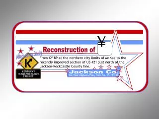
Reconstruction of Alternatives Study From KY 89 at the northern city limits of McKee to the recently improved section of US 421 just north of the Jackson-Rockcastle County line. Six-Year Highway Plan, Item No. 11-113.00 Jackson Co. ¥
Why are we here? • Provide information to you about the planning study and the proposed project • Listen to what you have to say about: • Possible issues, concerns, and impacts • Sensitive areas that should be avoided, if possible • Possible alternatives
Road Building Process • First step is Long-Range Planning • Identification of all proposed improvement needs by local communities, counties, and regions • $50 billion in projects identified on current needs list • Prioritization of needs for Statewide Transportation Plan • About $800 million per year in proposed projects in current Plan
Road Building Process • The Statewide Transportation Plan is a 20-year planning document that includes: • Six Year Highway Plan • 14-Year Long Range Element • However, there are a lot of identified needs that cannot be met with available funding over this 20-year period
Forever Road Building Process We Are Here Preliminary Design & Environmental Studies Project Planning and Programming Right of Way Final Design Utility Construction Operations 2 Yrs. 4 Yrs. 6 Yrs. 7 Yrs. 8 Yrs. 10 Yrs.
Purpose of Study • Listen to and share information with local officials, government agencies, other interested parties, and the public at large • Identify known issues, concerns, and constraints • Define project goals • Develop and evaluate project alternatives • Make recommendations
What about environmental issues and public input … • Study will follow the project scoping process defined in the 1969 National Environmental Policy Act (NEPA). • Public, government agencies, and other interested parties are encouraged to provide input on issues, impacts, and alternatives.
What about environmental issues and public input? • The No-Build alternative is given equal consideration along with proposed “Build” alternatives. • Study information and findings will be used in future decisions on the project.
This study will help us to… • Understand how local citizens feel about the proposed project • Identify issues and concerns so they can be considered early in the project development process • Define the purpose and goals for the project • Avoid or minimize impacts to sensitive areas in the natural and human environment
The study will also help … • Reduce the amount of additional work or rework • Accelerate project delivery • Create a project that local citizens can support
What will the study include? • Public Involvement • Environmental Overview • Transportation Analysis
What will the study include? • Public involvement • Meetings with local officials • Open-house public meetings • Coordination with and input from • State agencies • Federal agencies • Interest groups
What will the study include? • Environmental Overview • Natural environment • Lakes, creeks, wetlands, wildlife, plant life, terrain, scenery, etc. • Human environment • Communities, homes, businesses, churches, parks, cemeteries, schools, environmental justice, historic and archaeological sites, farmland, recreation and tourist areas, economy, jobs, quality of life, etc.
What will the study include? • Transportation Analysis • Purpose and goals of project • Highway design issues • Existing conditions, number of lanes, lane width, shoulders, curves, grades, etc. • Operations data • Traffic volumes, highway capacity, and crashes
Project Description Develop and evaluate alternatives for the possible reconstruction of US 421: • From KY 89 north of McKee in Jackson County • To improved US 421 near Bighill in Rockcastle County, north of the Jackson-Rockcastle County line.
Description of Existing US 421 • Federal Functional Classification = Rural Minor Arterial • State System Designation = Rural Secondary • Average daily traffic (ADT) between 3,930 and 5,160 vehicles per day (vpd) • Percent trucks between 4.1% and 9.7%
Description of Existing US 421 • Two-lane highway with: • 9-feet wide driving lanes • 2-feet wide shoulders • 35-55 mph speed limit • Rolling terrain
What have we done so far? • Developed Preliminary Project Goals • Looked at existing conditions of major state roads in the study area • Met with local officials • Identified local, state, and federal agencies to receive information and provide input
Preliminary Project Goals… • Provide improved regional access along an improved route that will: • Support economic development initiatives by opening up this low-income area • Improve access to jobs, hospitals, services, shopping, and schools in Berea, Richmond, and Lexington.
Another Preliminary Project Goal … • Help alleviate public concerns about safety and travel time along the existing US 421 corridor by providing alternatives for improved roadway geometrics.
Some of the issues so far… • Possible family clusters along US 421 • Availability of suitable relocations along the existing route • Impacts on the Daniel Boone National Forest • New residential development and new/improved businesses in Sandgap • Possible caves and karst topography near the Rockcastle County Line
Some more issues of concern… • The historic Cox Simpson House, in Morrill, currently receiving Transportation Enhancement Funds for improvements • Grade issues near Sandgap • Possible disturbance to a divide near the Jackson-Rockcastle County Line that separates the drainage basin • Possible impacts to a watershed near Morrill that drains into the Owsley Fork Reservoir
What happens next … • Review public input • Oral comments made at tonight’s meeting • Survey questionnaires received after tonight’s meeting
What happens next … • Get input from local, state, and Federal resource agencies and other interests • Summarize public and agency input to identify: • Issues, impacts, and concerns • Possible highway alternates
What happens next? • Develop and evaluate project alternates • Hold another meeting with Local Officials and Public in about 2 to 3 months to present proposed alternates
BEFORE YOU LEAVE …. • Help yourself to refreshments • Visit the exhibits and talk one-on-one with the staff • Please complete and turn in your Survey Questionnaire
Please visit the exhibits! • Exhibit Boards • Study area • Traffic and crash data • Preliminary environmental concerns • Other improvements • Map Drawing • Identify areas to avoid, if possible • Identify areas to improve
Reconstruction of Alternatives Study From KY 89 at the northern city limits of McKee to the recently improved section of US 421 just north of the Jackson-Rockcastle County line. Thank you for coming!!! Six-Year Highway Plan, Item No. 11-113.00 Jackson Co. Your comments are important to our decision making process! ¥