Download
1 / 20
200 likes | 326 Vues
This report identifies optimal areas in Washington State for developing a small wind farm with under 25 turbines. The focus is on locations with low construction costs and high energy generation potential, specifically land characterized by bare ground, agricultural use, or non-forested areas. Key specifications include outstanding to superb wind power density exceeding 600 W/m2 at 50m height, ensuring efficient energy production. Exclusions include proximity to existing wind farms, national parks, and major mountain ranges. A promising site has been selected for its favorable conditions and accessibility to infrastructure.

E N D
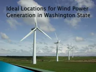
Ideal Locations for Wind Power Generation in Washington State
Background • We have been hired by an entrepreneur to locate areas within Washington State suitable for a small wind farm. • A small number of turbines (<25) • Low construction costs • High potential for energy and subsequent revenue generation
Location Specifications • Land Use that would feasible for construction of wind turbines: • Bare ground • Agriculture or • Non-forested land
Wind Power Generation Potential • Outstanding to Superb wind power density • > 600 W/m2 at a tower height of 50 m • This number is based upon multiple features including: wind speeds, terrain, and climate. • Ridges High Points Funneling Points
Outstanding to Superb Wind Power Classification and Suitable Land Cover Intersect
Proximity Requirements • Stay at least 10 miles away from existing wind farms • Within 5 miles of transmission lines • Within 5 miles of state highways
Other Exclusions • National Parks • All Washington State Mountain Ranges • Cascade Mountains • Blue Mountains • Olympic Mountains
Selected Location • Site with maximum area ~.5 square miles • Undeveloped area within Inner Olympic Peninsula • ~1.5 miles west of Highway 101 • South of the town of Quilcene • With a length of approximately 3.5 miles, the site’s unique shape allows for a high number of wind turbines to be installed along the ridge
Expected Power Generation • 50m wind turbines are to be used (rated at 750 kW) • They will be spaced at least five 50 meter rotor diameters apart. • Therefore, we could fit at most, 22 turbines in a line along the 3.5 mile ridge
Power/Revenue Generation • Assuming a 40% power capacity factor • This is on the high end because the site is particularly favorable • The site could potentially generate 6.6 MW of power which equates to about 57,800 MW*h over the course of one year
Data Sources • Washington State Geospatial Data Archive (WAGDA) • wagda.lib.washington.edu/data/geography/us/vector/ • Washington Department of Fish and Wildlife GAP Data Products • http://wdfw.wa.gov/wlm/gap/landcov.htm • Washington State Department of Transportation (WSDOT) GeoData Distribution Catalog • http://www.wsdot.wa.gov/mapsdata/geodatacatalog/default.htm#main • National Renewable Energy Laboratory • http://www.nrel.gov/gis/