Download
1 / 14
140 likes | 294 Vues
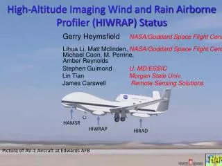
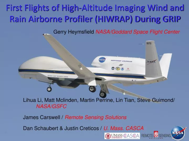
First Flights of High-Altitude Imaging Wind and Rain Airborne Profiler (HIWRAP) During GRIP. Gerry Heymsfield NASA/Goddard Space Flight Center. Lihua Li, Matt Mclinden , Martin Perrine, Lin Tian , Steve Guimond / NASA/GSFC James Carswell / Remote Sensing Solutions

E N D
First Flights of High-Altitude Imaging Wind and Rain Airborne Profiler (HIWRAP) During GRIP Gerry Heymsfield NASA/Goddard Space Flight Center Lihua Li, Matt Mclinden, Martin Perrine, Lin Tian, Steve Guimond/ NASA/GSFC James Carswell /Remote Sensing Solutions Dan Schaubert & Justin Creticos / U. Mass. CASCA
High-Altitude Imaging Wind and Rain Airborne Profiler (HIWRAP) MEASUREMENTS GOALS: Map the 3-dimensional winds and precipitation in precipitation regions associated with tropical storms. Map ocean surface winds in clear to light rain regions using scatterometry. NASA Global Hawk: • 19 km altitude, ~30 hour flight HIWRAP Characteristics: • Conically scanning. • Simultaneous Ku/Ka-band & two beams @ 30 and 40 deg • New technologies in radar:low power solid state transmitters with pulse compression, single antenna • GPM radar frequencies.
HIWRAP Development • Instrument development funded by NASA Instrument Incubator Program (IIP) and NASA Weather Focus Area funded GRIP Global Hawk activity. • Test flights conducted in March 2010 on WB-57. • GRIP Global Hawk installation June 2010 and campaign Aug-Sept 2010. • GRIP • 15 August 2010 – 25 Sept 2010 • 3 Test Flights & 5 Science Flights
Processing & Analysis • GRIP processing in progress. • Doppler processing (pulse pair) from I, Q. • Antenna pointing and navigation evaluation. • Data editing (cleaning up, unfolding,..) • Reflectivity calibration • Software in progress for 3D mapping, ocean surface wind analysis.
Tropical Storm Matthew23-24 Sept 2010 • Last GRIP Global Hawk flight but best (cleanest) data of campaign. • Convective burst (CB) began just prior to the GH getting on station, but was sustained throughout the flight. • Mathew intensified by 5 to 10 kts during the flight, max winds ~40kt. • Storm was unable to intensify beyond 50 kt winds but it went on to produce >16” of rain in parts of Yucatan, Mexico.
One Scan – Polar Plot Uncalib. Reflectivity Doppler (air+fallspd) Polar Plots < Ku-Band Inner Beam (30oH) < Ka-Band Inner Beam (30oH) 2010 GRIP Flights Ran at reduced resolution (150 m range; 2 deg azimuth) < Ka-band Doppler partial unfolding
Low level Flight Track Mosaic 03:27 to 08:32 UTC TS Matthew23/24 Sept 2010 1 9 A B 3 5 D 8 2 C 7 4 6 Uncalibrated backward looking (half-circle) HIWRAP reflectivity on GOES IR image.
Reconstructed Vertical Along-Track Cross Section Ku outer chirp (40o beam, V) Ku inner chirp (30o beam, H) Rear look Rear look Forward look Forward look Ka inner chirp (30o beam, H) Rear look Kaouter chirp (30o beam, V) Rear look
3D Gridded Data • 1.0 x 1.0 x0.25 km grid interval with Yt along flight track. • Weighted (by distance from the center point) average or nearest point. • Gridded with forward/backward half circle of the scan separately. Example: 2 km altitude cross-section. Y = 100 km X= 5km Yt X= -5km Xt Ku band, V, outer beam Y = 100 km Ka band, V, outer beam 100 km (folded)
HIWRAP Future Development & Flights Hardware improvements: Pulse pair processing (Doppler velocity, reflectivity). Improved receiver performance. FFT processing to aid in boundary layer wind retrievals. Downlink real-time products. Flights in April 2011 for GPM algorithms using HIWRAP on ER-2 in nadir pointing mode. Hurricane Severe Storm Sentinel (HS3) Global Hawk hurricane flights 2012-2014.