Download
1 / 21
210 likes | 278 Vues
Using GPS to Learn Significant Locations and Predict Movement Across Multiple Users. Daniel Ashbrook and Thad Starner College Of Computing Georgia Institute of Technology Personal and ubiquitous computing, 2003. Outline. 1. Introduction 2. Applications 3. Pilot Study Methodology

E N D
Using GPS to Learn Significant Locations and Predict Movement Across Multiple Users Daniel Ashbrook and Thad Starner College Of Computing Georgia Institute of Technology Personal and ubiquitous computing, 2003
Outline • 1. Introduction • 2. Applications • 3. Pilot Study • Methodology • 4. ZÄurich Study • Changes to Methodology • 5. Conclusion
1. Introduction • For any user-assisting technology to be useful, it must have some knowledge of the user. • Understand (or predict) what the user will do, when and where she will do it and the reason for her actions. • User modeling is a necessary step • Goal • We consider a model to be a collection of data on some particular aspect of a human user's behavior that yields predictions on what behavior the human will engage in next. • But Location Only-where
2. Applications • Potential applications for a location-modeling system fall into two main categories: • Single-user, or non-collaborative • Early-reminder applications • Multi-user, or collaborative. • The problem of scheduling a meeting for several people
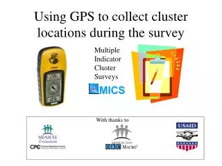
3. Pilot Study-Apparatus • Pilot study • with a single user over the course of four months. • Apparatus • a Garmin model 35-LVS wearable GPS receiver and a GPS data logger. • recorded the latitude, longitude, date and time from the GPS receiver per second • When the receiver was indoors or signal blocked, the logger did not record anything. • we captured most forms of transit, including automobile.
3. Methodology- Finding significant places • In order for any predictions we make to be meaningful, we want to discard as much of the data as possible. • Non-Significant places • “You're currently at 33.93885N, 84.33697W and there's a probability of 74% that you'll move to 33.93885N, 84.33713W next.“ • Significant places • where the user spends her time • From home to school. • It also seems likely that Locations will be inside buildings • where GPS signals do not reach. • We used this idea to find what we call places.
3. Methodology- Finding significant places • We define a place as any logged GPS coordinate with an interval of time t between it and the previous point. • We decided on ten minutes as an amount of stopping.
3. Methodology- Clustering places into locations • The basic idea of our clustering algorithms is to take one place point and a radius. • To find an optimal radius, we run our clustering algorithm several times with varying radii. • We then plot the results on a graph and look for a “knee” (Figure 4).
3. Methodology- Clustering places into locations • We create clusters of places using a variant of the k-means clustering algorithm.
Time = 10 minutes • Location radius = 0.5 mile • Number of location = 24
3. Methodology- Learning sublocations • “Campus->Home”in favor of things like • “Physics building->Home,” • “Math building->Home,” • graphing varying radii and looking for the knee in the graph (Figure 6).
3. Methodology-Prediction • a Markov model is created for each location. • Each node in the Markov model is a location, and a transition. • Figure 7 shows a partial Markov model with three paths-those for “Home”, “CRB”, and “VA”.
By using higher-order models, we can get significant increases in predictive power. • in Table 1 • the users' probability of traveling from A to B (“Home” to “CRB”) is 70%. • if we know the user was already at B, the user's probability of traveling from A to B increases to 81%!
4. ZÄurich Study-Changes to Apparatus • To determine whether the algorithms developed during the pilot study generalize, we conducted a second study in ZÄurich, Switzerland with multiple users. • Apparatus • Six more GPS receivers and data loggers from GeoStats. • The receivers were the same Garmin units we used
4. ZÄurich Study-Changes to Methodology • When finding places-in our previous study, • considered a point a place if it had time t between it and the previous point. • meant that places would be detected • when the user exited a building and the GPS receiver re-acquired a lock. • Our current method • registers a place when the signal is lost, • and so is not dependent upon signal acquisition time. • Figure 9 shows the difference between these two methods.
4. ZÄurich Study-Changes to Methodology Figure 9: Picture (a) shows the results of the old place finding algorithm, while (b) shows the results of the new algorithm on the same data. Clusters are much more evident in (b), and the clusters match well with users' experiences. Each color (or shape) of dot in the pictures represents a different user.
Figure 11: An illustration of the data reduction that occurs when creating places and locations. Picture (a) shows the complete set of data collected in ZÄurich for one user, around 200,000 data points
5. Conclusion • We have demonstrated • how locations of significance can be automatically learned from GPS data at multiple scales. • We have also shown a system • that can incorporate these locations into a predictive model of the user's movements. • In addition, we have described several potential applications of such models, including both single-and multi-user scenarios.
Comments • 所使用的方法簡單、易懂,可以學習 • 個人認為這一篇文章的最主要的關鍵: • 如何可以被定義為是一個place • 以時間來判斷 • 在這篇paper中所使用的10分鐘 • 進出一個building並再次的進行GPS request • 或一個地點停的時間 • The signal is lost • 如何將多個place轉成Location • 是否能有一較有效的方法可以用來決定多大的半徑才是最適的距離 • Location的精確確度對某些運用是不夠的 • prediction • 仍有很多方法可以運用