Download
1 / 19
190 likes | 263 Vues
The Use of High Resolution Mesoscale Model Fields with the CALPUFF Dispersion Modelling System in Prince George BC. Bryan McEwen Master’s project 2000-2002 Atmospheric Science Group Dr. Peter L. Jackson University of Northern British Columbia Funding supplied by the Oil and Gas

E N D
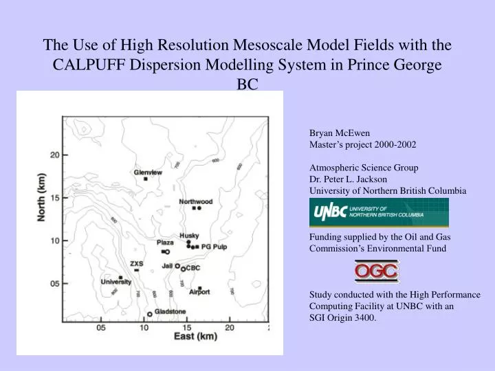
The Use of High Resolution Mesoscale Model Fields with the CALPUFF Dispersion Modelling System in Prince George BC Bryan McEwen Master’s project 2000-2002 Atmospheric Science Group Dr. Peter L. Jackson University of Northern British Columbia Funding supplied by the Oil and Gas Commission’s Environmental Fund Study conducted with the High Performance Computing Facility at UNBC with an SGI Origin 3400.
CALPUFF • A Dispersion modelling system composed of 3 separate modules: • CALMET – a meteorological model, constructs 3-dimensional fields of wind, temperature and other variables from local observations. Deterministic in nature. Requires upper air data as well as data from at least one surface station. • CALPUFF – a Gaussian Puff dispersion model, predicts 3-dimensional fields of pollutant concentrations. Requires CALMET fields and an inventory of pollutant sources and emission rates. • CALPOST – a post processor that extracts pollutant concentrations from CALPUFF fields.
RAMS • A prognostic (forecasting) mesoscale model, able to simulate circulations from hemispheric in scale down to 100’s of metres. • Smaller grids are nested within larger parent grids when higher resolution is required. • Calculates meteorological variables each time step. Smaller grid sizing requires a smaller time step and therefore more calculations. • Significant computer resources needed. SGI Origin 3400 ‘Fraser’ used at the HPC facility at UNBC.
A “HINDCAST” instead of a “FORECAST” • For regulatory modelling, a meteorological period in the past is used for dispersion analysis. • RAMS is therefore used to make a “hindcast” of what the atmosphere was like during the period. • ‘Nearby’ observations are used as boundary conditions to guide RAMS’ simulations. Predictions are periodically ‘corrected’ on the large scale. • Numerical models such as RAMS are able to ‘telescope down’ from the large scale motions to predict circulations on a local scale. The influence of topography, vegetation, bodies of water, radiation etc. are accounted for by the model.
Research Objectives (Can simulated meteorology (RAMS fields) be used in lieu of meteorological observations to perform dispersion modelling in an area of complex terrain??) • To assess the use of RAMS fields in producing high quality CALMET meteorological fields. • To assess the use of RAMS fields in producing high quality CALPUFF pollutant concentration estimates.
Methodology • SO2 chosen to model, within a 24.5km by • 24.5 km domain surrounding Prince • George. • Three 5-day periods in 1999 of moderate • to high levels of SO2 chosen to analyze. • 6 surface meteorological stations available. • - 1 upper air meteorological station available. • - 4 SO2 monitoring stations available. Surface meteorological station Upper air meteorological station Significant SO2 source SO2 monitoring station
RAMS Initialization The National Centers for Environmental Prediction (NCEP) coarse gridded datasets were used to initialize and nudge RAMS forecasts. These gridded fields at 2.5o lat. by 2.5o long, with 17 pressure levels in the vertical
Analysis of Results – WIND FIELDS • - Wind data from 5 of the 6 • surface stations used to test • each model’s wind fields • (heavy arrows indicate station • locations) • CALMET-3 used two of these • 5 stations in its analysis, hence • testing for this model is • favourably biased. • CALMET-6 used all surface • stations in its analysis, so no • test of its wind fields was • possible.
MODEL JANUARY APRIL JUNE CALMET-1 2.66 1.74 1.90 CALMET-3 1.48 1.30 1.74 RAMS-CALMET 2.35 2.01 2.01 Analysis of Results – WIND FIELDS Average Root Mean Square Vector Error (RMSVE), modelled surface winds compared to observed winds at 5 station locations.
Analysis of Results – WIND FIELDSWindrose diagram showing RAMS-CALMET modelled wind direction at Plaza during January Period.
Analysis of Results – WIND FIELDSWindrose diagram showing CALMET-3 modelled wind direction at Plaza during January period.
Analysis of Results – BOUNDARY LAYER Inversions conditions, developing overnight, exacerbate poor air quality by limiting vertical mixing During several evenings of the three periods examined, strong inversion conditions existed. RAMS consistently did not develop accurate temperature profiles within the boundary layer. (extreme case shown)
Analysis of Results – SO2 CONCENTRATIONS Mean Relative Error (MRE) (%), modelled 24-hr SO2 concentrations from observed concentrations at 4 monitoring sites.
Conclusions • There is evidence that RAMS accounted for much of the influence of topographical heights on the regional winds. • The use of RAMS fields with CALMET, although possessing errors, produced meteorological fields as good or better than CALMET using 1 or 3 surface stations. • CALPUFF dispersion estimates of SO2 made with RAMS input were more representative of observed concentrations than those made with 1 or 3 station CALMET fields.