Download
1 / 37
370 likes | 455 Vues
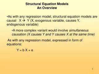
An Overview of Tour-Based Models. Southeast Florida FSUTMS User’s Group Meeting Florida Department of Transportation November 2, 2007. AB Models in Practice in US. Seattle. Oregon. Ohio. Chicago. NY. Sacramento. SF. Columbus. Denver. Bay Area. Phoenix. LA. Atlanta.

E N D
An Overview of Tour-Based Models Southeast Florida FSUTMS User’s Group Meeting Florida Department of Transportation November 2, 2007
AB Models in Practice in US Seattle Oregon Ohio Chicago NY Sacramento SF Columbus Denver Bay Area Phoenix LA Atlanta Developed & used Being developed Planned PB is prime PB is sub
Time Has Come for New Models • Growing recognition of / frustration with limitations of conventional aggregate models for the last 40 years • Intensive research on individual travel behavior and suggested operational model structures • Computer power breakthrough that made AB models realistic on a regional scale • Acquired experience with new models developed and successfully being applied in SF, NY, Columbus, Sacramento…
Complex Planning Issues Addressed with AB Models • Demand management policies (pricing, parking, peak spreading, ridesharing / HOV, flexible work schedules) • Demographic changes (“graying”, female workforce participation, occupation shifts, more singles, less children, elderly drivers, ethnic clusters) • Spatial level of details / natural integration with GIS / sensitivity to neighborhood design details • Better interface with local traffic simulation models • Global transportation policies & taxation by vehicle type / size / fuel efficiency • Information phenomena / telecommuting / tele/on-line shopping / banking
Tour-based models –Basic Definitions • A series of trips beginning and ending at home or work (anchor locations) • Primary destination, intermediate stops • No more non-home-based trips!! Tour Purpose Classification - Hierarchical • Mandatory – Work, School • Maintenance – Shop, pickup/drop-off • Discretionary - Social/Recreational, Other
Tour-based models – Why ? • More precise representation of travel • Greater behavioral realism (consistency) • More information available for analysis • Better able to address transportation demand management policies
Example: a day’s activities shopping movies work lunch shopping HOME day-care library
Example with “trips” shopping movies work lunch shopping HOME day-care Home-based work library Home-based other Non-home-based
Example with tours/journeys shopping movies work lunch shopping HOME day-care Journeys-to/from-work library Journeys-at-work Other journeys
Household Level Decisions Mode? TOD? Origin? Destination?
Model Structure Overview • Generation of activities • Scheduling of activities • Location of activities • Tours to visit activities All this in a consistent way for each person and HH
Main Features • Activity-based approach: • Daily pattern integrity • In-home activity • Intra-HH interactions • Tour-based approach: • Chained trips • Fragment of pattern • Micro-simulation approach: • Fully disaggregate models • List/agent-based structure • “Crisp” choice instead of fractional probability • Unlimited segmentation & spatial / temporal resolution
Intra-Household Interactions Entire-day level: • Staying at home / absent together (vacation, indoor family event, childcare) • Having non-mandatory travel pattern together (day-off for major shopping, outdoor family event) Episode level: • Shared activity / joint travel episodes • Allocation of maintenance activities • Car allocation
Time-Use Concept Recalculate residual time windows 5-6 1-Work 7-17 18-19 2-Discret 20-23 5 23
Tour-Based Model Output Household Data, Person Data, Tour/Trip List HID PID TID PUR MOD SB SA OTAZ DTAZ S1TAZ S2TAZ TLOR TLDS 1 1 1 2 1 0 1 943 987 0 964 1 3 1 1 2 1 2 1 0 943 731 856 0 3 3 1 2 1 4 1 0 0 943 952 0 0 1 2 1 3 1 2 4 1 1 943 565 698 982 1 2 Trip Tables Maps, Graphics Assignment Other Summaries
Types of Analysis Population employment land-use Transportation policy & pricing Transportation infrastructure (network) Model simulation run Traffic / ridership forecast Revenue Environmental impacts Traffic impacts Economic / financial analysis
PB Approach • Each new model will incorporate the best practices and operational research: • The best / most advanced operational model under the given conditions • But not a research exercise… • Specific regional conditions, not a simple transfer of model structures already applied • Addressing planning needs of the MPO and forthcoming projects • Gradual transition strategy is possible (from 4-step to AB) • CMF package developed by PB provides “blocks” for programming implementation
Application Experience • SFCTA model 2000-2007: • Numerous transit projects • Equity analysis • Area pricing study • NYMTC model 2002-2007 • 30 local users • Conformity • Numerous highway and transit projects • Area pricing study • MORPC model 2004-2007 • Highway and transit projects • Some examples follow…
Free Periphery Shown In Red 6:00 AM to 6:00 PM Manhattan Zone $ Entry Fee $7 Intra-Area Fee $4
City-wide Effects of the Entry Fee Hunts Point -7% Vehicle Hours Traveled 125th St Corridor -18% Long Island City -27% Flushing -3% Canal St Corridor -28% Greenpoint/Williamsburg -24% Downtown Brooklyn -29% Staten Island -2%
Columbus: North Corridor 13-mile corridor Potential New Starts project in AA/DEIS Three major employment centers interspersed with large residential areas • Crosswoods/Polaris area • Ohio State University • CBD
User Benefit Thematic MapsHBW peak Productions Attractions
San FranciscoCongestion Pricing Study • Almost 800,000 residents • Daytime population: 1.1 million • 43% of commuters in the AM peak ride transit to downtown SF • TTI’s Urban Mobility Report ranks the San Francisco Bay Area 2nd among the nation’s most congested areas • Bay Area Council’s recent survey listed transportation as the #1 issue for residents 8 of the last 10 years
SF Congestion Pricing Study • User fee paid by motorists using congested roads • Fee may vary in several ways • location/facility • time of day (e.g. peak vs. off-peak) • day of week (e.g. weekday vs weekend) • user group • Revenues typically reinvested in transportation improvements • transit lines • HOV/transit priority • Signal optimisation/traffic management • Bicycle network • Pedestrian facilities
Stated Preference Survey • 600 Respondents • Internet-based (online) • Auto drivers to downtown • Used to collect data on: • Value-of-time • Trade-off between mode choice, time-of-day choice
Value-of-Time • Use of distributed values-of-time to better capture variation in behavior • Cannot be implemented in trip-based models
San Francisco Central Subway • 1.4 miles connecting South of Market to Chinatown • Third Street LRT 7.1 mile surface line (IOS = Baseline)
Muni Central Subway • Third Street • Alternative • Headways: • 5 min. peak • 10 min. off-peak • 12 min. night
San Francisco Transportation PlanEquity Analysis “Ensure equity in transportation investments through a broad distribution of benefits among all city residents” The Countywide Plan targets areas and communities of historic under-investment Support and participation of stakeholders
0-Vehicle Population Zero Vehicle Population
Sacramento State BRT Project • Tour-based model used to simulate campus arrivals and departures by ½ hour time periods • Parking lots fill up -> park further from • Choice of BRT or walk from lot to destination
The tour-based model tracks time in ½ hour periods • Conventional models do not have this level of detail • Parking constraints and policies affect transit ridership