Download
1 / 11
110 likes | 236 Vues
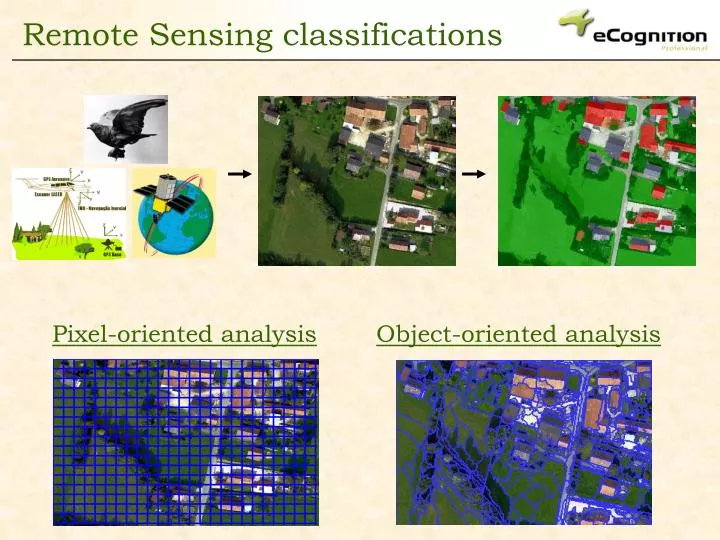
Pixel-oriented analysis. Object-oriented analysis. Remote Sensing classifications. Pixel-oriented limitations. Problems when dealing with rich information. Inappropriate scale of work. Inaccurate with elements of similar spectral behaviour (ex.: habitats). Salt and pepper effect.

E N D
Pixel-oriented analysis Object-oriented analysis Remote Sensing classifications
Pixel-oriented limitations Problems when dealing with rich information Inappropriate scale of work Inaccurate with elements of similar spectral behaviour (ex.: habitats) Salt and pepper effect
Which kind of structure can be seen in here? Object-oriented approach Important semantic information, necessary to interpret an image, is not represented in single PIXELS, but in meaningful OBJECTS , and their mutual relationships
Segmentation Classification Procces characteristics Object parameters color stadistics texture shape & size context Allows scale definition Different scales Hierarchical system Multi source data fusion
Image Segmented layer Classified layer Analysis workflow Multi-resolution segmentation Classification
multispectral image (2.8 m, color) Pancromatic image (0.7m, b/w) Tematic information Example Objective: To study an urban settlement in Madrid (Spain) by means of remote sensing . Multi-source data fusion
Example Segmentation
Example Hierarchical classification
Example Hierarchical classification
Example Hierarchical classification
Example Hierarchical classification Correct identification of roads, paths, houses, back-gardens, pools...