Download
1 / 54
540 likes | 647 Vues
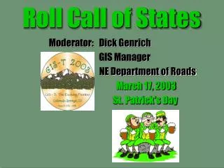
Roll Call of States. GIS-T’02. Moderator: Richard L. Genrich GIS Manager NE Department of Roads. GEORGIA GIS CONTACT - TED KOWAL ted.kowal@dot.state.ga.us. Recent project(s)/application(s): DLG-F BaseMap 1:12,000

E N D
Roll Call of States GIS-T’02 Moderator: Richard L. Genrich GIS Manager NE Department of Roads
GEORGIAGIS CONTACT - TED KOWAL ted.kowal@dot.state.ga.us • Recent project(s)/application(s): • DLG-F BaseMap 1:12,000 • Road Attribute Database Redesign • Enterprise ArcGIS Migration • SDE Implementation • Interested in the following issue(s): • Divided Highway Model • Imagery Integration • National Standards • BaseMap Maint/GPS Integration FOLLOWED BY HAWAII THEN IDAHO
HAWAIIGIS CONTACT - GORO SULIJOADIKUSUMO goro_sulijoadikusumo@exec.state.hi.us Recent project(s)/application(s): 1. 2. 3. 4. TIME IS UP Interested in the following issue(s): 1. 2. 3. 4. FOLLOWED BY IDAHO THEN ILLINOIS
IDAHOGIS CONTACT – LIZA FOXlifox@idt.state.id.us Recent project(s)/application(s): 1. Rdway Names table compliant w/NENA standards 2. Conversion of ITD network for State Police use 3. Stage two of base map expansion - minor collectors & above 4. Dev standards/guidelines for data coll. & attrib TIME IS UP Interested in the following issue(s): 1. Web-mapping applications 2. Use of Intranet for organization-wide access 3. Include All public roads in the 'base map' 4. Identifying a base segmentation model for multiple LRS FOLLOWED BY ILLINOIS THEN INDIANA
Recent project(s)/application(s): • Road Construction • Average Daily Traffic • Crash Analysis • GIS structures information system • ArcGIS migration experiences • Program & Planning GISs • ArcPad & GPS R & D • ArcGIS Dyn-seg concerns ILLINOISGIS CONTACT - MARY ANN PAULISPaulisMA@nt.dot.state.il.us TIME IS UP Interested in the following issue(s): FOLLOWED BY INDIANA THEN IOWA
INDIANAGIS CONTACT - MICHAEL WOODmwood@indot.state.in.us Recent project(s)/application(s): 1. 2. 3. 4. TIME IS UP Interested in the following issue(s): 1. 2. 3. 4. FOLLOWED BY IOWA THEN KANSAS
IOWAGIS CONTACT - BILL SCHUMANwilliam.schuman@dot.state.ia.us Recent project(s)/application(s): 1. LRS Implementation Project 2. GeoData Library (GDL) development 3. Decision support applications 4.Image catalog web page TIME IS UP Interested in the following issue(s): 1. Automated centerline extraction 2. LRS/GIS maintenance applications 3. Statewide road data partnerships 4. FOLLOWED BY KANSAS THEN KENTUCKY
KANSASGIS CONTACT - BRIAN LOGANbrian@ksdot.org Recent project(s)/application(s): 1. Construction & Detour Reporting System 2. Truck Routing Information System 3. Base Map Conversion 4. Second Generation DOQQ Interested in the following issue(s): 1. GIS & Remote Sensing for air quality analy 2. GIS & ITS in vehicle/animal crash reduction 3. Data ownership and release of data 4. GIS to enhance Public Information TIME IS UP FOLLOWED BY KENTUCKY THEN LOUISIANA
KENTUCKYGIS CONTACT - WILLIAM JONES BillH.Jones@mail.state.ky.us Recent project(s)/application(s): 1. Migration to Highways by Exor (3.0.2) 2. Implementation of SUPERLOAD suite 3. Operations Management System 4. Implement CARS TIME IS UP Interested in the following issue(s): 1. Environmental GIS footprint 2. Data/GIS Integration scenarios 3. 4. FOLLOWED BY LOUISIANA THEN MAINE
LOUISIANAGIS CONTACT - DOMINIC A. CALI dcali@dotd.state.la.us Recent project(s)/application(s): 1. Conv to Enterprise-wide ArcGIS using SDE w/DB2 2. Enterprise-wide access to spatial anal on the desktop 3. Web-based access to data and applications 4. Emergency Evac Rtes – Real-time operations TIME IS UP Interested in the following issue(s): 1. Inventory/Asset Management 2. GPS-based delineation of road network 3. Combining the state network w/digital data developed by local entities from different scales and sources FOLLOWED BY LOUISIANA THEN MAINE
MAINEGIS CONTACT - NANCY ARMENTROUTnancy.armentrout@state.me.us Recent project(s)/application(s): 1. Highway by Exor 2. Maine DOT Atlas 3. Project Locator Tool 4.Traffic Flow Update Tool TIME IS UP Interested in the following issue(s): 1. Location Reference Synchronization 2. Data Integration 3. Oracle Spatial 4. Web-based Applications FOLLOWED BY MARYLAND THEN MASSACHUSETTS
MARYLANDGIS CONTACT – JACK MARTIN jmartin1@sha.state.md.us Recent project(s)/application(s): 1.Designing new spatial dbase to support Arc8 tech 2. Support of existing enterprise GIS (DataViewer w/ ArcView) 3. Evaluating GIS needs of State Highway Admin 4. Looking at consolidating base map feature layers TIME IS UP Interested in the following issue(s): 1.Implementation of NCHRP 20-27 2. Implementation of NSDI Framework Transportation ID Standard 3. GIS (ESRI format) and CADD data integration 4. Terminal Server and Citrix to deliver GIS applications FOLLOWED BY MASSACHUSETTS THEN MICHIGAN
MASSACHUSETTSGIS CONTACT - BOB ANDERSEN robert.andersen@state.ma.us Recent project(s)/application(s): 1. 2. 3. 4. TIME IS UP Interested in the following issue(s): 1. 2. 3. 4. FOLLOWED BY MICHIGAN THEN MINNESOTA
MICHIGANGIS CONTACT - GIL CHESBRO chesbrog@mdot.state.mi.us Recent project(s)/application(s): 1. Field Collection of Road Conditions using GIS/GPS 2. Implementation of new Geographic Framework 3. Implementation of new LRS TIME IS UP Interested in the following issue(s): 1. Web-based GIS 2. Oracle Spatial 3. Data Collection & Maintenance FOLLOWED BY MINNESOTA THEN MISSISSIPPI
MINNESOTAGIS CONTACT - DANIEL ROSS dan.ross@dot.state.mn.us Recent project(s)/application(s): 1.LRS Implementation 2. Digital Base Map on the Web 3. Transp Operation Communication Centers 4. Transportation Info System Conversion TIME IS UP Interested in the following issue(s): 1.Partnering & the Tools/Processes to do so 2. Spatial Data Sharing & Converting formats via web 3. Application Integration FOLLOWED BY MISSISSIPPI THEN MISSOURI
Recent project(s)/application(s): 1. Legacy Data Conversion. 2. ITS - Pilot for traffic delays & route closures via internet. 3. Project Portal - Web based application for viewing highway project data. 4. Sign Inv data collection & management MISSISSIPPIGIS CONTACT - DON GRAYSON dgrayson@mdot.state.ms.us TIME IS UP Interested in the following issue(s): 1. Safety Data management and analysis. 2. Roadway inventory / Field Data Collection. 3. ROW Parcel Tracking and analysis. FOLLOWED BY MISSOURI THEN MONTANA
MISSOURIGIS CONTACT - LYNN STACY stacy@mail.modot.state.mo.us Recent project(s)/application(s): 1. 2. 3. 4. TIME IS UP Interested in the following issue(s): 1. 2. 3. 4. FOLLOWED BY MONTANA THEN NEBRASKA
MONTANAGIS CONTACT - JOHN O’MARA jomara@state.mt.us Recent project(s)/application(s): 1.Road inventory for every public road in Montana 2. Quality Control Quality Assurance Procedures 3. Scalable Vector Graphics(SVG) TIME IS UP Interested in the following issue(s): 1. Other states procedures for QA/QC. 2. Ortho Imagery projects 3. Scalable Vector Graphics(SVG) FOLLOWED BY NEBRASKA THEN NEVADA
NEBRASKAGIS CONTACT - DICK GENRICH dgenrich@dor.state.ne.us Recent project(s)/application(s): 1. Updated Data Model for Enterprise Applications 2. Standalone/Field Bridge Insp. Tool 3. Web Road Condition Report System TIME IS UP • Interested in the following issue(s): • Construction Management System • 2. ROW Parcel Tracking Application. • 3. HPMS Submission • 4. Emergency Response FOLLOWED BY NEVADA THEN NEW HAMPSHIRE
NEVADAGIS CONTACT - TONY DAIDONEY adaidone@dot.state.nv.us Recent project(s)/application(s): 1. 2. 3. 4. TIME IS UP Interested in the following issue(s): 1. 2. 3. 4. FOLLOWED BY NEW HAMPSHIRE THEN NEW JERSEY
NEW HAMPSHIREGIS CONTACT - DENNIS FOWLER dfowler@dot.state.nh.us Recent project(s)/application(s): 1. Statewide 1 meter DOQ coverage 2. Transition from GDS on VAX to ESRI 3. Crash Nodal Reference System 4. Laptops & software for Local PDs TIME IS UP Interested in the following issue 1. LRS & Mile Markers 2. HPMS Submission Process 3. Automated Straight Line Diagrams 4. Map updating procedures & policy FOLLOWED BY NEW JERSEY THEN NEW MEXICO
NEW JERSEYGIS CONTACT - JOE PERRY joe.perry@dot.state.nj.us Recent project(s)/application(s): 1. 2. 3. 4. TIME IS UP Interested in the following issue(s): 1. 2. 3. 4. FOLLOWED BY NEW MEXICO THEN NEW YORK
NEW MEXICOGIS CONTACT - GLENN CONDON Glenn.Condon@nmshtd.state.nm.us Recent project(s)/application(s): 1. 2. 3. 4. TIME IS UP Interested in the following issue(s): 1. 2. 3. 4. FOLLOWED BY NEW YORK THEN NORTH CAROLINA
NEW YORKGIS CONTACT - FRANK WINTERS fwinters@gw.dot.state.ny.us Recent project(s)/application(s): 1. Accident Location Coding 2. Vehicle Permit Routing 3. GIS Photolog 4. Web Applications TIME IS UP Interested in the following issue(s): 1. GPS in Bridge Inspection 2. Enterprise Spatial Data Architecture 3. UNETRANS 4. Emergency Response FOLLOWED BY NORTH CAROLINA THEN NORTH DAKOTA
NORTH CAROLINAGIS CONTACT - CHET NEDWIDEK cnedwidek@doh.dot.state.nc.us Recent project(s)/application(s): 1. 2. 3. 4. TIME IS UP Interested in the following issue(s): 1. 2. 3. 4. FOLLOWED BY NORTH DAKOTA THEN OHIO
NORTH DAKOTAGIS CONTACT - KEVIN ANDERSON klanders@state.nd.us Recent project(s)/application(s): 1. 2. 3. 4. TIME IS UP Interested in the following issue(s): 1. 2. 3. 4. FOLLOWED BY OHIO THEN OKLAHOMA
OHIOGIS CONTACT - DAVID BLACKSTONE Dave.Blackstone@dot.state.oh.us Recent project(s)/application(s): 1. GIS Strategic Plan Update/Revision Underway 2. Mandli System upgraded to digilog 3. GPS to collect Roadway Maint Data. TIME IS UP Interested in the following issue(s): 1. Operational Routing(permitting) Systems 2. GIS/GPS use for field collection 3. Highway Safety Projects FOLLOWED BY OKLAHOMA THEN OREGON
OKLAHOMAGIS CONTACT – JAY ADAMS jadams@odot.org Recent project(s)/application(s): 1. Geographical Resource Intranet Portal (GRIP) Project 2. GIS Transition to Spatial Enterprise 3. 2000 Census Urban Updates through GIS Management TIME IS UP Interested in the following issue(s): 1. Enterprise Database Integration and Procedures from other states 2. Spatial Data Management FOLLOWED BY OREGON THEN PENNSYLVANIA
OREGONGIS CONTACT – DENNIS J. SCOFIELD dennis.j.scofield@odot.state.or.us Recent project(s)/application(s): 1. 2. 3. 4. TIME IS UP Interested in the following issue(s): 1. 2. 3. 4. FOLLOWED BY PENNSYLVANIA THEN RHODE ISLAND
PENNSYLVANIAGIS CONTACT – FRANK DESENDI desendi@dot.state.pa.us Recent project(s)/application(s): 1. Projects on Internet for MPO/LDDs 2. Attribute Straight Lines on Intranet 3. Intranet address matching for Maint. 4. Multi-view video log TIME IS UP Interested in the following issue(s): 1. LRS 2. Line work accuracy 3. USGS National Map 4. Data sharing FOLLOWED BY RHODE ISLAND THEN SOUTH CAROLINA
RHODE ISLANDGIS CONTACT – MARY GERLARDI mgelardi@dot.state.ri.us Recent project(s)/application(s): 1. 2. 3. 4. TIME IS UP Interested in the following issue(s): 1. 2. 3. 4. FOLLOWED BY SOUTH CAROLINA THEN SOUTH DAKOTA
SOUTH CAROLINAGIS CONTACT – DONALD McELVEEN mcelveende@dot.state.sc.us Recent project(s)/application(s): 1. County Mapping Project 2. RIMS 3. OSOW 4. TIME IS UP Interested in the following issue(s): 1. Statewide Mapping Projects 2. Internet/Intranet Transportation App. 3. Personnel Classifications 4. FOLLOWED BY SOUTH DAKOTA THEN TENNESSEE
SOUTH DAKOTAGIS CONTACT – ROGER A. BREES roger.brees@state.sd.us Recent project(s)/application(s): 1. Moving non-State roads database into GIS environment 2. Truck Routing on State Highways 3. TIME IS UP Interested in the following issue(s): 1. Sign Inventory 2. Accident Locating and Crash Modeling 3. 4. FOLLOWED BY TENNESSEE THEN TEXAS
TENNESSEEGIS CONTACT – JOHN HARPER John.Harper@mail.state.tn.us Recent project(s)/application(s): 1. Oracle Spatial GIS database compatible with both Intergraph & ESRI platforms 2. TransDecisions LRSx with Oracle Spatial 3. Implementing a data loader for Oracle Spatial 4. Web based Road Conditions Reporting Sys TIME IS UP Interested in the following issue(s): 1. Temporality - Routing - Hand held computers 2. Data collection & attribution for ramps and opposite direction for divided roadways FOLLOWED BY TEXAS THEN UTAH
TEXASGIS CONTACT – BOBBY BENAVIDEZ bbenavid@dot.tx.us Recent project(s)/application(s): 1. 2. 3. 4. TIME IS UP Interested in the following issue(s): 1. 2. 3. 4. FOLLOWED BY UTAH THEN VERMONT
UTAHGIS CONTACT – CHRIS GLAZIER cglazier@dot.state.ut.us Recent project(s)/application(s): 1. 2. 3. 4. TIME IS UP Interested in the following issue(s): 1. 2. 3. 4. FOLLOWED BY VERMONT THEN VIRGINIA
VERMONTGIS CONTACT – SHAWN NAILOR Shawn.Nailor@state.vt.us Recent project(s)/application(s): 1. Statewide Bridge & Culvert data layer & maint standard. 2. Resurrection of our town based linear referencing system to compliment our end-to-end based system. 3. VTrans/Regional Planning Commission road centerline update/maintenance procedures. 4. VermontRoads.com, an ArcIMS based travel info web site. TIME IS UP Interested in the following issue(s): 1. Development of a Straight Line Diagram application. 2. Migration of our AML based Highway Mapping System from Tru64 Unix to Windows 2000. 3. Incorporation of GIS as an inventory & reporting tool in support of Asset Management initiatives within VTrans. 4. Data warehousing - GIS in a DBMS environment. FOLLOWED BY VIRGINIA THEN WASHINGTON
VIRGINIAGIS CONTACT – DAN WIDNER widner_dk@vdot.state.va.us Recent project(s)/application(s): 1.Web mapping of projects 2.Developed environmental GIS 3.Web enabled statewide videolog 4. TIME IS UP Interested in the following issue(s): 1.Serving raster data through ArcIMS 2.Maturing env. review process 3.Truly integrated asset management 4. FOLLOWED BY WASHINGTON THEN WEST VIRGINIA
WASHINGTONGIS CONTACT – RON CIHON cihonr@dot.state.wa.us Recent project(s)/application(s): 1. 2. 3. 4. TIME IS UP Interested in the following issue(s): 1. 2. 3. 4. FOLLOWED BY WEST VIRGINIA THEN WISCONSIN
WEST VIRGINIAGIS CONTACT – DAVE MANER dmaner@dot.state.wv.us Recent project(s)/application(s): 1. 2. 3. 4. TIME IS UP Interested in the following issue(s): 1. 2. 3. 4. FOLLOWED BY WISCONSIN THEN WYOMING
WISCONSINGIS CONTACT – CURTIS PULFORD curtis.pulford@dot.state.wi.us Recent project(s)/application(s): 1. Rails and Grade X-ing databases 2. ArcInfo/ArcView 8.1x implementation 3. ArcSDE implementation 4. Internet/Extranet ArcIMS TIME IS UP Interested in the following issue(s): 1. Functional/Carto. Internet standards 2. ArcObjects development environment 3. Enterprise (geodatabase) brokerage 4. Routing engine technologies FOLLOWED BY WYOMING THEN ALABAMA
WYOMINGGIS CONTACT – BEN SAUNDERS bsaund@state.wy.us Recent project(s)/application(s): 1. WY Road Report (road conditions) 2. BRASS OWL 3. Online Central Viewer/Clearinghouse 4. Base Roads Maintenance TIME IS UP Interested in the following issue(s): 1. LRS Standardization 2. Road Data Models 3. Enterprise Access to Event Data 4. Local Data Partnerships FOLLOWED BY ALABAMA THEN ALASKA
ALABAMAGIS CONTACT – HARVEY ELETHORP elethorph@dot.state.al.us Recent project(s)/application(s): 1. 2. 3. 4. TIME IS UP Interested in the following issue(s): 1. 2. 3. 4. FOLLOWED BY ALASKA THEN ARIZONA
ALASKAGIS CONTACT – JEFF OTTESEN jeff_ottesen@dot.state.ak.us Recent project(s)/application(s): 1. 2. 3. 4. TIME IS UP Interested in the following issue(s): 1. 2. 3. 4. FOLLOWED BY ARIZONA THEN ARKANSAS
ARIZONAGIS CONTACT – JAMI RAE GARRISON jgarrison@dot.state.az.us Recent project(s)/application(s): 1. Internet Map Server (ArcIMS) 2. Alternate Route Interactive System 3. GIS integration with Data Warehouse 4. Base map update and maintenance TIME IS UP Interested in the following issue(s): 1. Integrate addressed local road data 2. Data Warehousing w/ GIS using SDE 3. Automated process for deriving centerlines from remotely sensed data FOLLOWED BY ARKANSAS THEN CALIFORNIA
ARKANSASGIS CONTACT – MARGARETT SITHONG brde306@ahtd.state.ar.us Recent project(s)/application(s): 1. Deploying GIS Projects using GeoMedia Web Map: Lane Closures, Weather Condition Road Map, Historic Bridge System (intranet) 2. Developing methods for Environmental Analysis 3. Data Warehousing for sharing data department wide TIME IS UP Interested in the following issue(s): 1. Local/state/federal partnerships for data sharing 2. Developement of multi-agengy cultural resource information web protal 3. Migration of GIS data to GeoMedia FOLLOWED BY CALIFORNIA THEN COLORADO
CALIFORNIAGIS CONTACT – DIANE PIERZINSKI diane.pierzinski@dot.ca.us Recent project(s)/application(s): 1. Business Process Review (completed) 2. Strategic Implementation Plan (in progress) 3. CTIS (project location app) 4. TIME IS UP Interested in the following issue(s): 1. Road Layer Development 2. Homeland Security 3. Data Integration 4. Web GIS FOLLOWED BY COLORADO THEN CONNECTICUT
COLORADOGIS CONTACT – TAMMY GOORMAN tamala.goorman@dot.state.co.us Recent project(s)/application(s): 1. ArcIMS Corridor Application 2. E-HUTF Highway Users Tax Funds 3. Data Access Web Site 4. Enterprise GIS TIME IS UP Interested in the following issue(s): 1. Oracle SDE & Geo Databases 2. Traffic Data/Applications 3. Data Modeling/Design 4. Real Time ArcIMS Web Applications FOLLOWED BY CONNECTICUT THEN DELAWARE
CONNECTICUTGIS CONTACT – FRANK BUSCH frank.busch@po.state.ct.us Recent project(s)/application(s): 1. Web Map Portal 2. Call Before You Dig 3. Asset Management 4. Incident Management TIME IS UP Interested in the following issue(s): 1. Web Map Portal Development 2. Web Map Plotting 3. 4. FOLLOWED BY D.C. THEN DELAWARE
D.C.GIS CONTACT – ALI A. FATAH afatah@dpw.dcgov.org Recent project(s)/application(s): 1. Completed planimetrics & street centerline file 2. Developing a web based GIS 3. Colocation Map for utilities TIME IS UP Interested in the following issue(s): 1.Developing a UML transportation model 2. 3. FOLLOWED BY DELAWARE THEN FLORIDA