Download

1 / 27
270 likes | 479 Vues
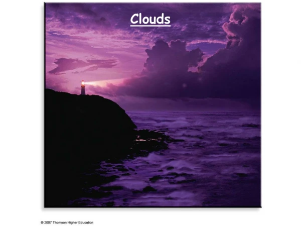
Clouds. Predicting the Weather. Meteorologists are primarily concerned with viewing the weather at a common point in time. This map shows the positions of high and low pressure systems as well as locations of weather fronts. . When viewed from space, much can be learned looking at clouds.

E N D
Predicting the Weather • Meteorologists are primarily concerned with viewing the weather at a common point in time. • This map shows the positions of high and low pressure systems as well as locations of weather fronts. When viewed from space, much can be learned looking at clouds
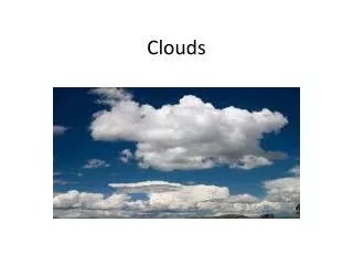
What are clouds? Clouds are water- Either small liquid water drops or tiny pieces of ice that are suspended above Earth’s surface.
Changing Forms of Water • Water exists in 3 states: • Liquid • Solid • Gas Water changes from one phase to another when heat energy is absorbed or released
The Water Cycle condensation condensation precipitation transpiration evaporation Run off infiltration accumulation
How do Clouds Form? • Clouds form when air is cooled to its dewpoint or the temperature, if the air is cooled, it reaches saturation. • The most common way is through lifting. • As a bubble or parcel of air rises, it moves into an area of lower pressure (pressure decreases with height). • As this occurs the parcel expands. This requires energy, or work, which takes heat away from the parcel. • So as air rises it cools. • This is called an adiabatic process.
Humidity • ……is water vapor in the atmosphere • Controlled by rates of condensation and evaporation • Evaporation is determined by the temperature of the air • The higher the temp, the higher the rate of evaporation • Condensation is determined by vapor pressure • The vapor pressure is high, the condensation rate is too • When rate of evaporation and rate = rate of condensation, • air is said to be saturated. • The temp at which the condensation rate= evaporation rate is called the dew point.
Absolute vs. Relative • Absolute humidity • The measure of the actual amount of water vapor in the air • = mass of water vapor (grams) • volume of air (cubic meters • Relative humidity • The ratio of actual water vapor content of the air to the amount of water vapor needed to reach saturation. • how close the air is to reaching its dew point • Ex. 25°c air is saturated when it contains 20g of water vapor per 1 kg of air • If air that is 25°c contains 5 g of water vapor, the relative humidity is 25%
How are Clouds Formed? • Clouds form when the moist air rises. • As air rises it expands and gets colder • colder air cannot hold as much water as warmer air. • Temperature and air pressure continue to drop, so tiny water droplets group together into clumps called cloud droplets. • These droplets becomes a visible cloud. If the cloud keeps going up, the cloud droplets will clump together and form water droplets. • These water droplets are too heavy to float in the air and they fall from the sky as either rain or snow.
Cloud Formation Cont. • Cloud Condensation nuclei- • suspended particles that provide the necessary surfaces for cloud-forming condensation. • Ash • Dust • salt • Small– less that 0.001 mm in diameter • Water molecules become attached to the particles and water droplets form
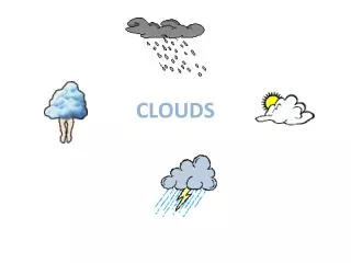
Cloud Classification • Clouds are classified based on characteristics, such as, altitude, appearance, or origin • high clouds - have bases above 18,000 feet (6000 m) • middle clouds - have bases between 6,500 and 18,000 ft • Low clouds - have bases below 6,500 feet • multi-level clouds- vertically thick spanning multiple layers • fog - cloud in contact with the ground • orographic clouds - clouds that form via interaction between wind and mountains
Cirrus- • “curly” • Stratus- • “sheetlike” or “layered” • Cumulus- • “piled” or “heaped” • Alto- • “high” • Nimbus- • “rain”
High Clouds • Cirrus- high altitude wispy clouds • Cirrocumulous- high clouds that have a distinct patchy and/or wavelike appearance • Cirrostratus- are high clouds that usually blanket the sky in ill-defined sheets • often looks like haze Cirrus Clouds are often composed of ice crystals are slow to evaporate and change very slowly with time
Middle Elevation Clouds • Altocumulus- Altocumulus is a white or grey cloud consisting of scattered tufts • This cloud is indicative of changeable weather but without imminent rain. • Altostratus- form a bluish or grayish veil that totally or partially covers the sky producing overcast conditions. • The sun can barely be seen through altostratus and its edges are not distinct • This cloud is indicative of imminent rain http://www.mountain-images.co.uk/mountain-pictures_full/085-loch-linnhe-sunset.jpg
Cumulous • Small clouds that look like lumps of cotton. • Can be found at various heights
Low Elevation Clouds • Stratus- the lowest cloud and forms as a featureless grey layer. • Precipitation from this cloud occurs as weak drizzle rain or snow • Stratocumulus- occurs in patches or layers, composed of rounded masses or rolls. • often gives a sheet of almost total cloud cover.
Rain Clouds • Nimbostratus- Nimbostratus is an overall sheet of grey cloud producing continuous rain or snow. • Base tends to be at 2,000 to 8,000 ft (600 to 2500m). The sun cannot be seen through it
Cumulonimbus • Heaped rain clouds of great vertical extent. • Bases tends to be below 6,500 ft (2,000 m) and can extend up to 6 miles (10 km) into the atmosphere. • Most common inland in the afternoon in spring and summer. • This cloud is associated with heavy showers hail and thunder http://www.centennialofflight.gov/2003FF/clues/clipart/cumulonimbus.jpg
Cap Clouds A smooth cap-shaped cloud on top of a mountain Formed when humid air (maybe moistened by the mountain terrain) is forced to flow over the mountain, condensing into a cloud
Lenticular Clouds • Lenticularis clouds are lens-shaped clouds, with a smooth layered appearance • They are stationary lens-shaped clouds that form at high altitudes They sometimes get confused as flying saucers or UFOs!
Mammatus Rare, pouch-like cloud structures caused by sinking air. • Only occur where cumulonimbus are present; however, they can drift up to 25 miles away from a thunderstorm. • Moist and unstable middle to upper atmosphere over a very dry, lower layer of the atmosphere. • Uplift shapes the mammatus into the pouch-like shape.
Fog • Fog is a cloud in contact with the earth's surface. • It occurs b/c of evaporation from the surface of the Earth. • air cools to a point at which water vapor in it condenses into tiny water droplets • The temperature at which water vapor will begin condensing is called the "dewpoint."
Types of Fog • Radiation fog– results from the nightly cooling of the earth. • The layer of air in contact with the earth becomes chilled below its dew point • Water vapor condenses into droplets • Usually forms on calm, clear nights and is thickest in valleys.
Advective Fog • Forms when warm air moves across a cold surface. • Common along coasts– where warm moist air from above the water moves over a cooler land surface
Upslope Fog • Formed by the lifting and adiabatic cooling of air as it rises along land slopes
Steam Fog • Forms over inland rivers and lakes • A shallow layer of fog formed when cool air moves over a warm body of water
Contrails • a.k.a condensation trail • They are cirrus-like trail of condensed water vapor • They are produced at high altitudes where cold temperatures freeze water droplets before they can evaporate. • Exhaust fumes from a jet engine inject water vapor into the atmosphere • To remain in tact for a long period of time, the air must have a high relative humidity with relatively light winds.