Download
1 / 19
190 likes | 309 Vues
GlobModel Workshop 12-14 September ESA and Global Change Projects Olivier Arino. Earth Explorer missions. GOCE Earth gravity field and Geoid measurements Launch: 2007. SMOS Soil moisture and ocean salinity measurements Launch: 2008. ADM-Aeolus Windspeed vectors measurements

E N D
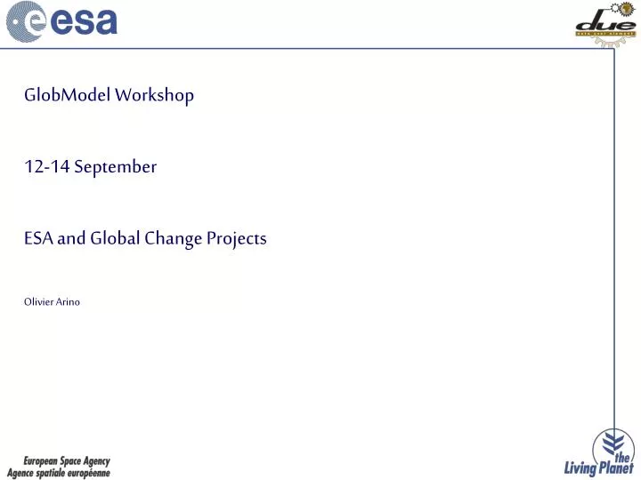
GlobModel Workshop 12-14 September ESA and Global Change Projects Olivier Arino
Earth Explorer missions GOCE Earth gravity field and Geoid measurements Launch: 2007 SMOS Soil moisture and ocean salinity measurements Launch: 2008 ADM-Aeolus Windspeed vectors measurements Launch: 2009 Cryosat-2 Ice elevation and ice thickness measurements Launch: 2009 EarthCARE Clouds, Aerosols & radiation measurements Launch: 2012+ SWARM Earth magnetic field & Earth core dynamics meas. Launch: 2009+
Earth Watch Missions Meteosat Since ’78, 8 ESA developed Meteosat satellites have been launched MetOp Europe’s first polar orbiting satellite for op. meteorology Launch: 2006 and now GMES Sentinel-1 Sentinel-2 Sentinel-3 ERS-1 1991 ERS-2 1995 MSG-1 29.8.2002
GLOBCARBON, Land Products for Carbon Cycle Models • Development of a processing system, to generate multi-annual (1998-2007) estimates of land surface products globally from the VEGETATION, ATSR-2, AATSR, MERIS sensors. • Demonstration and qualification of the GLOBCARBON processor by production of global estimates of Leaf Area Index, Fraction of Absorbed Photosynthetic Radiation, Vegetation Growth and Burned Area from 1998-2007. Project Team: VITO, B GIM, BTrasys, BDatamat, ILamma, I • User Organisations: • IGBP, Intl • ESSP Global Carbon Project (GCP), Intl • Potsdam Institute for Climate (PIK), D • Max Planck Institute for Meteorology (MPI), D • Laboratoire des Sciences du Climat et Environnement (LSCE), FR • CTCD UK • Geoland EU GMES Project, EU • Global, multi-annual, multi-sensor • Links with major land surface, atmospheric transport and terrestrial carbon modelling community
GLOBAEROSOL, Global Aerosol from Space • Development of a standard reference multi-year global aerosol product over land and water (1995–2005) to support the requirements of users in Climate and NWP research, Transboundary Air Pollution monitoring and Air Quality assessment. • Preparation for operationalisation under GMES. • Assimilation of the aerosol product in NWP and Chemisty Transport Models • Project Team: GMV S.A., ERAL, UKUniv. Oxford, UKLab. d'Optique Atmosphérique, F • Users Organisations (national and regional public authorities): • ECMWF, Intl • European Monitoring and Evaluation Programme, Intl • Max Planck Institute – Meteorology, D • Agenzia Regionale per la Protezione dell’Ambiente, I • Landesumweltamt Nordrhein-Westfalen, D • Ministry of Environment, GR • Flemish Environment Agency, B • Strong links with research, operational, and government users. • Development of merging of MERIS, (A)ATSR and MSG/SEVIRI data
GLOBICESea Ice Dynamics for Climate Research • Sea ice motion and deformation mapping • Seasonal cycle of sea ice in the Arctic • Long-term changes in the cryosphere e.g. extent, volume and flux of sea ice, based on 14 year archive of ERS and ENVISAT (more than 500 000 SAR scenes) Users Organisations: • CliC • IGBP, WCRP and other Climate Research Programmes • Scientific communities
GLOBCOLOUR, Global Ocean Colour for Carbon Cycle Research MERIS Chlorophyll Map (2005) • Development and demonstration of an EO-based service supporting global ocean carbon cycle research. • Provision of a long time-series (1997-2006) of consistently calibrated global ocean colour information, according to requirements specified by the global ocean colour user community • Demonstration NRT service for operational users • Based on merging MERIS, POLDER, SeaWIFS, and MODIS to provide the best possible coverage. • Will test different data merging approaches • Two user workshops planned
GlobCover access tool Data Access • Globcover access tool (Terradue) http://www.esa.int/due/ionia/Globcover • Bit torrent Technology • Compliant with GeoNetwork
GlobCover information Please register to our Globcover Newsletter ( contact point : olivier.arino@esa.int ) Next issue in September 2007 ESA/DUE Globcover website http://dup.esrin.esa.it/projects/ Postel Globcover website http://postel.mediasfrance.org
Europe classification resultsItalia Corine LC 2000 (300 m) Globcover 2005-2006 (300 m)
Europe classification resultsDenmark Corine LC 2000 (300 m) Globcover 2005-2006 (300 m)
Europe classification resultsFrance - Belgium Corine LC 2000 (300 m) Globcover 2005-2006 (300 m)
Europe classification resultsUK Corine LC 2000 (300 m) Globcover 2005-2006 (300 m)
Europe classification resultsSpain Corine LC 2000 (300 m) Globcover 2005-2006 (300 m)
GlobMODEL, EO in Global Earth System Modelling • Study contract to understand how to strengthen the use of satellite data in global earth system modelling • Consultation with the user community to gather and consolidate requirements • Analysis of the potential benefits of assimilating various new sources of EO data and of issues impeding wider use • Definition of a strategy for increasing the uptake of EO in global earth system modelling • Identification of priorities for future DUE work plan The Water Cycle • User Organisations: • Operational weather and climate modelling institutes • Earth-system modelling and data assimilation research groups • Wide user consultation leading to definition of future work plan
GlobSeries, Calendar • GlobWave User Requirement, 19-21 September, Ifremer, Brest • GlobCarbon second User Consultation, 11 october ESA, Frascati • TEMIS second User Consultatiuon, 8 and 9 October, ESA, Frascati • GlobCover second User Consultation, 13 November FAO • GlobColour second User Consultation, 20-22 November, Niva, Oslo • Medspiration 6th User Consultation, Niva Oslo