Download
1 / 23
230 likes | 237 Vues
Kurt Buchanan, CFM Economist Mapping, Modeling, and Consequences Center US Army Corps of Engineers Huntington, WV. Consequence Assessment for Dam Failure Simulations. Overview. Corps Dam Safety Program overview Consequence Estimation Using HEC-FIA (Flood Impact Analysis)

E N D
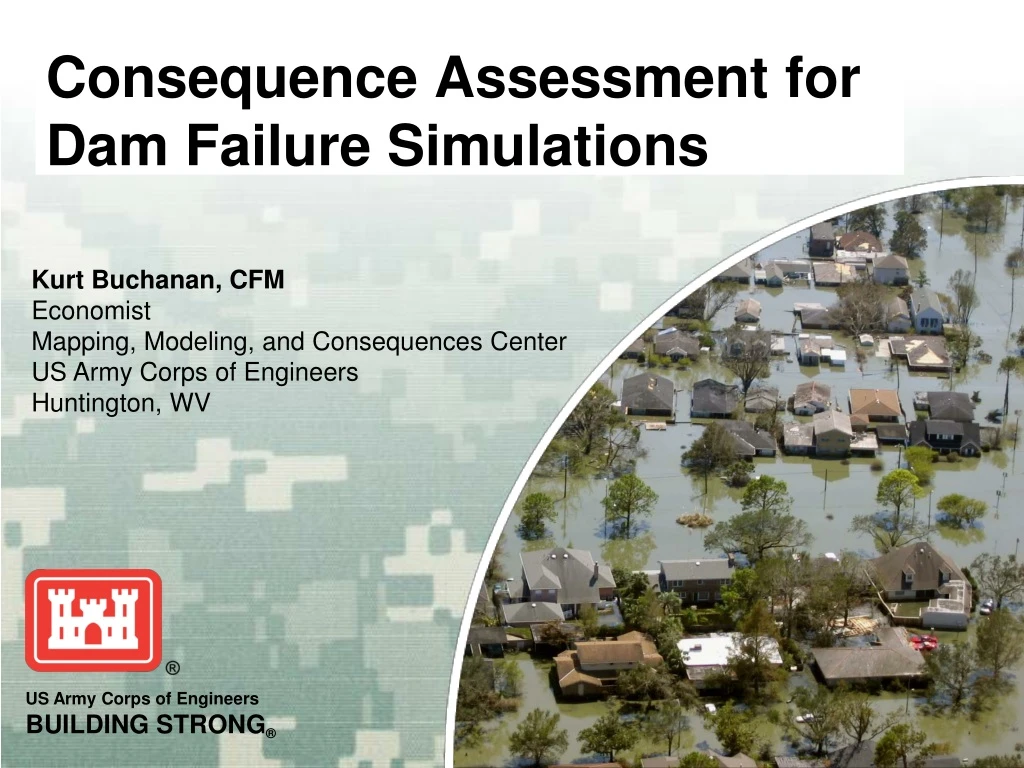
Kurt Buchanan, CFM Economist Mapping, Modeling, and Consequences Center US Army Corps of Engineers Huntington, WV Consequence Assessment for Dam Failure Simulations
Overview • Corps Dam Safety Program overview • Consequence Estimation Using HEC-FIA (Flood Impact Analysis) • Data inputs required • Methodology used by the software • Results • Indentifying Critical Infrastructure within dam failure inundation areas
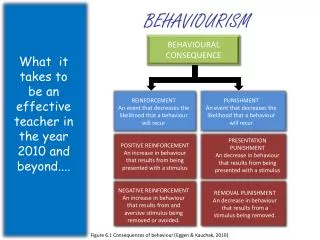
High Probability High Consequence High Probability Low Consequence Increasing Risk Probability Low Probability Low Consequence Low Probability High Consequence Consequence USACE Dam SafetyRisk Assessment Activities • Screening • Minimal effort, classify portfolio • Periodic Assessments andIssue Evaluation Studies • Validate screening, identify path forward • Dam Safety Modification Studies (DSMS) • Risk reduction alternative analysis • Critical Infrastructure Protection and Resiliency (CIPR) • Aligned with DHS homeland security RISK = (Probability, Consequence)
USACE Dam SafetyMapping, Modeling, and Consequences Team • Virtual team of technical experts from across the Corps • GIS specialists, hydraulic engineers, and economists • Provides a standard operating procedure, technical training, and quality reviews • Produces a dam break hydraulic model, consequence estimate, and inundation map for each project • Results in a quality standardized product to support the risk assessment process
USACE Dam SafetyConsequence Assessment Workflow MMC (H&H/Econ) • Generic dam break modeling • Consequence modeling (HEC-FIA) New Risk Assessment 3 new “teams” Dam Break & HEC-FIA models Risk Team (H&H/Econ) • PFMA specific dam break modeling • Consequence model refinement (HEC-FIA) District Team • Dam break modeling input and “QC” • Consequence modeling input and “QC”
Consequence EstimationCorps HEC-FIA Software • GIS-based software program, currently beta version • Uses data from a HEC-RAS dam failure model (depth grids, hydrograph, cross sections, etc.) • Structure inventory can be developed using data from FEMA’s HAZUS program • Tax parcel data or point shapefiles can also be used • Program gives a statistical estimate of direct damages and loss of life to individual structures
Consequence EstimationHEC-FIA Variables • Warning System Curves • Default lowest curve is the emergency broadcast system • Mobilization curves • Default is a maximum of 98% of population mobilized • Can be changed depending on expected evacuation capability • Evacuation velocity • Modeled as a straight line from the structure to the nearest safe zone, average evacuation speed is set at an average of 10 mph • Warning time relative to the breach initiation
Consequence EstimationHow HEC-FIA Works • For physical damages: • Determine the inundation depth at the structure from the depth grid • Apply the appropriate depth-damage curves based on structure type • For life loss estimate: • Determine if population was warned and had time to mobilize from arrival time data • Assign a fatality rate for remaining population based on inundation depth and structure type
Chance Zone – 91% >FH + 15' Consequence EstimationFatality Rate Zones (1-story) Compromized Zone - 12% FH + 13' to 15' Safe Zone – 0.02% <FH + 13' Fatality rates are based on historical averages
Consequence EstimationDouble Warnings • Downstream inundation is split into two warning zones • No Fail Zone – Area flooded prior to or regardless of the dam failure (i.e. spillway flow) • Population gets warned when flooding is predicted from heavy rainfall and will have more time to evacuate • Fail Zone – Not flooded until after the dam fails • Population is not at risk from normal flooding and will not have any reason to evacuate until a dam failure occurs or is predicted to occur
Double-Warning Procedure • Must be implemented any time there is significant non-fail Population at Risk HEC-FIA WARNING ISSUANCE TIMES FLOW Major Flood Evac. Warning Failure Evac. Warning TIME Overtopping Failure Expected MajorFlooding Forecast Failure Damaging Release
Consequence EstimationResults • Direct damage estimates to structures, contents, and vehicles • Population at risk during the day and at night • Loss of life during the day and at night • Agricultural damages • Results can be identified by locations/areas
Critical InfrastructureWhy it matters • Important to identify Critical Infrastructure and Key Resources (CIKR) that could be at risk from a dam failure • Impacts caused by damage to CIKR are not included in the direct damage estimate • Impacts can be cascading • Potential damage to CIKR can be included in planning and mitigated for if identified
Critical InfrastructureExamples of CIKR • Chemical manufacturing facilities, power generation plants, medical facilities • Water, sewer, and power infrastructure • Police stations, fire stations, prisons, schools • Transportation and communication networks • Many, many others…
Critical InfrastructureCorps Path Forward • Currently developing a GIS-based method to identify and prioritize CIKR assets in inundation areas using DHS datasets • Priority will be given to CIKR that could impact human life safety • Integrate CIKR information into the overall risk estimate of each dam • Communicate risk levels to CIKR owners and operators
Summary • Corps Dam Safety Program overview • Consequence Estimation Using HEC-FIA (Flood Impact Analysis) • Data inputs required • Methodology used by the software • Results • Indentifying Critical Infrastructure within dam failure inundation areas
Questions? • My Contact Info: • Kurt Buchanan • Kurt.L.Buchanan@usace.army.mil • (304) 399-5187 • Hydraulic Engineering Center Website: • www.hec.usace.army.mil