Download
1 / 18
180 likes | 281 Vues
The Use of Remote Sensing in Habitat Management for Wildlife. Helen Holdsworth EES 5053 University of Texas at San Antonio December 2, 2006. www.hdw-inc.com. www.fws.com. cache.britannica.com. Problem Statement.

E N D
The Use of Remote Sensing in Habitat Management for Wildlife Helen Holdsworth EES 5053 University of Texas at San Antonio December 2, 2006 www.hdw-inc.com www.fws.com cache.britannica.com
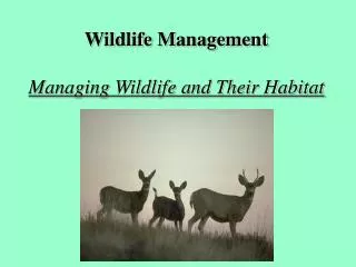
Problem Statement The ability to accurately assess habitat with remote sensing imagery should allow researchers to be more specific in their assessments and recommendations for habitat management. Habitat fragmentation and urban encroachment are two of the major factors threatening wildlife species around the world.
Overview • Introduction • Methods • Results • Management Implications • Conclusions fcit.usf.edu www.treknature.com animals.timduru.org
Landscape Metrics Associated with Habitat Use by Ocelots in South Texas • Hypothesis: Prefer large patches of closed canopy & avoid large patches of unsuitable habitat • Location: Laguna Atascosa National Wildlife Refuge
Methods • August 1991 Landsat Thematic Mapper imagery • Aerial photos • Digital orthophoto quadrangles Image from TNRIS
Methods • Used supervised and unsupervised classification for better accuracy • 4 land cover classes: Urban/barren Water Closed canopy Open canopy Image from published paper, Journal of Wildlife Management
Methods • Landscape Metrics Number of patches Shape Patch size Edge Mean nearest neighbor
Results & Management Implications • Closed canopy shows a great degree of fragmentation. • Ocelots used the largest patches available. • Decisions must consider size, shape, and edge. • Consider conserving areas with smaller patches. Image from Google Earth
Landscape Models to Predict the Influence of Forest Structure on Tassel-Eared Squirrel Populations • Question: Which characteristic best predicts squirrel density & recruitment? • Location: Mogollon Plateau in northern Arizona Image from www.forestera.nau.edu/vw2/images/wmpala__assess_area.gif
Methods • Data from Forest Ecosystem Restoration Analysis • Ground measurements • Digital orthophotos • ETM imagery
Results & Management Implications • Squirrel density best predicted by basel area • Recruitment best predicted by canopy cover • Remove smaller trees • Leave larger patches with moderate-to-high canopy cover
Identifying Suitable Sites for Florida Panther Reintroduction • Question: Which areas would be good for panther reintroduction? • Location: Historic range of panther
Methods • GIS map layers at 500 x 500 m • 1992 National Land Cover Data
Results & Management Implications • Identified 9 potential sites with the historic range • Need field survey at local scale to verify • Need remote inaccessible areas
Analysis of The Use of Remote Sensing Ocelot Research • 1991 Landsat Thematic Mapper • Spatial resolution of 30 m on bands 1-5, 7 • Spatial resolution of 120 m on band 6 • No problems reported http://edcsns17.cr.usgs.gov/EarthExplorer/
Analysis of The Use of Remote Sensing Squirrel Research • Enhance Thematic Mapper Plus (ETM+) • Spatial resolution of 30 m on bands 1-5, 7 • Spatial resolution of 120 m on band 6 • Spatial resolution of 15 m on band 8 • No problems reported http://edcsns17.cr.usgs.gov/EarthExplorer/
Analysis of The Use of Remote Sensing Panther Research • GIS map layers at 500 x 500 m • 1992 National Land Cover Data • Could not incorporate fine scale characteristics http://edcsns17.cr.usgs.gov/EarthExplorer/
www.treknature.com Conclusions • Many imagery tools available • What you use depends on your resources • Should see more research and recommendations based on remote imagery use • Probably always need some ground-truthing fcit.usf.edu animals.timduru.org