Download
1 / 37
370 likes | 439 Vues
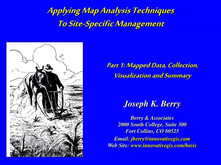
Applying Map Analysis Techniques To Site-Specific Management. Part 1: Mapped Data, Collection, Visualization and Summary. Joseph K. Berry. Berry & Associates 2000 South College, Suite 300 Fort Collins, CO 80525 Email: jberry@innovativegis.com Web Site: www.innovativegis.com/basis.

E N D
Applying Map Analysis Techniques To Site-Specific Management Part 1: Mapped Data, Collection, Visualization and Summary Joseph K. Berry Berry & Associates 2000 South College, Suite 300 Fort Collins, CO 80525 Email: jberry@innovativegis.com Web Site: www.innovativegis.com/basis
Yield Limiting Factors • Water • Topography • Nutrients • Weeds • Pests • Genetics • Weather • Other • Candidate for Site-Specific Management if… • significant driving variable • measurable spatial variability • variability can be explained and spatial relationships established • spatial response to management actions ** Factors are Spatially Distributed **
What Precision Farming Is (and isn’t) • Whole-Field Management is based on broad averages of field data, dominated management actions. • Weigh-wagon, or grain elevator measurements, established a field’s yield performance. Soil sampling determined the typical nutrient levels within a field. From these and other data the best overall seed variety was chosen and a constant rate of fertilizer applied, as well as a bushel of other decisions— treating the entire field as uniform within its boundaries. • Site-Specific Management recognizes the variability within a field and is about doing the right thing, in the right way, at the right place and time. • It involves assessing and reacting to field variability by tailoring management actions, such as fertilization levels, seeding rates and variety selection, to match changing field conditions. It assumes that managing field variability leads to both cost savings and production increases, as well as improved stewardship and environmental benefits. (Berry)
What Is Precision Farming? …about doing the right thing at the right place and time …identifies and responds appropriately to the variability within a field …augments (not replaces) indigenous knowledge • Global Positioning System (GPS) -- Establishes position in a field • Data Collection Devices (IDI- monitors) -- Collects data “on-the-fly” • Geographic Information Systems (GIS) -- Used for data visualization and analysis • Intelligent Implements (IDI- controls) -- Provides variable rate control “on-the-fly” (Berry)
Where is What Why and So What Do What and Where 4 Steps in the Precision Farming Process Advanced spatial analysis involves “map-ematical” treatment of mapped data • Continuous Data Logging 1) Yield Map “What you see is what you get” • Discrete Point Sampling 2) Condition Maps “Guessing over the whole field” • Mapped Data Analysis 3) Relationships “Now what could’ve caused that?” • Spatial Modeling 4) Prescription Map “Do this here, but not over there” (Berry)
Precision Farming’s Big Picture …a new application of the Spatial Technologies …that utilizes spatial relationships in a field for site-specific management (Berry)
Smart Farmers, Dumb Maps If I hadn’t believed it… I wouldn’t have seen it • “Visceral visions”of relationships • “Map-ematical analysis”of relationships 3 steps in analysis... (Berry)
Step 1:Continuous Data Logging • Data Collection Issues • Instrumentation • Positioning (GPS) • Mass Flow Adjustment • Data Storage • H/Software & System • Data Aggregation Issues • Point, Swath, Grid (surface) • Grid Configuration • Geo-Referencing • Gaps/Missing Data • Data Summary/Statistics • Data Visualization Issues • Thematic Mapping • Variation • Visual References • Tabular and Geo- • Based Queries (Berry)
GPS Positioning Triangulation from 4 satellites positions Unit (>100feet) Differential correction (<5 feet) (Berry)
Collecting Yield Data Antenna Offset GPS Fix Delay Mass Flow Lag and Mixing Overlap and Multiple Passes On-the-Fly Yield Map (Berry)
Incorrect Correct Worst Better Best Incorrect Correct Spotting Problems in Yield Maps (Position) Mass Flow Transport Delay, GPS Fix Delay and Antenna Offset Inline Antenna Offset (Snyder, Red Hen Systems)
Mapping Yield Data Point Map-- dot at each yield point Swath Map-- rectangle along path summarizing 2 or more points Grid Map-- square summarizing points within (and near) …colors assigned to each dot, rectangle or square based on the yield measurements (Berry)
Summarizing Yield Data 1) Gridding Resolution, 2) Summary Window, 3) Summary Procedure (Berry)
Spotting Problems in Yield Maps (Theme) Same Data but Different Colors Same Data but Different Ranges (+ or - StDev) Equal Ranges) (Manual) (Snyder, Red Hen Systems)
Visualizing Yield Data (Discrete classes) Numerical statistics …min, max, range, mean, median standard deviation, variance Geographic statistics …total area, area by class, drill-down Descriptive statistics Drill-Down (Berry)
Printing Yield Reports Field Map (Detailed View) Logo Text Report Variables Legend Area Graph (Histogram) Statistics (Snyder, Red Hen Systems)
Step 2:Point Sampling • Sampling Design Issues • Stratification • Sample Size • Sampling Grid • Sampling Pattern • Interpolation Issues • Reach • Number of Samples • Balancing • Technique • Assessing Results • Underlying Issues • Spatial Auto-Correlation • Micro Vs. Macro Process • Driving Variables • Data Costs (Berry)
Spatial Expression of Arithmetic Average “Mapping the Variance” …Soil Samples are collected with GPS coordinates …the location and nutrient levels of the sample points (Discrete Data) are used to estimate the nutrient pattern throughout the field (Continuous Data) (Berry)
Point Sampling Design Concerns Stratification--appropriate groupings for sampling Sample Size--appropriate sampling intensity for each stratified group (N) Sampling Grid--appropriate reference grid for locating individual point samples (Berry)
Point Sampling Design Concerns Sampling Pattern-- appropriate arrangementof samples considering both spatial interpolation and statistical inference (Berry)
Spatial Interpolation Revisited Interpolation Techniques (Inverse Distance, Kriging, MinCurve) (Berry)
Spatial Interpolation(Spatial variability) …the geo-registered soil samples form a pattern of “spikes” throughout the field. Spatial Interpolation is similar to throwing a blanket over the spikes that conforms to the pattern. …all interpolation algorithms assume that 1) “nearby things are more alike than distant things” (spatial autocorrelation), 2) appropriate sampling intensity, and 3) suitable sampling pattern. …the continuous surfaces produced “map the spatial variation in the data samples. (Berry)
Spatial Interpolation(Spatial variability) Comparison of the interpolated surface to the whole field average shows large differences in localized estimates (Berry)
Spatial Interpolation(Spatial variability) Comparison of the IDW and Krig interpolated surfaces shows small differences in in localized estimates (Berry)
Spatial Dependency • Spatial Variable Dependence-- what occurs at a location in geographic space is related to: • the conditions of that variable at nearby locations, termed Spatial Autocorrelation (intra-variable dependence) • the conditions of other variables at that location, termed Spatial Correlation (inter-variable dependence) • Spatial Relations Dependence-- the relationships among mapped variables are: • relationship constant throughout space (and time), termed Spatial Homogeneity • vary as a function of space (and time), termed Spatial Heterogeneity (Berry)
Spatial Autocorrelation (Nearest neighbor) Quick Tests--similarity among neighbors vs. overall similarity in the data set (Nearest Neighbor; Nearby Neighbors) Variogram-- plot of similarity as a function of distance between samples “Nearest Neighbor” (Berry)
Spatial Autocorrelation (Nearby neighbors) Quick Tests--similarity among neighbors vs. overall similarity in the data set (Nearest Neighbor; Nearby Neighbors) Variogram-- plot of similarity as a function of distance between samples …average for Nearby “steps” “Nearby/Distant Neighbors” …from Sample #1 to all other samples …(Distant - Nearby) / Distant (Berry)
Spatial Autocorrelation Quick Tests-- similarity among neighbors vs. overall similarity in the data set (Nearest Neighbor; Nearby Neighbors) Variogram-- plot of similarity as a function of distance between samples (Berry)
Interpolation Methods Nearest Neighbor— assigns the value of the nearest sample point Inverse Distance to a Power— weighted average of samples in the summary window such that the influence of a sample point declines with “simple” distance Modified Shepard’s Method— uses an inverse distance “least squares” method that reduces the “bull’s-eye” effect around sample points Radial Basis Function— uses non-linear functions of “simple” distance to determine weights Kriging— summary of samples based on distance and angular trends in the data Natural Neighbor—weighted average of neighboring samples where the weights are proportional to the “borrowed area” from the surrounding points (based on differences in Thiessen polygon sets) Triangulation— identifies the “optimal” set of triangles (facets) connecting all of the sample points, then converts to a grid Minimum Curvature— analogous to fitting a thin, elastic plate through each sample point using a minimum amount of bending Polynomial Regression— fits an equation to the entire set of sample points (not true interpolation, but map generalization procedure) Thiessen Polygons
Map Generalization • Characterizes the spatial distribution by fitting a mathematical equation to the entire set of data– general trend (Berry)
Spatial Interpolation Techniques • Characterizes the spatial distribution by fitting a mathematical equation to localized portions of the data (roving window) (Berry)
Spatial Interpolation Assessing Interpolation Results (Residual Analysis) (Berry) …the best map is the one that has the best “guesses”
Spatial Interpolation A Map of Error (Residual Map) …shows you where your estimates are likely good/bad (Berry)
Spatial Dependency • Spatial Variable Dependence-- what occurs at a location in geographic space is related to: • the conditions of that variable at nearby locations, termed Spatial Autocorrelation (intra-variable dependence) • the conditions of other variables at that location, termed Spatial Correlation (inter-variable dependence) • Spatial Relations Dependence-- the relationships among mapped variables are: • relationship constant throughout space (and time), termed Spatial Homogeneity • vary as a function of space (and time), termed Spatial Heterogeneity (Berry)
More Information on PF Data Analysis www.agriculture.com/technology/ Online articles and active discussion forum on technology PF Case Study(uses MapCalc Learner software) …the MapCalc Learner CD contains a copy of the Precision Farming Primer and the agriculture data set used in the case Studywww.redhensystems.com www.innovativegis.com/basis Online text and Case Study (Berry)