Download
1 / 30
300 likes | 397 Vues
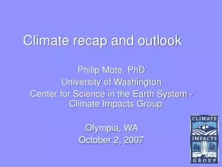
Climate recap and outlook. Philip Mote, PhD University of Washington Center for Science in the Earth System - Climate Impacts Group Boise, ID October 17, 2006. The CSES - Climate Impacts Group. http://cses.washington.edu/cig/.

E N D
Climate recap and outlook Philip Mote, PhD University of Washington Center for Science in the Earth System - Climate Impacts Group Boise, ID October 17, 2006
The CSES - Climate Impacts Group http://cses.washington.edu/cig/ • Goal: help the Pacific Northwest become more resilient to climate variations and climate change • Supported by NOAA Climate Program Office as part of the Regional Integrated Science and Assessments (RISA) program
global warming http://www.ncdc.noaa.gov
The pattern is global http://www.ncdc.noaa.gov
Accumulated Precip for the past year Source: http://www.cpc.ncep.noaa.gov/products/global_monitoring/precipitation/northwest_1yrprec.shtml
Daily Temperatures +1.23ºC +0.89ºC
2006 snow pack • Warm weather in May started a rapid melt of the PNWs abundant snow pack
Our hot-dry summer • For OR-ID-WA, May-June-July 2006 was warmest on record (back to 1895) • June-July-August was 3rd warmest on record
Oct 9 estimated soil moisture percentiles • Courtesy of Andy Wood, University of Washington, data and images are available at http://www.hydro.washington.edu/forecast/monitor
Last year’s outlook • The ENSO outlook: La Nada (“normal”) • PNW climate outlook: odds favoring a “warm” winter and spring
IRI ENSO Forecast Summary • Forecasts from October 2005 called for Nino34 ranging from -0.2 to +0.6, with an average of ~+0.2 http://iri.columbia.edu/climate/ENSO/currentinfo/SST_table.html#figure
Oct 12, 2005 NOAA NCEP ENSO forecasts http://www.cpc.ncep.noaa.gov/products/analysis_monitoring/lanina/ensoforecast.html
Last year’s forecast (from Oct 20) DJF temp 2005-06 FMA temp 2006
Last year’s precipitation forecasts for 2005-2006: issued Oct 20 2005
The tropical ocean is warm http://www.cpc.ncep.noaa.gov/products/analysis_monitoring/lanina/l
El Niño is simmering • Tropical ocean temperatures have been warmer than average since mid-May, and have already crossed the “El Niño” threshold
The latest ENSO forecasts See http://iri.columbia.edu/climate/ENSO European Center Forecast summaries NOAA NCEP
Average El Niño winter precip: 1916-2003 • Dry for most of Idaho From http://www.cses.washington.edu/cig/maps
Pacific Ocean Outlook Summary • Current forecasts rate weak-to-moderate El Niño as most likely situation for 2006/07 • PDO: A simple forecast with skill relies on “PDO persistence + ENSO influence” (see Newman et al. (2003), J. Climate) • Expect weak warm phase PDO conditions for 2006/7 • PDO = +0.3 to +0.8 st devs for Nino34 = +0.5 to +1.5 • A Note on Last year…
NOAA/CPC forecasts issued September 21, 2006 http://cpc.ncep.noaa.gov OND precip JFM precip
NOAA/CPC forecasts issued September 21, 2006 http://cpc.ncep.noaa.gov OND temperature JFM temperature
Another factor in seasonal forecasts Idaho December-January-February temperatures
The Bottom line • a weak to moderate El Niño is likely for the next 2-3 seasons • because of trends and expectations for a weak to moderate intensity El Niño, above-average fall/winter/spring temperatures are likely • El Niño also tilts the odds in favor of a dry fall/winter and below average end-of-season snow pack See http://www.cpc.ncep.noaa.gov