Download
1 / 21
210 likes | 374 Vues
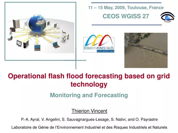
11 – 15 May, 2009, Toulouse, France CEOS WGISS 27. Operational flash flood forecasting based on grid technology Monitoring and Forecasting. Thierion Vincent P.-A. Ayral, V. Angelini, S. Sauvagnargues-Lesage, S. Nativi, and O. Payrastre

E N D
11 – 15 May, 2009, Toulouse, France CEOS WGISS 27 Operational flash flood forecasting based on grid technology Monitoring and Forecasting Thierion Vincent P.-A. Ayral, V. Angelini, S. Sauvagnargues-Lesage, S. Nativi, and O. Payrastre Laboratoire de Génie de l’Environnement Industriel et des Risques Industriels et Naturels
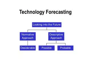
Context Prototype Grid Flash floods Conclusion • Research issues • French flood crisis management state and requirements • Grid technology potentialities • Existing operational flash flood monitoring and modelling platform • Grid-enabled OWS : an experimental platform • Towards an interoperable and spatial decision-making platform
Context Prototype Grid Flash floods Conclusion How grid technology capabilities enable the new forecasting mission of Grand Delta flood forecasting service (SPC-GD) ? Hazard : Flash flood Forecasting and Monitoring : Hydrological expertise (SPC-GD & SCHAPI) ? VOs ESR & CYCLOPS (EGEE) Research axes : 1. Improvement of hydrological forecasting capabilities 2. Grid potentialities for operational crisis management
Context Prototype Grid Flash floods Conclusion According to lessons learnt, flash flood crisis management requires accurate flood hazard evaluation and on-going situation anticipation in order to support civil authorities to : - evaluate hazard intensity - anticipate human and materials damages - organize rescues operations Integration and sharing of sensor observation outputs Geospatial data and processing enhancement Resource availability, short time of response, security and interoperability … Risk Hazard
Context Prototype Grid Flash floods Conclusion Existing client - server system provides realistic hydrological monitoring of supervised watersheds BUT SPC-GD computational’s lack limits short-term operational forecasting for the whole of supervised watersheds HPC innovative technologies provide important computational and storage resources to support such requirements • Grid capability provides on-demand remote computational resources to execute in parallel independent simulations • Open Geospatial Consortium services (OGC) enable the geospatial data management with high abstraction capability
Grid Prototype Context Flash floods Conclusion Distributing computing architecture enabling to share geographically distant resources to obtain important computing and storage capacities (Foster, 2001) • servers farms connection • resources virtualizing • important storage capacities • errors management • secured access system • interoperability Super computer P2P LAN VPN Distributed computing Internet WAN Grid access by virtual organization Cyclops based on the middleware gLite (EGEE) - GRID - Gridcomputing - Metacomputing
Grid Prototype Context Flash floods Conclusion SSH HTTP
Flash floods Prototype Context Grid Conclusion Efficient flash flood anticipation (few hours) requires more intensive computation and an adapted operational system to allow on-demand forecasting simulations of the whole of SPCGD watersheds
Flash floods Prototype Context Grid Conclusion
Flash floods Prototype Context Grid Conclusion measuring stations Expertise broadcasting Rainfall radar Geographical information system and hydrological simulation Watersheds data
Flash floods Prototype Context Grid Conclusion measuring stations Expertise broadcasting Rainfall radar Geographical information system and hydrological simulation Watersheds data
Flash floods Prototype Context Grid Conclusion
Flash floods Prototype Context Grid Conclusion Cells independency…
Flash floods Prototype Context Grid Conclusion Cells independency…
Prototype Flash floods Context Grid Conclusion Watersheds data
Prototype Flash floods Context Grid Conclusion
Prototype Flash floods Context Grid Conclusion
Prototype Flash floods Context Grid Conclusion Ex: Variations of 50% with a forecasting delay of 3h => 21 ALHTAÏR instances • Local ≈ 200 minutes • Grid ≈ 15 - 30 minutes
Conclusion Flash floods Context Grid Prototype • This improved system gives forecasters a wide range of forecasting options on the whole of SPC-GD watersheds • Grid-enabled OWS potentially enhances grid using for inexpert users by its capacity to wrap already prepared grid actions • Grid-enabled OWS architecture might permit the integration in a rapid way of new operational models in order to: • design a multi-models platform dedicated to the monitoring of the whole of hydrological phenomena occurring in S-E of France • have an on-demand flexible and parametric hydrologic workflow • Meteorological forecasting scenarios have to be more realistic according to well-known past meteorological situations • Simulation processes can easily be manage outside the risk zones
Prospects Flash floods Context Grid Prototype Raw and modelized data integration • rivers • Sensors outputs • watersheds characteristics • radar data • Hydrological simulations outputs • hydro-meteorological monitoring • Observed and modelized runoffs • Automatic alert thresholds Towards a decision support system enabling grid and local processing virtualization and hydro-meteorological data integration Query and geoprocessing operations • Stations and rivers search • Parametric meteorological accumulation • Parametric radar animations
Thank you for your attention ! Special thanks for CEOS WGISS … and for all CYCLOPS and ESR partners for their helps in this research !