Download
1 / 28
290 likes | 431 Vues
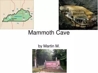
Characterization of the Mammoth Cave aquifer. Dr Steve Worthington Worthington Groundwater. Mammoth Cave area Mammoth Cave 300 miles Martin Ridge Cave. Model 1 assumptions. Karst feature are local scale Aquifer behaves as porous medium at large scale Useful data for calibration

E N D
Characterization of the Mammoth Cave aquifer Dr Steve Worthington Worthington Groundwater
Model 1 assumptions • Karst feature are local scale • Aquifer behaves as porous medium at large scale • Useful data for calibration • 1) Heads in wells • 2) Hydraulic conductivity from well tests
Hydraulic conductivity data • Matrix 2 x10-11 m/s • Slug tests (geo. mean) 6 x 10⁻⁶ m/s • Slug test (arith. mean) 3 x 10⁻⁵ m/s • Pumping tests 3 x 10⁻⁴ m/s • MODFLOW (EPM) 1 x 10⁻³ m/s
MODFLOW - homogeneous EPMsimulationK=1.1x10⁻³ m/s48 wellsmean absoluteerror = 12 m
Problems with model 1 • Major assumption incorrect • Lab studies and numerical models (e.g. Plummer and Wigley, 1976; Dreybrodt, 1996) suggest channel networks and caves should always form) • Karst aquifers are not just “features”
Model 2 assumptions • Aquifer has integrated conduit network • Useful data for calibration • 1) Heads in wells • 2) Hydraulic conductivity from well tests • 3) Heads and discharge in conduits • 4) Tracer tests
Simulated tracer pathsall 54 tracer paths go to correct spring
MODFLOWwith high K cellsK 2x10⁻⁵ to 7 m/sMean absolute error 4 m
Results of MODFLOW with “conduits cells” • Head error reduced from 11 m to 4 m • Tracer paths accurately shown • Model reasonable for steady-state • Poor performance for transient (hours) • Poor performance for transport • No good codes available for karst aquifers
Differences between karst aquifers and porous media • Tributary flow to springs • Flow in channels with high Re • Troughs in the potentiometric surface • Downgradient decrease in i • Downgradient increase in K • Substantial scaling effects
Triple porosity at Mammoth Cave • Matrix K 10-11 m/s • Fracture K 10-5 m/s • Channel K 10-3 m/s - most of flow • Matrix porosity 2.4% - most of storage • Fracture porosity 0.03% • Channel porosity 0.06%
Characterizing carbonates • Wells are great for matrix and fracture studies • but only ~2 % of wells at Mammoth Cave will hit major conduits • Cave and spring studies, and sink to spring tracer tests are great for channel studies • but little is learned about matrix and fracture properties
Comparison of Mammoth Cave and N. Florida aquifers • Mammoth Cave area EPM 1.1 x 10⁻³ m/s • Mammoth Cave area with conduits 4x10⁻⁵ to 7x100 m/s • Wakulla County 8x10⁻⁶ to 2x10⁻² m/s (Davis, USGS WRIR 95-4296)
Available global cave data • About 100,000 km of caves passages at or above the water table have been mapped. • About 1000 km of cave passages below the water table have been mapped.
Increase in mapped caves • Total of mapped caves above the water table is increasing by about 8% each year. • Total of mapped caves below the water table is increasing by about 15% each year. • Only a very small fraction of all caves are known.
Significance of caves • Known caves represent examples from a large and mostly unknown data set • Most active conduits below water table • Fossil passages analog for active conduits • Fossil conduits 10 m high and wide and kilometers in length at Mammoth Cave • Hydraulic parameters and tributary network in fossil and active systems
Problems with applying cave data • Most cave data local scale, not aquifer scale • Caves above the water table may not be representative of active conduits below the water table • Water supply is usually from wells - what is relevance of cave studies?