Download
1 / 15
150 likes | 266 Vues
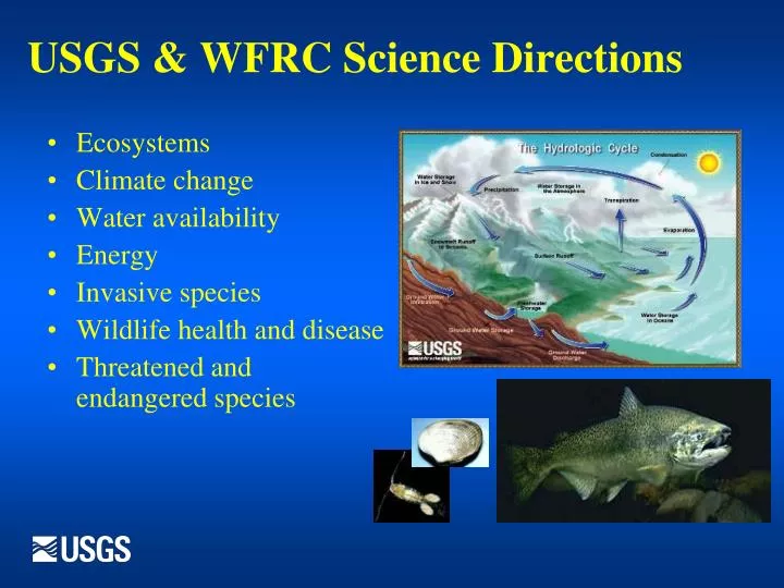
USGS & WFRC Science Directions. Ecosystems Climate change Water availability Energy Invasive species Wildlife health and disease Threatened and endangered species. The Pacific Northwest Climate Change Collaboration (C 3 ). C 3. 2. On the Landscape: CSCs & LCCs.

E N D
USGS & WFRC Science Directions • Ecosystems • Climate change • Water availability • Energy • Invasive species • Wildlife health and disease • Threatened and endangered species
The Pacific Northwest Climate Change Collaboration (C3) C3 2
On the Landscape: CSCs & LCCs Climate Science Centers (CSCs) Delivering Fundamental Climate-Impact Science to Resource Managers on a Regional Basis Landscape Conservation Cooperatives (LCCs) On-the-Ground Applied Science and Adaptive Management • National Climate Change and Wildlife Center at USGS HQ & Eight regional Climate Science Centers (CSCs) • Provide scientific information, tools and techniques for land, water, wildlife and cultural resource managers to adapt to climate and ecologically-driven responses at regional-to-local scales. • Deliver basic climate-change-impact science to Landscape Conservation Cooperatives • Prioritize fundamental science, data and decision-support activities to meet the needs of the LCCs. • Work with the LCCs to develop adaptive management and other decision-support tools for managers. • Twenty-One Nationwide, functioning within a specific landscape as part of a national and international network • Focus on-the-ground strategic conservation & adaptive management efforts at the landscape level. • Management-science partnerships that inform integrated resource-management • Link science and conservation delivery • LCCs are cooperatives, formed and directed by land, water, wildlife and cultural resource managers and other stakeholders. • Steering committees will include representatives from governmental entities (federal, state, tribal and local), as well as non-governmental organizations. 3
Responding to Climate Variability and Change:Trans-boundary Assessment & Services in the CRB Objective Develop and test a practical, integrated approach to organizing and collecting climate change information and science to support climate related decision making at both regional and local scales
Decision Analysis: What is it? • A set of tools for structuring and analyzing complex decision problems • An approach and process for making logical, reproducible, and defensible decisions in the face of: • Technical complexity • Uncertainty • Multiple, competing objectives • A multi-disciplinary field of study drawing from statistics, economics, operations research, management science, psychology…
Numerous structured decision making “tools” exist Examples in use within the USGS include: • Joint Fact Finding (JFF) • Stakeholder Analysis (SA) • Decision Support Systems (DSS) • Adaptive Management DA has similarities with all these approaches, but some key differences • More quantitative than JFF • More decision-focused than SA • More process- focused than DSS • More comprehensive than AM
Decision Analysis at the USGS DA provides (at least) 3 key benefits • Multi-discipline integration: Acts as an integrating tool, to help bring together the varied research and researchers within the climate change community (and the broader technical community) • Information value: Helps to locate and/or highlight areas where significant gaps in data or knowledge limit understanding of the full nature of the issue being considered • Link to end-users: Provides a tangible and explicit link between science and the needs of customers and end-users of the science and data.
aka Research to Operations (R2O) = Integrated Approach to Global Climate Change Economic Demands Natural Resources Recreation Agriculture Physical Biological Population Growth Tribal Culture Social WFRC, Columbia River Research Laboratory NOAA – NCDC, Western Region Climate Services
Decision Support: Linking Models to Predict Climate Change Effects Habitat PhysicalPopulationCommunity Bioenergetics Social & Economic Analyses • Partners: • Federal, State, and Local Agencies • Universities • Tribes • Great Northern LCC, CSCs • Stakeholders: • Agriculture, Landowners, Local Recreation • Tribes: Yakama, Colville, Umatilla • Local Officials
Linking Models to Predict Climate Change Effects in the Yakima River Basin Habitat Aquatic Physical Population Community Bioenergetics Socioeconomic analyses • Idaho Falls, ID (USGS, Science Apps., Climate Change) - $ • Tacoma, WA (USGS Water Resources) - Physical models • Yakima, WA (BOR)-Water management (RiverWare) • CRRL - Habitat criteria, GIS, Decision Support Tools • CRRL – Bioenergetics • CRRL – Fish population analyses • Ft Collins, CO (USGS) — Sociologist & Economist
Linking Physical, Biological, Social & Economic Bioenergetics Model (Growth) Change Scenarios Base 1988 -2006 Early 2020-2030 Mid 20402050 Salmon Survival Model (Population) Watershed Model Interactions (Community) RiverWare Socioeconomic Analyses Hydrodynamic Model Temperature Model GIS Modeling Habitat maps Habitat DSS
Columbia Basin R2O Workgroup [20+ Fed (US & Canada), State, Tribal & NGOs] Pilot project: Methow River Basin • Jan. 2010 – Methow CC Team • ~20 researchers/managers • March 16-18, 2010 • DA Stakeholders Workshop • Developed Conceptual Model for the Methow • Oct 2010 • data compiled, modeling approach defined • February 2011 • DA Stakeholders
Why is R2O Working? • Strong Multi-Disciplinary Approach • Integrates Research at International, Regional, & Local levels • Collaborative Research with Multiple Local Agencies • High Stakeholder Involvement • Stakeholders’ Workshops • Online Decision Support Tools • Decision Analysis • Conceptual Models
Why USGS? • Federal mission, experience/expertise, credibility, and multidisciplinary capability • Significant NW presence—5 science centers, 3 Coop units, 2 Geology laboratories • Expertise in biologic, cartographic/geographic, geologic, and hydrologic sciences • Decades of scientific studies in the Basin, e.g., stream-gauging stations, salmonid research
Next Steps • Continue on-the-ground science in the Methow • Cross-Case comparison of studies in Columbia River Basin • Select additional sites for monitoring • Develop long-term anchor location • Long-Term monitoring, paired with answering specific questions