Download
1 / 20
200 likes | 208 Vues
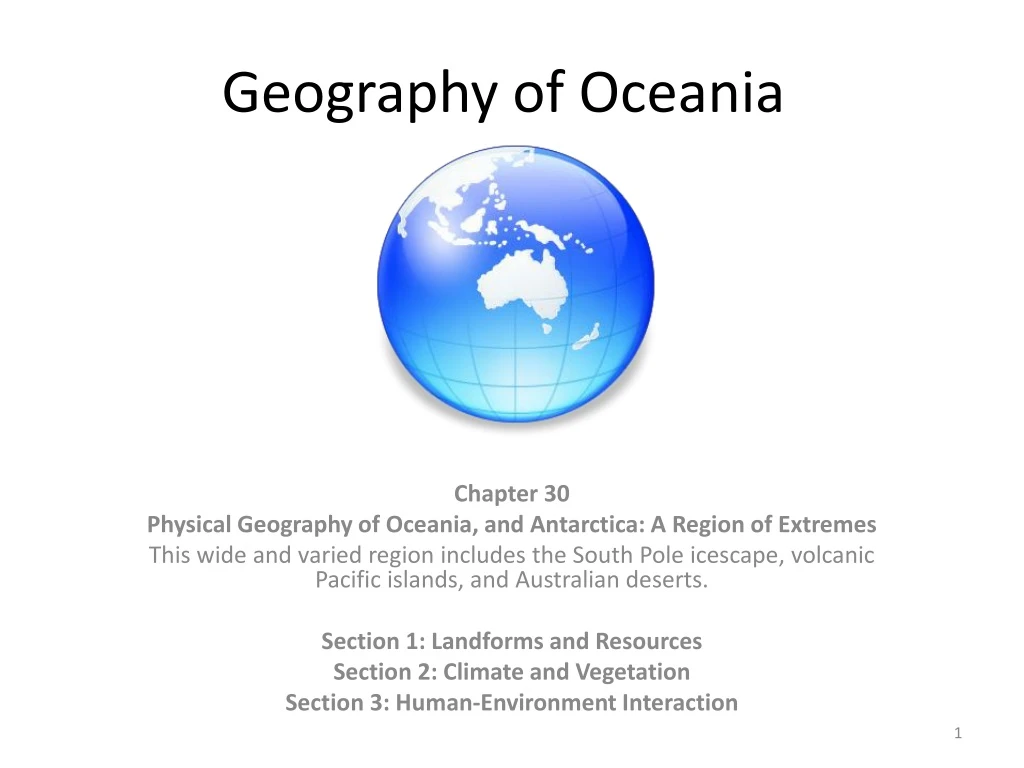
Geography of Oceania. Chapter 30 Physical Geography of Oceania, and Antarctica: A Region of Extremes This wide and varied region includes the South Pole icescape, volcanic Pacific islands, and Australian deserts. Section 1: Landforms and Resources Section 2: Climate and Vegetation

E N D
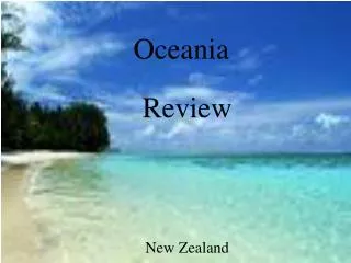
Geography of Oceania Chapter 30 Physical Geography of Oceania, and Antarctica: A Region of Extremes This wide and varied region includes the South Pole icescape, volcanic Pacific islands, and Australian deserts. Section 1: Landforms and Resources Section 2: Climate and Vegetation Section 3: Human-Environment Interaction
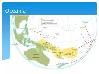
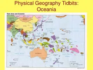
Section 1: Landforms and Resources • This region includes two continents, and more than 20,000 islands.
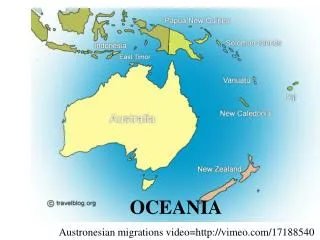
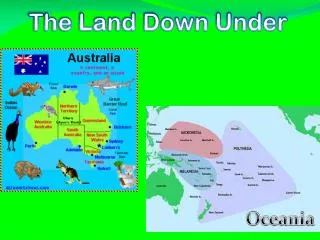
Lands of the Pacific and Antarctica • No Exact Number • No one knows how many islands there are in the Pacific • Some estimate there are more than 20,000 • Hard to count because islands vanish and new ones appear • As a group, the Pacific Islands are called Oceania • includes New Zealand, Australia (a continent, not an island) • doesn’t include Philippines, Indonesia—culturally Asian
Oceania’s Many Islands • Some islands vanish due to erosion, new ones are created • Volcanoes create high islands; coral reefs make up low islands • Most islands are small; total land area is smaller than Alaska
Majestic New Zealand • New Zealand has two main islands, North Island and South Island • Southern Alps—300-mile Mountain range down center of South Island • 16 peaks over 10,000 feet; over 360 glaciers • North Island has hilly ranges, volcanic plateau • Fertile farmland; forests for lumber; natural harbors • Few mineral resources, but dams generateelectricity
Flat Australia • Australia is earth’s smallest, flattest continent • Great Dividing Range—chain of highlands parallel to east coast • West of range are plains and plateaus • Murray River is largest of continent’s few rivers • Little forestry, but rich in bauxite, diamonds, opals, lead, coal • Great Barrier Reef—1,250-mile chain of 2,500 reefs, islands
Icy Antarctica • Fifth-largest continent is circular in shape, centered on South Pole • Thick ice sheet covers landscape—world’s largest fresh-water supply • Transantarctic Mountains divide continent • East Antarctica is plateau surrounded by mountains, valleys • West Antarctica is group of separate islands linked by ice • There could be coal, minerals, petroleum under ice • In 1991, 26 nations agreed not to mine region for 50 years
Section 2: Climate and Vegetation This region’s climates range from tropical to desert to polar icecap. There is a great diversity of plant and animal life, including some species found nowhere else in the world. Widespread Tropics • Year-Round Rains • Tropical wet climate in Oceania.
Bands of Moderate Climate • Hot Summers, Mild Winters • Australia and New Zealand have generally mild climates • Mountain chain runs parallel to east coast of Australia
Hot and Cold Deserts • Arid Australia • One-third of Australia is desert, located in the continent’s center • Few live in dry inland region called the outback
The White Desert • Antarctica is earth’s coldest, driest continent • Icecap climate: temperatures can drop to –70 degrees • Cold air doesn’t hold moisture well • has 1/10 the water vapor of temperate zones • Area receives little precipitation; called a polar desert
Section 3: Human-Environment Interaction - Pacific Islanders developed technology that enabled them to travel the Pacific Ocean. - This region has been damaged by nuclear testing and the introduction of European animals.
Traveling the Pacific • Navigation Charts • It’s believed Pacific Island settlers came from Southeast Asia • use land bridges, small rafts, canoes to reach nearest islands • Later venture further out, use stars and charts to navigate • On charts, sticks show wave patterns, shells show islands • Islanders keep secrets of charts until late 1800s • Then begin using European navigation methods
Special Canoes • To sail ocean, islanders develop special voyaging canoes • Double hulls stabilize canoe; allow it to carry lots of weight • Canoes use sails, sometimes have cabin on top for shelter • Also use outrigger canoe—float attached on one side for balance
Invasion of the Rabbits • The Rabbit Problem • European colonizers bring animals to Australia, including rabbits • In 1859, Thomas Austin releases 24 rabbits into Australia to hunt • One pair can have 184 descendants in 18 months • Australia has over one billion rabbits by 1900 • Rabbits strip sparse vegetation, ruin sheep pastures, cause erosion
Control Measures • Efforts are made to control number of rabbits • import foxes to prey on them, but foxes also endanger native wildlife • In 1950s, they’re intentionally infected with myxomatosis; 90% die • ranches then able to support twice as many sheep • rabbits become immune to disease; back to 300 million by 1990s • Today a combination of poisons, diseases, fences are used
Nuclear Testing • Tests in Bikini Atoll • Nuclear arms race between U.S., USSR begins in the 1940s • U.S. conducts 66 nuclear bomb tests on Bikini, Enewetak atolls • Atoll—ring like coral island, or islands, surrounding a lagoon • Marshall Islands’ Bikini Atoll is far from shipping, air routes • “Bravo” hydrogen bomb test vaporizes several islands • Radiation contamination injures or sickens many islanders
Long-Term Effects • Bikini Islanders moved to the island of Kili in 1948 • Conditions there don’t allow them to fish or grow enough food • U.S. declares Bikini safe in late 1960s, some islanders return • In 1978, doctors find dangerous radiation levels in islanders • Islanders leave again • Cleanup of Bikini Atoll begins in 1988 • Still unknown when Bikini will be suitable for humans again
Why is it necessary for world governments involved in the exploration of Antarctica to develop and sign the Antarctic Treaty of 1961? • To peacefully agree to use Antarctica only for research purposes. • Each nation enjoys the freedom of research on the continent. • The treaty prohibits the use of the continent for military bases and nuclear testing or dumping.
Bibliography • McdougalLittell, World Geography. Houghton Mifflin Company. 2012