Download
1 / 38
380 likes | 550 Vues
INPE / CPTEC Satellite and Environmental Systems. Cuiabá, MT. Cachoeira Paulista, SP. INPE / CPTEC Satellite and Environmental Systems(DSA). NOAA / HRPT. NOAA / HRPT. NOAA/HRPT. MSG/SEVIRI. AQUA/MODIS/AIRS/AMSU/AMSR TERRA/MODIS. GOES / VISSR. GEONETCast/EUMETCast Intelsat-9/NSS-806.

E N D
INPE / CPTEC Satellite and Environmental Systems Cuiabá, MT Cachoeira Paulista, SP
INPE / CPTEC Satellite and Environmental Systems(DSA) NOAA / HRPT NOAA / HRPT NOAA/HRPT MSG/SEVIRI AQUA/MODIS/AIRS/AMSU/AMSR TERRA/MODIS GOES / VISSR GEONETCast/EUMETCast Intelsat-9/NSS-806 Cachoeira Paulista - SP Cuiabá - MT
Definição: GEONETCast é um sistema de disseminação de dados – pela qual dados de satélites ambientais, medidas in situ, produtos derivados e serviços são transmitidos aos usuários através de satélites de telecomunicação. NOAA WMO EUMETSAT CMA
INTELSAT-9 End User Receiving station Uplinker Ellenwood, GA USA 2.4m Antenna Via FTP INPE’s Products Cachoeira Paulista, SP. Brasil.
Componentes de uma Estação de Recepção PC ANTENA • SOFTWARE • Windows XP • FAZZT Professional Client (Kencast) • Driver Placa DVB REFLETOR FEED LNBF LNB CONV Placa DVB PCI SkyStar2
PC de Recepção (Windows) • Sistema Operacional: Windows XP Professional • CPU 1 x Advanced Micro Devices Athlon 642.2Ghz. • Memoria 2GB. • Video NVIDIA GeForce FX 5200 adapter, • HD 160 GB • Placa de Rede Gigabit Ethernet Network PCI • Placa DVB PCI TV TechniSatSkyStar2 • Unidade DVD RW
Estimativa de Custo da Estação (Brasil, 29/05/2009) • ANTENA...............................................US$ 150,00 • LNBF (Monoponto)..............................US$ 26,00 • PLACA DVB........................................US$ 228,00 • COMPUTADOR...................................US$1014,00 • FAZZT PROFESS. CLIENT .............US$ 350,00 (Dic2007) • CONTRATO MANUT. ANUAL.........US$ 53,00 (Dic2007) • CABOS (50m), CONECTORES..........US$ 38,00 • TOTAL...US$ 1859,00
Satélites Meteorológicos geoestacionários cobrindo o Brasil: GOES -10
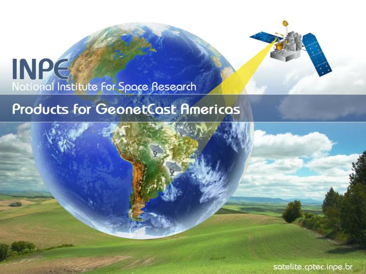
Cooperation of the INPE for the GEONETCast Americas: data collection, processing, exchange and dissemination of 25 products.
INPE Products: Satellite Images GOES/MSG Composites - This is a product created by composing the GOES-10 IR images with MSG IR images, every 15 minutes. Every 3 hour the composite will be derived from the full disk of GOES and full disk of MSG, in the 13-North to 50-South Latitude; 85-West to 55-East Longitude region, encompassing South America and Africa.
INPE Products: Satellite Images GOES South America Channel Difference -SAD, band 4 and band 5, with frequency 15 minutes.
INPE Products: Satellite Images GOES South America Visible Channel (SAV). Frequency 15 minutes.
INPE Products: Satellite Images GOES South America Infrared Channel - SAI, images generated every 15 minutes.
INPE Products: Satellite Images GOES South America Water Vapour Channel – SAW, images generated every 15 minutes.
INPE Products: Satellite Images GOES South America Enhanced - SAE. Frequency 15 minutes.
INPE Products: Goes-10 Now Casting - Fortracc Images – FTC. Short time prediction (120 minutes) of convective systems displacement, area and lifestage. This nowcasting is based in the ForTraCC technique developed by INPE using as input GOES-10(channel 4) images every 15 minutes, from the infrared channel. Colors correspond to lifestage: RED – intensifying, YELLOW is unchanged and GREEN is desintensifying. Fortracc Images allows tracking of convectives systems, and forecast their evolution…
INPE Products: Goes-10 Now Casting Lightning Discharges Images – LDI Combination of GOES-10(IR) cloud images and lightning occurrence information collected by RINDAT ground Network (Integrated National Network for Detection of Atmospheric Lightning Discharges). Color correspond to the number of lighting each 15 minutes.
INPE Products: Goes-10 Clouds Drift Winds GOES wind chart visible – GWV. Images generated every hour.
INPE Products: Goes-10 Clouds Drift Winds GOES wind chart Water Vapour – GWW. Images generated every hour. GOES wind chart infrared – GWI. Images generated every hour. INPE_GWW_200904140500 INPE_GWI_200904140500
INPE Products: Rainfall Satellite – RFS Rainfall Satellite – RFS This product is the instantaneous and the accumulated convective rainfall estimates, based on GOES images, for the South America region. The estimation is based in the adjusted hydroestimator methodology , using INPE informations about precipitated water, relative humidity and winds. Frequency 15 minutes.
INPE Products: Surface Products Vegetation Index – NDVI The NDVI images are computed from data of two channels on AVHRR instrument of NOAA-18. Three NDVI images are created and made available in 15 days interval mosaic. Frequency: 2 files for month.
INPE Products: Surface Products Fire Detection – FDN Indicates fire occurrence spots in individual states, and in the South America countries. These fire maps are derived from the mosaicing NOAA , 3.7um thermal band ascending passes. Frequency daily.
INPE Products: Surface and Atmospheric Land Surface Temperature – LST Make use of NOAA-18 images. 5 images per day.
INPE Products: Dry Season Monytoring Number of Days without rain – NDR This product indicates the number of days without convective rainfall, making use of GOES images and an hidroestimator. Frequency daily.
INPE Products: Radiation in the Atmospheric Ultraviolet Index – UVI This product indicates the maximum daily value of the ultraviolet radiation. It takes into consideration the ozone concentration based on AURA-OMI and SBUV sensor measurements provided by NASA, and the images of nebulosity derived from GOES data. Frequency 30 minutes.
INPE Products: Nomeric Forcast Weather Forcast 5 days – WGT Temperature at 1000mbar Weather Forcast 5 days – GWR 24h accumulated rain INPE_WGT_200904130000 INPE_WGR_200904130000
INPE Products: Numeric Forcast Weather Forcast – LG5 Lines of currents and wind magnitute at 500 mbar Weather Forcast – LG2 Lines of currents and wind magnitute at 200 mbar INPE_LG2_200904130000 INPE_LG5_200904130000
INPE Products: Numeric Forcast Weather Forcast next 24h – RT1 Temperature at 1000mbar Weather Forcast next 24h – RR1 24h accumulated rain plus pressure
INPE GeonetCast Product List (*) File name convention: INPE_XXX_AAAAMMDDhhmm.jpg(png)
Estimated Dataflow Broadcasting tests!!
INPE has been involved in GEONETCast Americas since 2008. • During this period it was delivered 23 different enviromental data products in time scales ranging from each 15 minutes to daily. • So far, INPE provided an average of 750 images per day or more than 270,000 images in total for the GEONETCast Americas users.
Thank you. www.satelite.cptec.inpe.br