Download
1 / 24
240 likes | 340 Vues
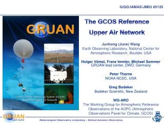
Profiling the atmosphere to Meet Climate Needs -- GCOS Reference Upper Air Network. Junhong (June) Wang, NCAR Earth Observing Laboratory, WGARO member Anna Kuhn, Staphan Bojinski , Carolin Richter, GCOS Secretariat Peter Thorne, Met Office Hadley Centre, WGARO chair

E N D
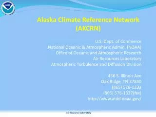
Profiling the atmosphere to Meet Climate Needs-- GCOS Reference Upper Air Network Junhong (June) Wang, NCAR Earth Observing Laboratory, WGARO member Anna Kuhn, StaphanBojinski, Carolin Richter, GCOS Secretariat Peter Thorne, Met Office Hadley Centre, WGARO chair HolgerVoemel, Michael Sommer, GRUAN Lead Center, DWD
The climate is changing: It is likely to continue to change! • The change is not uniform spatially and temporally! • Strong need to sustain current observing systems, and to create comprehensive climate observing systems to monitor, understand and predict climate changes! IPCC (2007)
ICSU IOC WMO UNEP GEO GCOS Ocean Observing Systems Terrestrial Observing Systems Atmospheric Observing Systems GEOSS Global Climate Observing System (GCOS) • GCOS is a co-sponsored programme comprising the climate-relevant components of existing atmospheric, oceanic and terrestrial observing systems and it is reporting to the UNFCCC. • The Goal of GCOS is to provide continuous, reliable, comprehensive data and information on the state of the global climate system.
GCOS Components • Atmosphere • GCOS Upper Air Network (GUAN) (~ 160 stations) • GCOS Surface Network (GSN) (~ 1000 stations) • Global Atmosphere Watch (GAW) (22 global and 300 regional stations) • GCOS Reference Upper-air Network (GRUAN) • Ocean • Voluntary Observing Ships (~ 7000 ships, 52 countries) • Global Sea-Level Observing System (~300 global sea- level stations) • Argo ( ~ 3000 profiling floats, 14 countries) • Terrestrial • Global Terrestrial Network for Glaciers (GTN-G) (~750 glaciers monitored) • Global Terrestrial Network for Permafrost (GTN-P) (300 boreholes, 15 states) • Global Terrestrial Network for Hydrology (GTN-H) • Space-based Observations • Crucial for observing 26 essential climate variables such as atmospheric temperature, precipitation, sea level, sea ice, etc.
Essential Climate Variables (44 ECVs) • Priority list of variables to be observed systematically • Criteria: • Global observations feasible (practical, cost-effective) • High impact on needs of UNFCCC, climate research, climate change assessments (IPCC) • Review in 2009
Global radiosonde network • Errors and biases • Spatial and temporal inhomogeneity • Spatial and diurnal sampling errors 6
Atmospheric temperature trends • Agreement in signs; • Still large uncertainty and large disagreement in the stratosphere; • Significant amount of efforts in producing homogenized datasets (both radiosonde and satellite); • A clear need for multiple independent analyses. Trenberth et al. (2007, IPCC)
Atmospheric temperature trends at Camborne, UK 100 hPa 0.6 K 500 hPa Phillips Mark3 Vaisala RS80 Vaisala RS92 Phillips Mark IIb
Update toOltmans et al., GRL 2001 from Holger Voemel Water vapor trends • Stratosphere: • No current operational radiosonde is valid. • Satellite records still short. • Midde/upper troposphere: • Radiosonde: temporal inhomogeneity and less efforts on homogenizing it. • Satellite: only last two decades; inhomogeneity in HIRS; only proxy from MSU. Surface/LT: increasing trend from surface and satellite (over ocean) data
Real change False change Challenge of radiosonde data for water vapor trends Wang et al. (2001)
Water vapor trends from homogenized radiosonde data (preliminary results from Aiguo Dai, NCAR) DPD=30C 1973-1979 2000-2008 Raw Adjusted
Why do we need GCOS Reference Upper Air Network -- GRUAN? Historical upper-air records are not as good as required for studying climate change • Changes in tropospheric temperatures are very poorly constrained • Changes in humidity are understood even less, especially in the radiatively important upper troposphere • Changes in other variables are generally worse still • Primary reason: observations were never made for climate research We need a way of separating the true signal from the inevitable non-climatic effects that will be imparted into the record!
Towards a GCOS Reference Upper Air Network • Initiation 10/2004: GCOS Implementation Plan: “Key Action 12: To establish a high quality reference network of about 30 precision radiosonde stations and other collocated observations” (2005-2009) • Motivation • Problems for climate in accuracy, long-term stability • Changes in measurement systems • Objectives • Provide long-term, high-quality upper-air climate records • Constrain/calibrate data from more spatially-comprehensive global observing systems (including satellites) • Measure large suite of co-related climate variables
Climate driven Spatial density GCOS Reference Upper Air Network (GRUAN) 30-40 stations GCOS Upper Air Network (GUAN) 161 stations Comprehensive observing network All stations, observing systems, reanalyses etc. The concept Cascade of Networks
GRUAN instruments • Focus on priority 1: Pressure, temperature, water vapor • Focus on upper troposphere and stratosphere • Focus on reference observations for climate research
What is a reference measurement? • A reference measurement gives: • the best estimate for the quantity to be measured • the best estimate for the level of confidence for this measurement (i.e. uncertainty) • The measurement uncertainty is a property of the measurement • To be a reference GRUAN observations must include the measurement uncertainty
Uncertainty estimationRS92 Temperature at Linderberg GRUAN Requirement: 0.1/0.2 K (TR/ST) accuracy 0.05 K/decade long term stability Ground check T correction (2004-2008) Sensor calibration:manufacture in-house: 0.15KGround-check: -0.3+/-0.2K External influences: Radiation error (radiation model and different cloudy conditions)
Radiation errors Luers (1990) mC(dT/dt) = qabs – qemit + qconv + qelec + qcond • Option #1: Multi-thermistor Technology • Simultaneously solving multiple heat balance equations; • Each with different emissivity and absorptivity values; • Conduction and thermal lag error correction are included; • Knowledge of the environmental radiative background is not necessary. • Optional #2: Better radiation corrections • Radiation sensors on the sonde • Calculating radiation flux profiles with observed cloud, aerosol and other parameters
Managing Change To document changes To assess impacts of changes To minimize impacts MEIR91 RSII-80 RSII-56
Assessing impacts Parallel testing PW comparison (Radiosonde-GPS) Improved MEIR91 MEIR91 Courtesy of Aiguo Dai and Paul Ciesielski
Signatures of GRUAN • Reference quality: long-term stable, traceable, verifiable. • Management of change: detailed documentation, assessment of changes, parallel testing, prevention. • Long-term suitability: long-term commitment from different partners. • Redundancy: inter-comparisons of multiple sensors and systems. • Co-related climate variables: co-location and integration for climate processing.
What is in it for you? • Better Science: Improved understanding of climate change • The opportunity to influence it in every way (sites, instruments, operational procedures, data management) • Recognition from international community and many data users of the data for a long time to come.
http://www.gruan.org More Information