Download
1 / 7
70 likes | 204 Vues
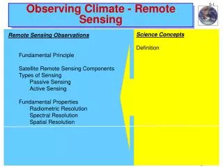
Observing Climate - Upper Air. Science Concepts. Upper-air Measurements Radiosonde Rawinsonde. Observing Climate - Upper Air. U.S. Upper-Air Observations Radiosonde Movie. http://www.nws.noaa.gov/om/educ/radiosnd.rm. Observing Climate - Upper Air. U.S. Upper-Air Observations

E N D
Observing Climate - Upper Air Science Concepts Upper-air Measurements Radiosonde Rawinsonde
Observing Climate - Upper Air U.S. Upper-Air Observations Radiosonde Movie http://www.nws.noaa.gov/om/educ/radiosnd.rm
Observing Climate - Upper Air U.S. Upper-Air Observations • Radiosonde instrument package - Pressure - Temperature - Relative Humidity • Rawinsonde - Tracked radiosonde - Winds http://www.ua.nws.noaa.gov/
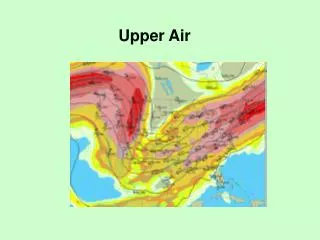
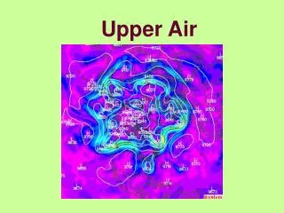
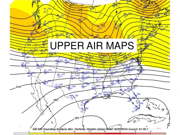
Observing Climate - Upper Air Note drift distance during sonde’s flight, especially in regions of high speed winds denoted by red shading (Isotachs - Contour of wind speed) Radiosonde • 2 m (6 ft) wide hydrogen or helium filled balloon filled • Rises at about 300 m/min (about 1,000 ft/min) • Tracking position yields wind speed and direction - called a rawinsonde. New system will use GPS • Flight can last more than 2 h • Can ascend to over 35 km (about 115,000 ft) and drift more than 200 km (about 125 miles) http://www-das.uwyo.edu/~geerts/cwx/notes/chap07/hodo.html Shipley, S.T, 2005: GIS applications in meteorology - Or adventures in a parallel universe. Bull. Amer. Meteor. Soc., 86, 171-173..
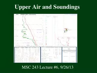
Observing Climate - Upper Air Radiosonde • When the balloon expands too large (about 6 m or 20 ft in diameter), it bursts and a small parachute slows the descent minimizing the danger to lives and property • Data (temperature, dewpoint temperature, and wind speed and direction) is plotted on a graph (Skew-T Log-p diagram) depicting the sounding versus pressure Temperature Dewpoint Temperature Winds http://www-das.uwyo.edu/~geerts/cwx/notes/chap07/hodo.html
Observing Climate - Upper Air U.S. Upper-Air Sites http://www.ua.nws.noaa.gov/nws_upper.htm
Observing Climate - Observing Site Typical Weather Service Observing Site Wind Vane Cup Anemometer Instrument Tower Balloon Inflation Shelter with Radiotheodolite radome Rain Gage Instrument Shelter http://www.ua.nws.noaa.gov/